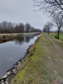
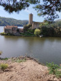
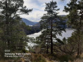
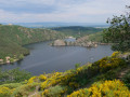
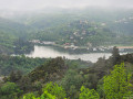
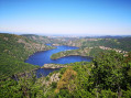
The Forez Canal and hamlets as seen from Étang David

A walk, partly along the Canal du Forez and through the countryside around Saint-Rambert. Minimal elevation gain. At the start of the route, there is a birdwatching post at Étang David. The hamlets of Razoux, Les Côtes, Noailleux and Cessieux. Viewpoints over the Forez plain.

Edit: to take the comment into account, 25 per cent of the route is on tarmac.
- Currently (April 2025), Étang David is dry due to the eradication of invasive plants.

Details

44494644
Creation:
Last update:
Last review:
  • Walking
    Activity: Walking
  • ↔
    Distance: 7.72 mi
  • ◔
    Average duration: 3h 55 
  • ▲
    Difficulty: Moderate

  • ⚐
    Back to start: Yes
  • ↗
    Ascent: + 381 ft
  • ↘
    Descent: - 381 ft

  • ▲
    Highest point: 1,667 ft
  • ▼
    Lowest point: 1,273 ft

Photos

Description of the walk

Starting point: Étang David car park, Chemin des Unchats, in the Saint-Rambert neighbourhood.

(S/E) From the car park, head west, cross a road and take the path alongside the canal (do not cross the canal).

(1) After about fifty metres, turn right onto a wide path signposted “Maison Départementale de la Pêche et de la Nature” (go through the barrier intended for cars).

(2) Turn right to quickly reach a birdwatching post by the pond. Retrace your steps.

(2) Head south (slightly to the right if you’re returning from the observatory, to the left if you’ve skipped the return trip) and leave the Maison de la Pêche et de la Nature on your right. Cross a stream, pass through a picnic area and reach the edge of the canal.

(3) Turn right and walk along the canal on your left-hand side. Cross a small road (marker 393) and continue along the canal.

(4) At the old waste disposal site, take the bridge over the canal on the left. At the junction immediately ahead, go straight on along a wide path. Walk alongside the ponds on your right. Keep heading south, cross a stream and reach the hamlet of Chavas.

(5) Then turn left onto a tarmac road.

(6) At the next junction, in Razoux, turn right onto the Route de Combartier and immediately ignore a turn-off on the right. Stay on the road until the next junction.

(7) Turn left onto the Route de Cordeyron and pass the hamlet of Chez Vieux.

(8) At the junction, turn right onto Route de la Fortunière. Turn left with the road, pass by the foot of a cross and reach another junction at the hamlet of Les Côtes.

(9) Leave the road and turn right onto Chemin du Château d’Eau, which is tarmac-surfaced at the start and continues as a dirt track. Carry on uphill to Noailleux, following a GRP® (yellow and red markings).

(10) At Noailleux, take the road on the left.

(11) You’ll come out onto the D108; follow it to the left. From here, you leave the GRP® route; pass through the hamlet of Cessieux, going past the restaurant.

(12) When the road bends to the right, take a small road on the left. Ignore the entrance to a housing estate on the right. At the end of the tarmac, continue along a track.

(13) At a Fork in the road (Yellow Circle and White Circle signs), take the left-hand track. Go straight on, heading north, then north-west, and ignore all side tracks.

(14) At a T-junction, turn left.

(15) At the entrance to Chavagneux, turn right twice.

(16) After about fifty metres, on leaving Chavagneux, turn left. Immediately turn right onto the track and head due north.

(17) At the ‘Dead end’ sign, veer left. Pass the hamlet of Ruillat. Cross the Route de Cordeyron and continue straight ahead. Cross a stream and reach the canal.

(18) Turn right and follow the canal on your left. Further on, you’ll come out onto the Route de Chavagneux; follow it to the left and cross the bridge over the canal. You’ll immediately see the starting car park on your right (S/E).

Waypoints

  1. S/E : mi 0 - alt. 1,286 ft - Car park at the - Etang david
  2. 1 : mi 0.05 - alt. 1,283 ft - Entrance to the path leading to Étang David
  3. 2 : mi 0.35 - alt. 1,276 ft - Departmental Centre for Fishing and Nature
  4. 3 : mi 0.51 - alt. 1,283 ft - Canal du Forez
  5. 4 : mi 1.49 - alt. 1,286 ft - Bridge over the canal. Towards the - Bonson (rivière) - Affluent de la Loire
  6. 5 : mi 2.48 - alt. 1,332 ft - Chavas
  7. 6 : mi 2.66 - alt. 1,345 ft - Razoux
  8. 7 : mi 3.16 - alt. 1,371 ft - Junction – Route de Cordeyron
  9. 8 : mi 3.43 - alt. 1,345 ft - Chez Vieux
  10. 9 : mi 3.68 - alt. 1,424 ft - Les Côtes
  11. 10 : mi 4.45 - alt. 1,657 ft - Noailleux
  12. 11 : mi 4.94 - alt. 1,604 ft - Car park near the D108
  13. 12 : mi 5.17 - alt. 1,594 ft - Junction
  14. 13 : mi 5.34 - alt. 1,634 ft - T-junction
  15. 14 : mi 5.97 - alt. 1,411 ft - T-junction
  16. 15 : mi 6.11 - alt. 1,388 ft - Entrance to Chavagneux
  17. 16 : mi 6.18 - alt. 1,378 ft - Exit from Chavagneux
  18. 17 : mi 6.33 - alt. 1,342 ft - Junction
  19. 18 : mi 7.01 - alt. 1,283 ft - Canal du Forez
  20. S/E : mi 7.72 - alt. 1,286 ft - Car park at the - Etang david

Notes

Picnic area on the route, near the Maison Départementale de la Pêche et de la Nature.

Worth a visit

Birdwatching post at Étang David.

Reviews and comments

4.6 / 5
Based on 3 reviews

Reliability of the description
5 / 5
Ease of following the route
4.7 / 5
Route interest
4 / 5
FRAYSSE Jacques
FRAYSSE Jacques

Overall rating : 4.3 / 5

Date of your route : Mar 19, 2025
Reliability of the description : ★★★★★ Very good
Ease of following the route : ★★★★☆ Good
Route interest : ★★★★☆ Good
Very busy route : No

The route wasn’t very busy because we were there in March and the weather wasn’t very good.
We enjoyed the route.
Just a general comment on all the route descriptions: there’s no mention of the percentage of track versus tarmac, not even an approximate figure.
Thank you for this route.

Machine-translated

louisjust
louisjust

Overall rating : 4.7 / 5

Date of your route : Apr 02, 2024
Reliability of the description : ★★★★★ Very good
Ease of following the route : ★★★★★ Very good
Route interest : ★★★★☆ Good
Very busy route : No

A very easy walk. No uphill sections, but the scenery varies greatly. It’s ideal for a first walk after an operation. We cut the route short, walking only from point 9 to 15.

Machine-translated

TEYSSIER YVES
TEYSSIER YVES

Overall rating : 4.7 / 5

Date of your route : Apr 08, 2024
Reliability of the description : ★★★★★ Very good
Ease of following the route : ★★★★★ Very good
Route interest : ★★★★☆ Good
Very busy route : No

A lovely walk
Easy walk

Machine-translated

Other walks in the area

For more walks, use our search engine .

The GPS track and description are the property of this route's author. Please do not copy them without permission.