


Refine your search for walks in Cabane de Rubren
Cabane de Rubren walks


 Bric de Rubren via the Mongioia Pass and the Salsa Pass
 Visorando Member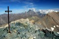
 18.01 mi
 +5,118 ft
 -5,092 ft
 10 hrs
 Very difficult
 Departure from Saint-Paul-sur-Ubaye (Alpes-de-Haute-Provence)
This is a beautiful circular of just under 30 km, crossing the Ubaye several times and taking hikers to one of the highest peaks in the Ubaye at 3,340 m.
The view from the top is magnificent and stretches far into the distance.
At the foot of the Bric is the high-altitude lake of Mongioia at 3,080 m.
Return to the starting point via the Pas de Salsa and Lac du Loup.
Refuge de la Blanche – Franco Boerio Bivouac
 8.91 mi
+4,465 ft
-2,543 ft
8h 00
8.91 mi
+4,465 ft
-2,543 ft
8h 00
 Difficult
Departure from Saint-Véran (Hautes-Alpes)
Difficult
Departure from Saint-Véran (Hautes-Alpes)
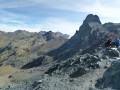
A foray into the Haute Ubaye to round off the route in style at its highest point. With the option of watching the sunset from the summit of the Bric de Rubren.
The route deliberately moves away from the border to take the easiest route up the hill.
Walks near Cabane de Rubren
From Rubren to Marinet
 12.45 mi
+4,498 ft
-6,201 ft
10 hrs
Very difficult
Departure from Saint-Paul-sur-Ubaye (Alpes-de-Haute-Provence)
12.45 mi
+4,498 ft
-6,201 ft
10 hrs
Very difficult
Departure from Saint-Paul-sur-Ubaye (Alpes-de-Haute-Provence)
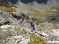
A very long day criss-crossing the border. But what breathtaking scenery! And you won’t be bothered by the neighbours... there’s little chance of coming across other two-legged creatures. But perhaps some ibex, vultures, including (apparently) a pair of bearded vultures.
Trek around Chambeyron Mountain Range (4) Maljasset - Refuge Campo Base
 9.28 mi
+2,408 ft
-3,304 ft
6h 20
Difficult
Departure from Saint-Paul-sur-Ubaye (Alpes-de-Haute-Provence)
9.28 mi
+2,408 ft
-3,304 ft
6h 20
Difficult
Departure from Saint-Paul-sur-Ubaye (Alpes-de-Haute-Provence)
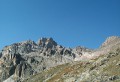
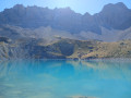
Quite a long stage but a steady route. A climb up to Col de Mary then a long downhill hike all the way to the shelter, in Chiaperra, Italy.
Maljasset - Ceillac
 7.50 mi
+2,808 ft
-3,678 ft
5h 55
Difficult
Departure from Saint-Paul-sur-Ubaye (Alpes-de-Haute-Provence)
7.50 mi
+2,808 ft
-3,678 ft
5h 55
Difficult
Departure from Saint-Paul-sur-Ubaye (Alpes-de-Haute-Provence)
Return to Queyras by crossing the Col Girardin via a path that starts off quite steep but then levels out before ending with large hairpin bends that finish at the pass. This is followed by a long descent past the lakes, which reflect the famous Font Sancte, the highest point in Queyras.
Maljasset - Ceillac
9.92 mi
+3,320 ft
-4,242 ft
7h 25
Difficult
Departure from Saint-Paul-sur-Ubaye (Alpes-de-Haute-Provence)
The passage between the two departments of Alpes de Haute Provence and Hautes Alpes is via the famousGR®5, which supports theGRP® of the Tour de la Font Sancte on this section.
Maljasset - Larche
15.60 mi
+4,199 ft
-4,898 ft
10h 50
Difficult
Departure from Saint-Paul-sur-Ubaye (Alpes-de-Haute-Provence)
Etape de la traversée des Alpes à partir du hameau de Maljasset qui suit la route de la Haute Ubaye avec une vue époustouflante sur les sommets qui bordent le flanc sud du Queyras. Traversée de la Haute Ubaye dans un univers minéral parmi les sommets de plus de 3000m.
Refuge de la Blanche – Le Raux
 11.04 mi
+2,641 ft
-4,770 ft
7h 25
Difficult
Departure from Saint-Véran (Hautes-Alpes)
11.04 mi
+2,641 ft
-4,770 ft
7h 25
Difficult
Departure from Saint-Véran (Hautes-Alpes)
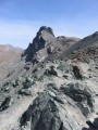
On the second day of this trip, the plan is to walk the Tour de la Tête des Toillies and finish the day with a long walk back to Le Raux.
Refuge de la Blanche - Maljasset
10.03 mi
+1,532 ft
-3,494 ft
5h 55
Difficult
Departure from Saint-Véran (Hautes-Alpes)
Here, the names change from white to black with great dexterity. Indeed, the passage from Queyras, Refuge de la Blanche, to Ubaye is via the Col de la Noire. Original, isn't it?
From Ceillac to Fouillouse
 13.37 mi
+4,452 ft
-4,216 ft
10h 00
Difficult
Departure from Ceillac (Hautes-Alpes)
13.37 mi
+4,452 ft
-4,216 ft
10h 00
Difficult
Departure from Ceillac (Hautes-Alpes)
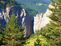
This fifteenth stage crosses the Escreins massif (not to be confused with the Écrins massif) and, via the Ubaye valley, enters the Chambeyron valley. From the Refuge de la Cime, the route—off the GR®5—crosses the Torrent du Mélezet valley and climbs up the Pré Girardin valley via the ski runs; then, on the plateau, it skirts the rocky ridge overlooking Lac Miroir, reaches the lake and rejoins the GR®5. The route climbs up the valley between the shoulder of the Pic des Heuvières and the Crête de Coste Belle, passing the small pass of Sainte-Anne and then the lake of the same name before reaching the Col Girardin. It descends towards a basin, where the Torrent des Séchoirs has its source, and follows it. Clinging to the side of a steep slope, it joins the D25 road in the upper Ubaye valley and continues downstream, alternating between the road and paths close to the river. It leaves the D25 for the Fouillouse road, passes the vertiginous Pont du Châtelet, a tunnel and, via a path, reaches the hamlet of Fouillouse.
Agnel Mountain Hut – La Monta Mountain Hut
 8.25 mi
+1,434 ft
-4,390 ft
5h 00
Difficult
Departure from Molines-en-Queyras (Hautes-Alpes)
8.25 mi
+1,434 ft
-4,390 ft
5h 00
Difficult
Departure from Molines-en-Queyras (Hautes-Alpes)
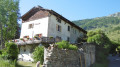
The third stage of this journey presents no major difficulties, with exceptional views around the lakes. Only the descent from the Col Vieux to the Refuge de la Monta quickly takes its toll on your legs.
The abundance of flora makes this stage even more beautiful.