


Refine your search for walks in Cabane de Louvie
Cabane de Louvie walks


 Louvie Mountain Hut – Mauvoisin
 Visorando Member
 6.50 mi
 +2,680 ft
 -3,944 ft
 5h 20
 Difficult
 Departure from Bagnes (Valais)
This seventh stage will take you from the Cabane de Louvie to Mauvoisin. The route begins by skirting the lake to the north, then turns right for a winding climb up to the Col du Bec d’Aigle. After a descent of around 200 metres, you’ll need to climb the Col du Sarshlau. At this pass, a well-deserved break is in order to enjoy the superb panoramic view of the Combins massif and Lake Mauvoisin below. The route then continues with a long descent to La Vacheresse. A final climb will take you to the former construction village of the Mauvoisin Dam.
Walks near Cabane de Louvie
Louvie Hut - Prafleuri Hut
 7.26 mi
+4,019 ft
-2,654 ft
6h 50
Difficult
Departure from Bagnes (Valais)
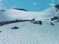
This sixth stage takes place in the high mountains and, depending on the season, may involve crossing snowfields.From Lake Louvie, climb up to Col Termin and rejoin the balcony path that comes from the Montfort Hut. Continue to Col de Louvie (possibility of snowfields). After descending Col de Louvie, the path passes at the foot of the Grand Désert Glacier. The trail then crosses scree; look out for the red and white markings and follow the signs for Prafleuri. Climb Col de Prafleuri. Descend to Torrent de Prafleuri (small bridge); on the left, a trail leads to the Prafleuri Hut.
Louvie Hut - Prafleuri Hut
 6.32 mi
+3,501 ft
-2,103 ft
8 hrs
 Very difficult
Departure from Bagnes (Valais)
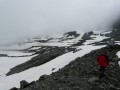
The second stage of the route involves crossing two passes, the Louvie and the Prafleuri, both of which were snow-covered.
Fionay - Cabane de Louvie
 2.01 mi
+2,592 ft
-177 ft
3h 10
 Moderate
Departure from Bagnes (Valais)
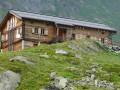
First stage of the trek linking the village of Fionay to Saas Fee. A pleasant stage to reach the Cabane de Louvie, built on the edge of the lake of the same name.
Trek from Fionay to Saas-Fee
 63.00 mi
+27,582 ft
-26,322 ft
7 days
Very difficult
Departure from Bagnes (Valais)
In the Swiss valley, this particularly pleasant hike allows you to explore the many 4000 m peaks that surround the route.
N.B. this route is outlined on Openmap which doesn't have the details of our fine IGN maps. Before being able to get your hands on a Swiss map, which are more precise, the route and GPS layouts will be handy for this pleasant trek.
Brunet Hut - Louvie Hut
 5.46 mi
+3,333 ft
-2,930 ft
5h 25
Difficult
Departure from Bagnes (Valais)
This fifth stage crosses the Val de Bagnes. To the right of the Cabane Brunet, follow the path that descends directly to Fionnay. Be careful, this very steep path with countless tree roots can be slippery and dangerous in wet weather. Cross the road that leads to Fionnay. The path to the Louvie Hut is signposted in the centre of the village, on the right bank of the torrent. The trail is well marked all the way to the hut. Ibex often come close to the hut. A little further on, it is possible to see chamois.
Brunet Hut - Panossière Hut
 4.16 mi
+2,815 ft
-1,070 ft
4h 20
Moderate
Departure from Bagnes (Valais)
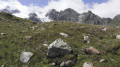
The route passes through the Col des Avouillons before descending to the rest of the Corbassière glacier, which is crossed via a spectacular 200 m long footbridge over a 70 m drop. The high mountains reveal themselves after the pass in a grandiose setting.
Panossière Hut - Chanrion Hut
 9.72 mi
+3,921 ft
-4,501 ft
7h 55
Very difficult
Departure from Bagnes (Valais)
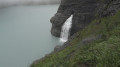
This is a fairly long stage but set against a magnificent backdrop. The Mauvoisin dam is impressive, as are all the waterfalls along the right bank of the lake. The route passes through the easy and beautiful Tsofeiret Pass.
From Ruinettes to La Chaux
1.36 mi
+243 ft
-46 ft
0h 50
 Easy
Departure from Bagnes (Valais)
An extremely easy walk on a very gentle slope. Take the ski lifts from Verbier to Ruinettes (or walk up), and you can continue to Mont-Fort by cable car. At La Chaux, the restaurant “Le Dahu”, with sun loungers and occasional entertainment (such as concerts), awaits you.
Prafleuri hut - La Sage lodge
 12.28 mi
+4,327 ft
-7,536 ft
10 hrs
Very difficult
Departure from Hérémence (Valais)
Today's stage is unusual: it starts with a descent before a long climb, a second descent and a chairlift transfer, followed by a flat walk and a bus ride to the lodge.
Cabane de Prafleuri - Cabane des Dix
 6.98 mi
+2,710 ft
-1,870 ft
5h 35
Difficult
Departure from Hérémence (Valais)
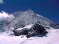
This seventh stage takes place in high mountains and, depending on the season, may involve crossing snowfields.From the Prafleuri hut, head towards the Col des Roux, then descend to Lac des Dix. Walk along the lake to the south-eastern end, where you will find signs for the Cabane des Dix. The path follows the glacier moraine and then goes around Tête Noire to reach the Cabane des Dix. Views of Mont Blanc de Cheilon, La Ruinette and Pigne d'Arolla.