A Neuve Mountain Hut

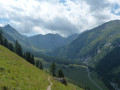
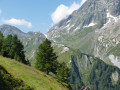
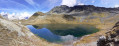
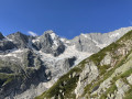
This hike to the A Neuve mountain hut, perched on a promontory at an altitude of 2,735 metres, offers splendid views of Mont Dolent, the Tour Noir and their surrounding glaciers, as well as the Val Ferret.

Details

n°61682249
Creation:
Last update:
Last review:
  • Walking
    Activity: Walking
  • ↔
    Distance: 6.72 mi
  • ◔
    Average duration: 6h 20 
  • ▲
    Difficulty: Difficult

  • ⚐
    Back to start: Yes
  • ↗
    Ascent: + 3,763 ft
  • ↘
    Descent: - 3,763 ft

  • ▲
    Highest point: 9,006 ft
  • ▼
    Lowest point: 5,226 ft

Photos

Description of the walk

Access by public transport
Orsières SBB station, then bus 272 towards Ferret. Get off at La Fouly VS.

Access by car
From Geneva and Lausanne, take the A9 motorway, exit 22, then follow signs for the Grand-Saint-Bernard Pass. On the road to the pass, take the exit on the right towards Val Ferret and La Fouly. Drive through La Fouly along the main road until you reach a car park opposite a small shopping centre and the Hôtel des Glaciers.

Car park
La Fouly, opposite the shopping centre and the Hôtel des Glaciers.

(S/E) From the car park, head south-south-west along the road. After about 150 m, turn right and cross the bridge over a torrent, then continue to the first junction. Ignore the sign for Refuge du Dolent on the left and continue towards Le Désert and Cabane de l’A Neuve. A few metres further on, just after a right-hand bend, you’ll reach a Fork in the road.

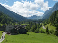
(1) Ignore the Chemin de la Chapelle on the right and turn left (north-west). Walk through a development of chalets, cross a stream and you’ll immediately reach a junction.

(2) Carry on straight ahead towards Le Désert and Cabane de l’A Neuve, and cross the campsite.

(3) At the next junction, turn left towards Le Désert and Cabane de l’A Neuve. Walk westwards for a long stretch through the forest. Leave the forest, continue straight on and reach a junction.

(4) Carry on straight ahead (west, then west-north-west). The path approaches the stream and leads to a bridge.

(5) Cross the bridge and continue, following the red and white markings. Climb up a series of hairpin bends. Towards the end of the route, the Cabane de l’A Neuve, perched on its promontory, comes into view. In this area, a snowfield may persist until late in the season (take care).

(6) At the fork, just before the A Neuve hut, there are two options for reaching the hut.

1) The option shown on the map: the path opposite leads directly to the hut via a clearly visible chimney equipped with cables (southern route on our itinerary).

2) The path on the left, which is longer, allows you to avoid the chimney and winds its way up the slope (northern route on our itinerary). Before reaching the hut, however, you will need to cross a few rocky outcrops secured with ropes.
Please note: this route may be blocked by snow and therefore impassable until late in the season.

(7) For the return journey from the hut, you can either take the same route as on the way up or opt for the circular route as shown on the map. Ignore the chimney on the left that you took on the way up, and continue straight on via the northern route. Return to the junction

(6) Then make your descent by following the same path as on the ascent but in the opposite direction, until you reach the car park at La Fouly (S/E).

Waypoints

  1. S/E : mi 0 - alt. 5,253 ft - La Fouly car park
  2. 1 : mi 0.14 - alt. 5,249 ft - Fork in the road
  3. 2 : mi 0.32 - alt. 5,240 ft - Intersection
  4. 3 : mi 0.44 - alt. 5,256 ft - Intersection
  5. 4 : mi 0.75 - alt. 5,436 ft - The Desert
  6. 5 : mi 1.84 - alt. 6,886 ft - Bridge
  7. 6 : mi 3.26 - alt. 8,891 ft - Crossing the circular loop – Two options
  8. 7 : mi 3.32 - alt. 8,835 ft - Cabane de l'A Neuve
  9. S/E : mi 6.72 - alt. 5,253 ft - La Fouly car park

Notes

Swiss National Map 282T – Martigny.

Grand Saint-Bernard walking map (Bagnes Valley – Entremont Valley – Val Ferret – Trient Valley) published by the Valais Hiking Association. Published by MPA.

Equipment: Good walking shoes and walking poles.
Markings: White and red
For further information on trail markings in Switzerland, see the “Hiking Trail Categories” on Suisse Rando: https://www.suisse-rando.ch/fr/savoir/si....
Difficulty: With over 1,200 metres of elevation gain, this route is suitable for experienced walkers who are in good physical condition and sure-footed. Furthermore, whichever route you choose to reach the hut in the final section of the hike, snowfields may persist well into the season and the routes include T3-rated sections, equipped with chains or ropes.
Further information on the difficulty scale for alpine hikes, established by the Swiss Alpine Club:
https://www.sac-cas.ch/fileadmin/Ausbild...

Our hikes wouldn’t be nearly as rewarding without the contribution of the people who live in and look after the mountains. But they need us too. Do remember to support local businesses!

If you’d like to check train and bus timetables, use the ‘Mobile CFF’ app on your phone rather than the SBB website. The ‘Mobile CFF’ app also includes ‘EasyRide’, which allows you to book a ticket online and automatically calculates the cost from your point of departure to your destination. You might also want to consider the ‘Fairtiq’ app, which offers the same service regardless of the public transport used – whether it’s trains, PostBus, urban transport or even ski lifts – either on their own or in combination.

Worth a visit

A Neuve Mountain Hut:
Open from late June to early September.
https://www.aneuve.ch/
https://www.sac-cas.ch/fr/cabanes-et-cou...

The Cabane de l’A Neuve, opened in 1927, is also named after Edouard Dufour, an honorary member of the Diablerets Section of the Swiss Alpine Club, who funded its construction through a bequest.

We highly recommend the delicious homemade pastries!

Reviews and comments

4.7 / 5
Based on 1 review

Reliability of the description
4 / 5
Ease of following the route
5 / 5
Route interest
5 / 5
Gilcool 1
Gilcool 1

Overall rating : 4.7 / 5

Date of your route : Aug 01, 2025
Reliability of the description : ★★★★☆ Good
Ease of following the route : ★★★★★ Very good
Route interest : ★★★★★ Very good
Very busy route : Yes

I took a group of 10 people to the Cabane on Swiss National Day. Unfortunately, the highest peaks were shrouded in fog, which limited the appeal of the hike. In good weather, the view of the nearby glaciers is absolutely stunning.
The route is very well marked, as always in Switzerland. Access to the summit rock is fun because it is very well equipped, both on the way up and on the way down, which can also be done more easily by going around the rock, a route that is also well marked.
Excellent atmosphere at the refuge. Be sure to try the homemade cakes. They're delicious!

Machine-translated

Other walks in the area

For more walks, use our search engine .

The GPS track and description are the property of this route's author. Please do not copy them without permission.