


Bumpstead 10 Miler
Details
Creation:
Last update:
–
–
-
 Activity: Walking
 -
 Distance: 10.05 mi
 -
 Average duration: 4h 50
 -
 Difficulty: Not specified
 -
-
 Back to start: Yes
 -
 Ascent: + 220 ft
 -
 Descent: - 233 ft
 -
-
 Highest point: 361 ft
 -
 Lowest point: 177 ft
-
 Country:
United Kingdom
Country:
United Kingdom
-
 City:
Haverhill
City:
Haverhill -
 Start/End: N 52.081133° / E 0.444271°
 -


 Hour-by-hour weather


Waypoints
- S/E : mi 0 - alt. 207 ft
- 1 : mi 0.32 - alt. 272 ft - Head south on Hollands Rd towards Rookwood Way
- 2 : mi 0.4 - alt. 262 ft - Turn right onto Rookwood Way
- 3 : mi 0.42 - alt. 266 ft - Head west on Rookwood Way
- 4 : mi 0.5 - alt. 279 ft - Enter the roundabout
- 5 : mi 0.52 - alt. 279 ft - Head east towards Rookwood Way
- 6 : mi 0.53 - alt. 279 ft - Exit the roundabout onto Rookwood Way
- 7 : mi 0.67 - alt. 302 ft - Head north-west on Rookwood Way towards Moon Hall Ln
- 8 : mi 0.67 - alt. 302 ft - Turn left onto Moon Hall Ln
- 9 : mi 1.07 - alt. 299 ft - Enter the roundabout
- 10 : mi 1.13 - alt. 305 ft - Head north-east towards A1017
- 11 : mi 1.18 - alt. 302 ft - Exit the roundabout
- 12 : mi 1.54 - alt. 318 ft - Turn right
- 13 : mi 1.55 - alt. 318 ft - Head south-east
- 14 : mi 1.56 - alt. 318 ft - Turn right towards Copy Hill
- 15 : mi 1.81 - alt. 344 ft - Continue onto Copy Hill
- 16 : mi 2.09 - alt. 315 ft - Head south on Copy Hill
- 17 : mi 2.41 - alt. 325 ft - Continue onto Haverhill Rd
- 18 : mi 2.57 - alt. 338 ft - Head south-west on Haverhill Rd
- 19 : mi 2.81 - alt. 344 ft - Head west on Haverhill Rd
- 20 : mi 3.22 - alt. 344 ft - Head south-west on Haverhill Rd towards Steeple Bumpstead Rd
- 21 : mi 3.37 - alt. 322 ft - Head south-east on Steeple Bumpstead Rd
- 22 : mi 3.67 - alt. 312 ft - Head south-east on Steeple Bumpstead Rd
- 23 : mi 4.06 - alt. 253 ft - Head south-east on Steeple Bumpstead Rd
- 24 : mi 4.31 - alt. 243 ft - Head north-east on Steeple Bumpstead Rd
- 25 : mi 4.62 - alt. 226 ft - Head east on Steeple Bumpstead Rd towards Helions Rd
- 26 : mi 4.86 - alt. 223 ft - Continue onto Helions Rd
- 27 : mi 5.05 - alt. 207 ft - Head east on Helions Rd towards Water Ln/B1054
- 28 : mi 5.07 - alt. 207 ft - Turn left onto Water Ln/B1054
- 29 : mi 5.5 - alt. 200 ft - Continue straight onto Haverhill Rd/B1057
- 30 : mi 5.58 - alt. 200 ft - Head north-east on Haverhill Rd/B1057
- 31 : mi 5.62 - alt. 200 ft - Continue straight onto The Endway
- 32 : mi 6.09 - alt. 200 ft - Head east
- 33 : mi 6.45 - alt. 187 ft - Head north-east
- 34 : mi 6.88 - alt. 240 ft - Head east
- 35 : mi 7.35 - alt. 220 ft - Head north-east towards A1017
- 36 : mi 7.68 - alt. 177 ft - Head north-east towards A1017
- 37 : mi 7.69 - alt. 177 ft - Turn left onto A1017
- 38 : mi 8.22 - alt. 197 ft - Head north-west on Rowley Hill/A1017 towards Hill Ln
- 39 : mi 8.68 - alt. 210 ft - Head north-west on Rowley Hill/A1017 towards Church Walk
- 40 : mi 8.98 - alt. 220 ft - At the roundabout, take the 2nd exit onto Rowley Hill/A143
- 41 : mi 9.2 - alt. 197 ft - Head north-west on Sturmer Rd/A143 towards Falconer Rd
- 42 : mi 9.63 - alt. 207 ft - At the roundabout, take the 2nd exit and stay on Sturmer Rd/A143
- 43 : mi 9.67 - alt. 203 ft - Head north-west on Sturmer Rd/A143 towards Hamlet Rd
- S/E : mi 10.05 - alt. 203 ft
Other walks in the area
Great Bradley Circular
 Visorando Member3.05 mi
+92 ft
-82 ft
1h 30
Visorando Member3.05 mi
+92 ft
-82 ft
1h 30
 Easy
Easy
 Departure from Great Bradley (Suffolk)
Discover the start of the river Stour, Constable's country
Dullingham Circular
4.07 mi
+138 ft
-125 ft
2h 00
Easy
Departure from Dullingham (Cambridgeshire)
Discover the start of Constable's river Stour.
Round route through the gallops of Little Ditton
5.84 mi
+135 ft
-105 ft
2h 50
Easy
Departure from Woodditton (Cambridgeshire)
See where the racehorses train and enjoy the panorama of the Cambridgeshire countryside from some of it’s higher points.
Stetchworth Circular
3.41 mi
+72 ft
-79 ft
1h 40
Easy
Departure from Stetchworth (Cambridgeshire)
A lovely walk around the Cambridgeshire border.
Audley End Estate
 6.53 mi
+246 ft
-246 ft
3h 15
6.53 mi
+246 ft
-246 ft
3h 15
 Moderate
Departure from Wendens Ambo (Essex)
Moderate
Departure from Wendens Ambo (Essex)
An impressive Jacobean House, a colourful park and a cute pub are a few of the things you can discover during the Audley End Walk. Follow me in Essex for a walk through history, perfect for a stroll with friends, family and our four-legged companions.
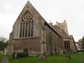
Great Dunmow Town Trail
 2.70 mi
+135 ft
-141 ft
1h 20
Easy
Departure from Great Dunmow (Essex)
2.70 mi
+135 ft
-141 ft
1h 20
Easy
Departure from Great Dunmow (Essex)
A circular walk around the small Essex town of Great Dunmow.
With plenty of historic buildings, a fine 13th century church, some great pubs and a fantastic Indian Restaurant this provides any visitor a taste of this ancient town. The walk is simple and easy and one cannot visit Dunmow without discovering the interesting history of the Dunmow Fitch which is the main feature to this walk.
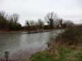
Around Fen Ditton, along the Cam River
 3.39 mi
+36 ft
-36 ft
1h 35
Easy
Departure from Fen Ditton (Cambridgeshire)
3.39 mi
+36 ft
-36 ft
1h 35
Easy
Departure from Fen Ditton (Cambridgeshire)
A picturesque walk (public paths) along the famous river that gave its name to Cambridge. Enjoy seeing the rowers racing in their fragile boats, the cox shouting at them, and the coach biking along the path.
For more walks, use our search engine .
The GPS track and description are the property of this route's author. Please do not copy them without permission.

