


 Country:
 City:
City:


Start from the car park at Place Monaco in Saint-Martin de Bréhal.
On arriving in Saint-Martin de Bréhal via Avenue de Saint-Martin (D592), just before the 30 km/h speed limit sign, shortly before the end of the road and the main entrance to the beach, turn right onto Rue des Sports. A small sign indicates the car park at the entrance to the street, opposite an estate agent’s.
(S/E) Leave the car park and turn right onto Rue des Sports, heading towards the church, which is clearly visible. Leave the church on your right and the tennis courts on your left, and continue along Rue des Sports, which bends to the left. Cross a road (Rue du Docteur de la Bellière on the map) and turn onto the gravelled path opposite, Rue des Minquiers, which leads to the sea.
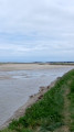
(1) Then take the sea wall on the right, heading north with the Agon-Coutainville headland on the horizon.
(2) Just before the end of the sea wall, in a slight right-hand bend, in front of a large building just before the sailing school, turn right to leave the sea wall. Pass a wall-mounted sign on the right, setting out the rules for shellfish gathering.
Join the D345 opposite, Avenue de la Passerelle, running alongside the racecourse on the right and then the Pony Club on the left. Pass some picnic tables on the right, then cross Rue des Goélettes to the right.
(3) Cross the bridge and follow this road through the marshes. After a sharp left-hand bend, turn left towards “Village Marigny”. Pass through the village and, shortly afterwards, at a road sign indicating a right-hand bend, take the small road on the right, opposite the “Village Pichard” sign.
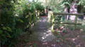
Just after a road sign indicating a junction, turn onto a grassy path on the left.
Cross the small bridge.
(4) At the end of the track, opposite a long, narrow building (an old farmhouse known locally as a ‘longère’) marked No. 30, turn left (the road is called ‘Le Petit Jersey’ – signposted further on). At the T-junction, turn right (“Le Chemin du Bois” on the map) and at the next crossroads, turn right again (“Le Chemin du Châtet” on the map).
(5) At the “Give Way” sign, cross the D375 and continue straight ahead (“Le Chemin de Sable” on the map, which is by no means a sandy track, but a wide, well-maintained road).
At the T-junction, turn right (D98), then immediately left onto Route du Village de l’Isle. Drive through the village, ignoring Chemin Sevalle on the right, then Chemin de la Fontaine. Continue to the next junction.
(6) Opposite a stone house marked No. 2 and featuring a sundial, turn right onto the D135 “Towards the D20”. Pass a small road on your right, the Route du Village Adam, and at the Fork in the road further on, turn right onto the D442 “Towards the D20”, continuing to the next junction.
(7) Pass an amusing orientation sign on your left pointing towards… Canada!
Carry on straight ahead along the stony path. At the end, turn left and then right opposite an electricity pole, onto Rue de la Gardinière, where you’ll come across an old well on the left a little further on.
(8) At the fork in the road, pass a dead-end road straight ahead and take the road on the left opposite No. 12.
At the T-junction, turn right. A little further on, cross a road on the left and continue to the next junction.
(9) Turn left onto Route du Moulin,
Pass a dirt track immediately on the right and take the next small road on the right towards the sea, still following Route du Moulin. A little further on, pass a dead-end road on the right leading to private property, and turn left with the road.
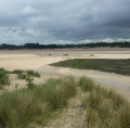
At the fork in the road, ignore a stony path on the left and turn right for 100 m to Havre de la Vanlée, for a little-known view of Le Havre.
(10) Turn round and this time take the stony path you passed earlier on the right.
At the next fork in the road, opposite a post bearing the cycle route logo, turn right towards the sea and follow the stony path which curves to the left to continue running parallel to the sea.
(11) When you reach the road, turn right (Route des Salines on the map), which offers views of the eastern coast of Le Havre and the salt marshes at various points.
(12) At the end of the road, opposite a restaurant, turn right onto the submersible road (D375E1).
(13) At the junction, turn left towards “Saint-Martin de Bréhal”, passing the campsite on your right and then the golf course. Carry on straight ahead until you reach the Place Monaco car park on your right (S/E).
 Visorando Member

