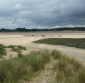
Bréville-sur-Mer

A hike offering varied scenery, with small country roads and paths winding through hamlets, marshes and pastures. Along the way, you’ll find traces of the past and panoramic views of the coastline.
There are some climbs halfway through the route… followed by some lovely descents!

Details

3598518
Creation:
Last update:
Last review:
  • Mountain biking
    Activity: Mountain biking
  • ↔
    Distance: 7.75 mi
  • ◔
    Duration according to the author: 2 hrs 
  • ▲
    Difficulty: Moderate

  • ⚐
    Back to start: Yes
  • ↗
    Ascent: + 171 ft
  • ↘
    Descent: - 174 ft

  • ▲
    Highest point: 203 ft
  • ▼
    Lowest point: 23 ft
  • ⚐ Country: France
  • ⚐ City: Bréhal (50290)
  • ⚑
    Start/End: N 48.897805° / W 1.567317°
  • ❏
    IGN map(s): Ref. 1215ET

  • ◶
    Type of surface:
  •  
     
     
     33% Road  34% Byway  33% Path
  • ⇧
    Bike carrying: Not specified
  • ▲
    Difficulty: Moderate
  • Hour-by-hour weather

Description of the route

Start from the car park, Place Monaco in Saint-Martin de Bréhal.
On arriving in Saint-Martin de Bréhal via Avenue de Saint-Martin (D592), immediately before the 30 km/h speed limit sign, just before the end of the road and the main entrance to the beach, turn right onto Rue des Sports. A small sign indicates the car park at the entrance to the street, opposite an estate agent’s.

(S/E) Leave the car park and turn left onto Rue des Sports (the way you came from). Atthe first junction, at the Stop sign, carry on straight ahead along Rue des Sports. At thesecond junction, at the Stop sign, carry on straight ahead along Rue du Rouge, and atthe third junction, at the Stop sign, carry on straight ahead.

(1) At the end of the road, opposite some large stones, take the path on the right through the dunes, going round the last house on the street; turn left onto the track, with houses on your right and a vast expanse of dunes on your left.
Carry on along the gravel path, pass a small community garden and reach the road. Leave Rue des Tamaris opposite you and turn left for about fifty metres.

(2) Turn right onto Rue des Chardons Bleus and carry on straight ahead until you reach a side road (D351).

(3) Cross the D351, turn left and take the side lane running alongside a campsite on the right. Then carry on straight ahead along the road, passing the aerodrome on your right.
(It is, of course, possible to take the service lane on the left-hand side of the road, but you will need to cross the road again).

(4) After about 600 m, at the end of the service lane on the left, take the path on the right beneath the ‘No Motorised Vehicles’ sign.
Further on, on the right, you’ll pass an old stone building overgrown with vegetation, right in the middle of a field, then you’ll go under a wooden archway. Leave the Ball-Trap Club on your right; the path then becomes sandy.
Keep to the left and follow the track which crosses the golf course. When you reach the road, turn left (D236) – known as the Route de la Mer on this stretch – and follow it for about 200 m.

(5) At the left-hand bend, before the hamlet of La Belle Croix, which can be seen in the distance, take the path on the right beneath the ‘No Entry’ sign.
Pass a building on your right and carry on straight ahead along the track. Pass a chicane and continue along the road called L’Allée des Ormes, lined with modern houses. At the first junction, go straight on.

(6) At the ‘Give Way’ sign, cross the D135E3 and continue straight ahead on the C108 towards Donville-les-Bains, known as Rue des Marais, and carry on for approximately 700 metres.

(7) At a wide right-hand bend, turn left onto the path under the trees. Then take the path leading uphill to the left beneath the ‘No Entry’ sign, the Chemin des Sablons. At the end of the path, turn left.

(8) At the fork in the road, turn left, leaving the small road on your right which climbs towards “La Mizière”.
Pass the Church of Notre Dame de Bréville and the Saint-Hélier Fountain on your left.

(9) When you reach the roundabout, cross at the pedestrian crossing on the left in front of the inn, and head left, keeping the central reservation on your left.
Go round the manor house on your right, pass a picnic table and turn right onto the small uphill road, passing the ‘No Entry’ sign on your left and the ‘Chemin Neuf’ sign on your right.

(10) At the fork in the road, turn left uphill until you reach the panoramic view of the Normandy countryside and the sea at the top of the hill, known as “Mont Pierre”.
When you reach the road, turn right, continuing uphill.

(11) At the junction, pass a stone gate marked No. 19 on your right and take the D594 to the left, heading downhill towards Coudeville-Plage. Pass through the hamlet of “Le Vau Richard” with its old stone houses brightened up by geraniums and hydrangeas.

(12) At the Stop sign, at the Village Garnier crossroads, take the D351 on the left, heading downhill towards Coudeville-Plage.
Pass through the hamlet of La Rivière and, opposite a wash house, turn left. Take the D135 on the right towards Saint-Martin-le-Vieux.

(13) Take thefirst road on the left (D597) downhill, pass through the hamlet of ‘Le Herbert’, then cross a stream.
When you reach the T-junction, cross the road (Rue des Bisquines) and take the small grassy path lined with mulberry trees opposite.
Carry on straight ahead, passing a sports ground on the left and scrubland on the right.
Pass a pine copse on your left with benches and a picnic table, and at the end of the path go round a chicane.
Take the road leading uphill opposite, Rue du Herbert, between houses on the left and the dunes on the right.
Cross Impasse des Mouettes on your left, then Rue des Îles.

(2) Opposite Rue des Chardons Bleus (which you took on the way out), turn right onto the path through the dunes.

(1) Once you reach the road, carry on straight ahead to reach Place Monaco (S/E).

Waypoints

  1. S/E : mi 0 - alt. 33 ft - Place Monaco 
  2. 1 : mi 0.3 - alt. 33 ft - The Dunes
  3. 2 : mi 0.58 - alt. 39 ft - Rue des Chardons Bleus on the right
  4. 3 : mi 0.73 - alt. 36 ft - Coudeville-Plage
  5. 4 : mi 1.33 - alt. 23 ft - The Golf Trail
  6. 5 : mi 2.41 - alt. 26 ft - La Belle Croix
  7. 6 : mi 2.82 - alt. 33 ft - D135E3
  8. 7 : mi 3.21 - alt. 30 ft - The Chemin des Sablons
  9. 8 : mi 3.64 - alt. 75 ft - Fork in the road, turn left
  10. 9 : mi 4.03 - alt. 69 ft - Roundabout
  11. 10 : mi 4.24 - alt. 85 ft - Fork in the road, turn left
  12. 11 : mi 4.84 - alt. 200 ft - Le Vau Richard
  13. 12 : mi 5.47 - alt. 95 ft - The Village Garnier
  14. 13 : mi 6.09 - alt. 46 ft - D597
  15. S/E : mi 7.75 - alt. 30 ft - Place Monaco 

Notes

Toilets are available at the start and finish behind the information centre next to the church.

On this route, some roads are one-way, except for business owners or local residents.
However, the municipality of Bréville allows cyclists to use these small roads and paths, some of which are included in the canton’s cycling routes.

Worth a visit

- “La Mizière” between (7) and (9)
There used to be a leper colony in the village of La Mizière, as the disease was widespread until the end of the Middle Ages. In the region, sufferers were known as ‘mézeaux’ (from the Latin ‘miser’, meaning ‘unfortunate’), and the hospices were called ‘mézières’ or ‘mizières’.
No remains of this former leper colony survive today.
Centuries later, La Mizière came into the possession of a noble family from Granville, shipowners who operated cod-fishing vessels in Newfoundland and who amassed their fortune by equipping privateer ships during the war against the English in 1792.
(Small information panel along the path)

- Notre-Dame de Bréville Church and the Saint-Hélier Fountain between (7) and (9)
The church, with its octagonal bell tower, was built at the end of the 12th century in the shape of a ship and has retained its original Romanesque character.
Legend has it that Saint Hélier (6th century) lived in a cave on the Channel Islands.
Beheaded by pirates from the north, his body was found on the shores of Bréville; he was buried there, on the site where the church would later be built.
Next to the church, the fountain, known as the ‘Fontaine Saint-Hélier’, is said to possess healing properties, particularly for eye diseases.
In 1886, the fountain was adorned with a large statue of Saint Hélier.
See here.

- The Manoir du Vau Février (19th century) between (9) and (11)
Opposite and right at the foot of the Vau Février Manor House, the Bréville marshes once began, stretching all the way to the salt marshes.

- The Chemin Neuf between (9) and (11)
The Bréville path, where you can breathe in the sea air and the countryside!
Forming a link between the marshes and the bocage, this path was once used by the inhabitants of the upper hamlets as they made their way down to Bréville church.
In the 1900s, the path was used by children walking to school, women laden with baskets of laundry on their way to the washhouse at Fontaine Saint-Hélier, donkeys pulling carts laden with seaweed, and men setting off to fish on foot with their sole nets…
The path highlights the striking contrast between the barren marshes and the lush Normandy countryside.
(Small information sign along the path)

- Mont Pierre, between (9) and (11)
From the top of the hill, there is a sweeping view of the sea horizon and the coastline, stretching from north to south: the Pointe d’Agon, the coastal strip of Régnéville, the Chausey archipelago and the cliffs of Donville-les-Bains.
On a clear day, Jersey can sometimes be seen.
(Small information sign along the path)

Reviews and comments

4.3 / 5
Based on 2 reviews

Reliability of the description
4.5 / 5
Ease of following the route
4.5 / 5
Route interest
4 / 5
User 14260449

Overall rating : 4.7 / 5

Date of your route : Apr 26, 2026
Reliability of the description : ★★★★★ Very good
Ease of following the route : ★★★★★ Very good
Route interest : ★★★★☆ Good
Very busy route : No

A lovely little walk with no major difficulties.
Very pleasant!

Machine-translated

OLVMALOU
OLVMALOU

Overall rating : 4 / 5

Date of your route : Sep 11, 2022
Reliability of the description : ★★★★☆ Good
Ease of following the route : ★★★★☆ Good
Route interest : ★★★★☆ Good
Very busy route : No

Very pleasant and not too difficult, apart from Mont Pierre.

Machine-translated

For more walks, use our search engine .

The GPS track and description are the property of this route's author. Please do not copy them without permission.