Country:
 City:
City:


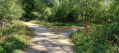
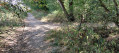
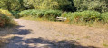
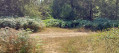
This walk starts at the official car park for Bourne Woods, a turn off to the East from A151 down a rough road, but it is passable.
(S/E) From the car park, take the footpath going Eastwards to reach the main track after 50 metres. Turn left and reach waymark 1 after 130 metres.
(1) This is a junction of five pathways; basically go straight on in a northerly direction. Continue along this major path for about 2.6 kilometres to reach waymark 2.
(2) At this waymark there is a turn to the right, but continue straight on for about 200 metres. The next junction will be the fourth waymark you'll reach from the right later on, but for now, ignore the path to the right and veer slightly to the left for 300 metres, then turn right and continue for 500 metres to reach waymark 3.
(3) At this waymark bear right and continue for 300 metres to reach the major path. Turn right and after 500 metres reach waymark 4.
(4) This waymark you have passed before and there is a bench opposite. Turn left and continue for 200 metres to return to waymark 2. Turn left and continue for 400 metres to reach waymark 5.
(5) Turn right to start climbing and continue for 2.6 kilometres to reach waymark 6
(6) Turn right off the main walkway. After 250 metres, turn left onto a pathway and after 400 metres reach a main pathway. Turn right and continue 150 metres to return to waymark 1, the fiveways junction. Turn left to return to the car park.(S/E)
 Visorando Member