Ferrrand Circulars

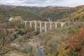
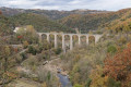
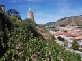
A circular loop starting from Ferrand. Stunning views over the Doux and Duzon gorges.

Please note: read the practical information carefully before setting off on the route.

Details

17917240
Creation:
Last update:
Last review:
  • Walking
    Activity: Walking
  • ↔
    Distance: 5.12 mi
  • ◔
    Average duration: 3h 25 
  • ▲
    Difficulty: Moderate

  • ⚐
    Back to start: Yes
  • ↗
    Ascent: + 1,230 ft
  • ↘
    Descent: - 1,250 ft

  • ▲
    Highest point: 1,470 ft
  • ▼
    Lowest point: 735 ft

Photos

Description of the walk

To reach the start from Tournon, take the D 532 towards Lamastre. Just after house number 179, continue left towards Chemin du Martinot – Chemin des Crêtes, then turn sharply right. At the first hairpin bend, ignore the start of the trail opposite (Chemin du Martineau) and continue to the right onto Chemin des Crêtes. Drive for about 1 km and park at the fourth hairpin bend (parking available for 3 to 4 vehicles).

(S/E) Take the tarmac road downhill and return to the road you took coming from Tournon. Continue for about 300 m, heading north, until you reach a cross.

(1) Turn right onto the unmarked path heading east (caution: there are two paths; make sure you take the one furthest to the left). Continue for 500 metres until you reach a wider path (marked in white and yellow). Turn left for a few metres, then follow the path to the right (marked with a White Cross and a Yellow Cross). Stay on the path on the right until, after about 450 m, you reach a path marked in yellow and white. Turn right onto the path to reach the Route des Crêtes at a place called Les Tuiles.

(2) Cross the road and take the path leading down towards the north-north-west; you’ll soon reach the GR®420.

(3) Turn left, heading south.

(4) Walk past the waterfall and carry on to Mouret.

(5) Follow the tarmac road for a few metres, then climb the rock face on the left (opposite the gate) to join the unmarked path that rises above the road. The clearing of undergrowth, carried out in December 2021, ensures easy progress along the entire length of the path as it climbs up to a field. Continue straight on along the left-hand (eastern) edge of the field and follow the track which joins the road.

(6) Turn right, follow the road, ignore the track on the left and reach the hamlet of Le Rey. Continue straight on, ignoring the off-road paths on either side, and just before the hamlet of Le Bec, turn right onto the GR®420, which descends towards the north and then north-west.

(7) At the junction, carry on to the right on theGR®, heading north-north-east, until you reach La Grange de Vaure.

(8) Walk through the hamlet and continue along the tarmac road to Mouret.

(5) Take the GR®420 towards Ferrand and follow the route back along the same path as on the way there.

(4) Walk past the waterfall and carry on.

(3) Leave the route you have already taken and go straight on until you reach the tarmac road (S/E).

Waypoints

  1. S/E : mi 0 - alt. 1,047 ft - Route des Crêtes Ferrand
  2. 1 : mi 0.18 - alt. 994 ft - Road x Path – Overlooking the - Doux (rivière)
  3. 2 : mi 0.77 - alt. 1,148 ft - Les Tuiles / Route des Crêtes
  4. 3 : mi 0.84 - alt. 1,030 ft - Ferrand
  5. 4 : mi 1.23 - alt. 869 ft - Waterfall
  6. 5 : mi 1.55 - alt. 751 ft - Mouret
  7. 6 : mi 2.44 - alt. 1,460 ft - Chemin du Rey
  8. 7 : mi 3.4 - alt. 988 ft - Overhanging junction at the - Duzon (rivière)
  9. 8 : mi 3.84 - alt. 902 ft - La Grange de Vaure
  10. S/E : mi 5.12 - alt. 1,047 ft - Route des Crêtes Ferrand

Notes

Eighty per cent of the route follows paths and tracks. The few tarmac sections are very quiet.
Given the lack of signposting on part of the route, it is strongly recommended that you use a GPS in addition to the IGN map.

At the start, there is parking space for 3 to 4 vehicles.

Difficulty, according to the FFR grading guide:
Effort: 2, Easy (IBP45)
Technical difficulty: 4, Difficult (one section where you need to use your hands)
Risk: 3 (low)
This route is suitable for experienced walkers in good physical condition.

At the (5), access to the path requires you to “use your hands” to cross a sloping rocky section approximately 1.5 metres long. There are no significant difficulties, but you should take particular care over the first hundred metres as the path was damaged during the bad weather in November 2019.

Worth a visit

The station and the Ardèche tourist train. The Mastrou. Railbike.
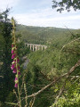
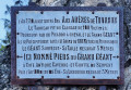
Views of the Duzon Viaduct
The Duzon Tanks
The Cité du Chocolat.

Always be cautious and plan ahead when you're outdoors. Visorando and the author of this route cannot be held responsible for any accidents occurring on this route.

The GR® and PR® markings are the intellectual property of the Fédération Française de Randonnée Pédestre.

Reviews and comments

4.1 / 5
Based on 3 reviews

Reliability of the description
4.3 / 5
Ease of following the route
4 / 5
Route interest
4 / 5
deeper26
deeper26

Overall rating : 4 / 5

Date of your route : Jul 17, 2026
Reliability of the description : ★★★★☆ Good
Ease of following the route : ★★★★☆ Good
Route interest : ★★★★☆ Good
Very busy route : No

We went on the walk; it’s nicely shaded
After starting on the GR, you need to follow the markings consisting of three dots
The only tricky bit on the way there is the section at point 5 (a rock you have to climb opposite the house, but there’s no signpost); just after this rock, the path is full of brambles but it’s easy to follow
There are no further difficulties for the rest of the route
Gerald

Machine-translated

REYNAUD Chantal
REYNAUD Chantal

Overall rating : 4 / 5

Date of your route : Mar 05, 2023
Reliability of the description : ★★★★☆ Good
Ease of following the route : ★★★☆☆ Average
Route interest : ★★★★★ Very good
Very busy route : No

We did this route yesterday; it’s a lovely route with some stunning views. However, it would be good if the signposting were better, as we had a few difficulties, particularly in the hamlet of Le Bec, where we had to retrace our steps and ask the few local residents for directions. The rock face, although not very high, isn’t easy to climb. It would be worth making some provision for this. Steps or handholds.

Machine-translated

philippe bleton
philippe bleton

Good evening,
Thank you for your comment. I’ve just corrected the spelling of the Martinot path.
Have a lovely evening.
Philippe

Machine-translated

Other walks in the area

For more walks, use our search engine .

The GPS track and description are the property of this route's author. Please do not copy them without permission.