In the footsteps of the giant in Tournon-sur-Rhône

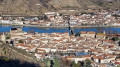
If you enjoy varied landscapes, vineyards and panoramic views of the Rhône Valley, this walk is for you. You’ll set off from the north of the town, where you can admire the harbour, the castle-museum and the suspension bridge. You’ll then climb through the vineyards up to the Ardèche plateau, where you’ll enjoy breathtaking views of the Vercors and the Alps before heading back down to explore this astonishing giant.

Details

44655801
Creation:
Last update:
Last review:
  • Walking
    Activity: Walking
  • ↔
    Distance: 3.49 mi
  • ◔
    Average duration: 2h 20 
  • ▲
    Difficulty: Moderate

  • ⚐
    Back to start: Yes
  • ↗
    Ascent: + 876 ft
  • ↘
    Descent: - 856 ft

  • ▲
    Highest point: 1,191 ft
  • ▼
    Lowest point: 384 ft

Photos

Description of the walk

Park at the Octroi car park.

(S/E) Head towards the Rhône to reach the Promenade Roche Defrance in just a few steps. Follow it to the marina.

(1) Turn right towards Avenue Maréchal Foch, walk along it, then turn left, cross at the pedestrian crossing and go round the church on the right. Turn left and continue to the junction with the Grande Rue.

(2) Turn right onto it and follow it to the chemist’s. Turn right onto Rue Gabriel Faure and, once at the top of the street, continue up the steps to Rue du Docteur Cadet. Turn right and follow the road for 200 metres, negotiating the hairpin bend.

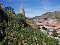
(3) Turn right onto Chemin des Tours and, at the second hairpin bend, carry on straight ahead along the path that climbs through the vineyards. After a 600-metre climb, you’ll come out onto a ridge with a viewpoint (elevation 276).

(4) Turn immediately right, heading north, leaving the vineyards on your right. Continue along a well-maintained path, skirting the mast, to reach a small road at a place called Chapon. Turn left, follow the road for 100 m and leave it on the right to follow a farm track. This takes a sharp left-hand bend and heads south, leading onto a tarmac road.

(5) Walk about twenty metres to the right, then head down the path on the right. After a 300-metre descent, at the Fork in the road, ignore the path that drops steeply to the left; continue north for 600 metres to emerge into a small triangular field.

(6) Walk along the edge of the field heading north-east to join a clearly marked path on the left, which descends gently then steeply for 300 metres: ignore the paths branching off to the right.

(7) At the junction, take the path on the right to pass above the pool (the Giant’s Pool). At the junction, turn left and continue carefully along the Chemin du Géant.

(8) On your left is the carved rock of the Grand Géant: see the ‘Places to see’ section. Please note: the descent to the sculpture is perilous. Do not attempt it without solid experience of very steep terrain. Continue for about 150 m to reach the ‘Homme primitif des Cévennes’, hidden in a recess to the left of the path.

(9) Continue straight ahead to a ruined house. Pass it and head down to the right to join Rue du Doux. Turn left for 100 m, then right to go under the railway line, and carry on along Rue du Doux until you reach the roundabout at Avenue Maréchal Foch. Go round it on the right to reach the Octroi car park (S/E).

Waypoints

  1. S/E : mi 0 - alt. 404 ft - Octroi car park. Confluence of the Rhône and - Doux (rivière)
  2. 1 : mi 0.5 - alt. 384 ft - Marina - Rhône (River)
  3. 2 : mi 0.81 - alt. 410 ft - Rue Gabriel Faure
  4. 3 : mi 1.02 - alt. 486 ft - Junction of the panoramic road and Chemin des Tours
  5. 4 : mi 1.41 - alt. 912 ft - Viewpoint
  6. 5 : mi 2.1 - alt. 1,165 ft - Junction with tarmac road
  7. 6 : mi 2.64 - alt. 1,060 ft - Champ
  8. 7 : mi 2.82 - alt. 833 ft - Piscine du Géant
  9. 8 : mi 2.92 - alt. 650 ft - Seated Giant
  10. 9 : mi 3.02 - alt. 620 ft - Standing Giant
  11. S/E : mi 3.49 - alt. 404 ft - Octroi car park

Notes

Please note: although this walk is short and has a gentle gradient, it requires sure-footedness, good footwear and, if possible, walking poles. It is not accessible to people with reduced mobility.

Please note: between (7) and (9), rockfalls may occur. You should take particular care. In particular, do not let children climb on unstable rock faces.

(S/E) The free car park at L’Octroi can accommodate over 100 vehicles. There is also a parking area for motorhomes.

Worth a visit

The legend of the giant (based on the article published in the JTT on Thursday 10 December 2020).

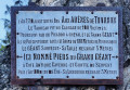
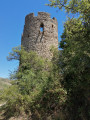
Mr Foriel, who owned the Domaine de la Terrasse and the entire hill up to the Peyregourde Tower between the 1880s and 1930s, was an eccentric figure with a passion for esotericism, who scattered a variety of whimsical works all over the area.

(8) The sculpture of the Great Giant, perched on a rock overlooking Tournon, hidden amongst the box trees. On its plinth is a completely outlandish inscription recounting its so-called history. But above all, it offers a sublime view of the Doux and Rhône valleys.

(9) This is the ‘Primitive Man of the Cévennes’, according to Foriel, a work that has suffered the ravages of time. In the past, the children of Tournon were forbidden from playing in this area, as the statue was deemed indecent!

Ruins further on (9): this is where the gallows once stood. It was here that the gallows were erected, from which bandits were hanged in the Middle Ages. At the time, this spot was not overgrown with vegetation but visible from across the valley, making it an ideal place for educating the people.

Reviews and comments

4.2 / 5
Based on 3 reviews

Reliability of the description
4 / 5
Ease of following the route
4 / 5
Route interest
4.7 / 5
albizia2
albizia2

Overall rating : 4.3 / 5

Date of your route : May 26, 2024
Reliability of the description : ★★★★☆ Good
Ease of following the route : ★★★★☆ Good
Route interest : ★★★★★ Very good
Very busy route : No

A succession of magnificent views, particularly as you walk along the ridge on the farm track.

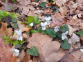
Very pretty woodland from (5) to (6), abounding with flowers in this particularly wet spring.

Unfortunately, the ascending paths have been badly eroded by the recent storms.

However, as I am 77 years old, I won’t be doing this route again, given how genuinely perilous the section between (6) and (9) is.

Machine-translated

jpakiki
jpakiki

Overall rating : 4.3 / 5

Date of your route : Mar 24, 2024
Reliability of the description : ★★★★☆ Good
Ease of following the route : ★★★★☆ Good
Route interest : ★★★★★ Very good
Very busy route : No

Hello, this is a lovely walk to discover, with a section of the path that isn’t shown even on recent maps; the descent on the way back requires caution. I completed it in 2 hours and 15 minutes and found the elevation gain to be 290 metres.
Many thanks to the author of this lovely route.

Machine-translated

philkikou
philkikou

Hello, having read the review, and comparing it with someone I know who has done your walk, I did it in the opposite direction and ‘extended’ it by combining it with two other walks from the Visorando website . Thank you for introducing me to this route – lovely trails amongst boxwood, juniper and orchids at this time of year, and some good gradients too.

Machine-translated

jeanluc guilhot
jeanluc guilhot

Overall rating : 4 / 5

Date of your route : Feb 13, 2024
Reliability of the description : ★★★★☆ Good
Ease of following the route : ★★★★☆ Good
Route interest : ★★★★☆ Good
Very busy route : No

A lovely walk around Tournon, but a steep descent at the end

Machine-translated

Other walks in the area

For more walks, use our search engine .

The GPS track and description are the property of this route's author. Please do not copy them without permission.