Circular routes around Saint-Pardoux-Corbier

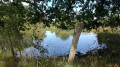
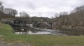
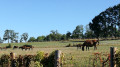
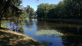
A walk starting from the lake, which takes you along numerous tarmac sections, through fields on well-maintained paths, with streams crossing the path in places.

Details

93589442
Creation:
Last update:
Last review:
  • Walking
    Activity: Walking
  • ↔
    Distance: 7.19 mi
  • ◔
    Average duration: 3h 40 
  • ▲
    Difficulty: Moderate

  • ⚐
    Back to start: Yes
  • ↗
    Ascent: + 466 ft
  • ↘
    Descent: - 489 ft

  • ▲
    Highest point: 1,368 ft
  • ▼
    Lowest point: 1,152 ft

Description of the walk

Start from the lake car park.

(S/E) Join the D50 and follow it to the right until you reach the three-way junction.

(1) Turn left onto the D54 and continue to the next junction.

(2) Turn left onto Route de Louméjoux and follow it to Rue de la Géréthie on the right.

(3) Take this road, pass through the hamlet by making a 90° left turn, then continue along the path until you reach a track suitable for vehicles.

(4) Walk a few metres to the left, then take the path on the right.

(5) At the road, turn right (Route de Jouméjoux) and continue to the next junction.

(6) Take the hairpin bend to the left, onto Route de l'Age, and follow this road to the church at Saint-Pardoux-Corbier.

(7) Continue along the D54.E1, Route de Pompadour, and reach the three-way junction, at the sign marking the village boundary.

(8) Continue on the D54.E1, ignore the Impasse de l'Inteillet on the left and reach the next path on the left, at the edge of the woods.

(9) Ignore it (return path) and continue along the road. Pass Route de Lavaud on your left and reach the next path on the left, about a hundred metres further on.

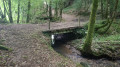
(10) Take this path and head straight on until you reach the ford across the stream.

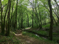
(11) The stream now runs alongside the route. Take the tracks through the woods on the left after the ford and continue until you find a path on the left, at the edge of the forest.

(12) Follow this and, after about a hundred metres, turn onto the path on the right. Late March 2026: fallen trees, very muddy section; it is best to go round behind the signpost and continue along the path to rejoin the signposted route at the next junction.

(13) Turn left and head between the fields. Cross the forest and continue to the hamlet of Champtiaux.

(14) Walk through the hamlet and continue along the road. Pass the hamlet of Lanouialle then turn onto the path on the right. Follow it until you rejoin the D54.E1.

(9) Follow it to the right until you reach the junction at the sign marking the entrance to the town of Saint-Pardoux-Corbier.

(8) Turn right onto Allée du Bouyjoux and head for the car park by the lake, going round it on the right (S/E).

Waypoints

  1. S/E : mi 0 - alt. 1,230 ft - Car park - Plan d'eau de Saint-Pardoux-Corbier
  2. 1 : mi 0.24 - alt. 1,289 ft - D54 road
  3. 2 : mi 0.34 - alt. 1,289 ft - Route de Louméjoux
  4. 3 : mi 0.61 - alt. 1,329 ft - Rue de la Géréthie
  5. 4 : mi 1.14 - alt. 1,312 ft - Vehicle-accessible track
  6. 5 : mi 1.37 - alt. 1,332 ft - Road
  7. 6 : mi 1.67 - alt. 1,365 ft - Route de l'Age
  8. 7 : mi 2.41 - alt. 1,270 ft - Route de Pompadour (D54.E1)
  9. 8 : mi 2.67 - alt. 1,257 ft - T-junction (return)
  10. 9 : mi 3.09 - alt. 1,250 ft - T-junction (return)
  11. 10 : mi 3.25 - alt. 1,289 ft - Path on the left
  12. 11 : mi 3.91 - alt. 1,168 ft - Fording - Gavassou (ruisseau) - Affluent du ruisseau des Planches
  13. 12 : mi 4.34 - alt. 1,299 ft - Path at the edge of the forest
  14. 13 : mi 4.58 - alt. 1,270 ft - Junction
  15. 14 : mi 5.38 - alt. 1,227 ft - Champtiaux
  16. S/E : mi 7.19 - alt. 1,230 ft - Car park - Plan d'eau de Saint-Pardoux-Corbier

Notes

Signposted PAPSE or Corbier Oxigène (Corbier).

Alternatives:
(3) On the hill, there is a very wet section; it is best to continue on the tarmac, which also offers a splendid view of the hills to the right before the Bois de Juge.
(14) Option to turn right to follow the PAPSE trail. Continue for 200 m and turn onto the path on the left, which is usually very muddy, for a view and landscape that aren’t worth the effort.

Saint-Pardoux Corbier Standardised Physical and Sporting Activities Trail (PAPSE), opened by the Corbier Oxigène association .

Bar-tobacconist and restaurant along the route.

Worth a visit

Other walks in the area

For more walks, use our search engine .

The GPS track and description are the property of this route's author. Please do not copy them without permission.