Thoubervillaise Circular Loop

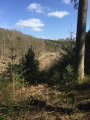
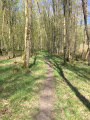
A walk entirely within the La Londe State Forest, where you can enjoy panoramic views of the forest and a cave along pleasant paths.

Details

n°7914554
Creation:
Last update:
Last review:
  • Walking
    Activity: Walking
  • ↔
    Distance: 3.92 mi
  • ◔
    Average duration: 2h 00 
  • ▲
    Difficulty: Easy

  • ⚐
    Back to start: Yes
  • ↗
    Ascent: + 200 ft
  • ↘
    Descent: - 220 ft

  • ▲
    Highest point: 410 ft
  • ▼
    Lowest point: 236 ft

Photos

Description of the walk

Starting point: Impasse des Jouveaux. Parking available at the side of the road.

(S/E) Head down into the forest until you reach a crossroads about fifty metres from the edge of the woodland.

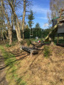
(1) Turn right onto the path that runs past a few houses and continue to the sewage treatment plant.

(2) Head back up to the right, go round the sewage treatment plant by turning left and walk alongside it until you re-enter the woods. At the first houses in Offranville, take the path on the left leading down into the woods.

(3) Carry on straight ahead, cross the clearing, then head slightly to the right.

(4) Please note: leave the path and head down towards the field on the right, which you will then follow to reach Rue d’Offranville. Continue to the left; after barely 50 metres, turn immediately right onto a path running alongside a house. Just past the house, turn right again, keep going straight on, then walk along the meadow until you come out onto Rue d’Offranville.

(5) Head to the left and, after 100 metres, turn right to re-enter the woods and rejoin the path you took earlier.

(3) Head to the right, but do not go down to the clearing you crossed on the way there. This time, turn left to go down to another clearing; follow this to reach the Route Forestière de Mesnil. Continue to the left to reach the Mesnil crossroads (sign).

(6) Take the path behind the sign and follow it straight on.

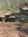
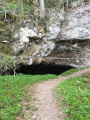
(7) Walk past a cave (take a short detour to have a look at it without going inside), then carry on.

(1) Go straight on to return to the starting point at Impasse des Jouveaux (A/D).

Waypoints

  1. S/E : mi 0 - alt. 410 ft - Impasse des Jouveaux
  2. 1 : mi 0.11 - alt. 367 ft - Junction with the circular loop
  3. 2 : mi 0.46 - alt. 387 ft - Wastewater treatment plant
  4. 3 : mi 1.3 - alt. 381 ft - Junction with the short circular loop
  5. 4 : mi 1.7 - alt. 335 ft - Turn right towards the field
  6. 5 : mi 2.28 - alt. 400 ft - Rue d’Offranville
  7. 6 : mi 3.37 - alt. 249 ft - Mesnil crossroads
  8. 7 : mi 3.63 - alt. 269 ft - Cave
  9. S/E : mi 3.92 - alt. 410 ft - Impasse des Jouveaux

Notes

During wet weather, some sections may be very muddy at point (4).
It is forbidden to enter the cave at point (7).

Worth a visit

(7) Cave.

Reviews and comments

2.9 / 5
Based on 5 reviews

Reliability of the description
2.6 / 5
Ease of following the route
2.8 / 5
Route interest
3.2 / 5
papi marcheur 76
papi marcheur 76

Overall rating : 4.3 / 5

Date of your route : Oct 10, 2025
Reliability of the description : ★★★★☆ Good
Ease of following the route : ★★★★☆ Good
Route interest : ★★★★★ Very good
Very busy route : No

A beautiful route through forest.
200 metres of tarmac to get to and from the trail. Magnificent trees and peace and quiet. A great place to spend some time in dry weather. In rainy weather, it must be more difficult... Thank you to whoever discovered this beautiful walk.

Machine-translated

clicnet
clicnet

Overall rating : 3.3 / 5

Date of your route : Sep 24, 2024
Reliability of the description : ★★★★☆ Good
Ease of following the route : ★★★☆☆ Average
Route interest : ★★★☆☆ Average
Very busy route : No

It’s a shame, as the walking route runs mainly through woodland

Machine-translated

clicnet
clicnet

The walk is scheduled for 29 September 2024, so there are no comments yet.

Machine-translated

Nadinenad
Nadinenad

Overall rating : 1 / 5

Date of your route : May 13, 2024
Reliability of the description : ★☆☆☆☆ Very disappointing
Ease of following the route : ★☆☆☆☆ Very disappointing
Route interest : ★☆☆☆☆ Very disappointing
Very busy route : No

A 6km stretch of the route was not used; the path had disappeared.
It’s a shame because the walk is through the woods, but having to make our way through nettles, brambles and so on turned this stroll into an obstacle course.

Machine-translated

Angot
Angot

Overall rating : 1.7 / 5

Date of your route : Aug 24, 2022
Reliability of the description : ★☆☆☆☆ Very disappointing
Ease of following the route : ★☆☆☆☆ Very disappointing
Route interest : ★★★☆☆ Average
Very busy route : No

The paths were hard to see and there were no signposts at the junctions. We weren’t able to stick to the route. As the cave wasn’t signposted, we didn’t spot it. On the plus side, as it was hot, this walk was pleasant as it was mainly through the forest.

Machine-translated

benoitrando
benoitrando

Overall rating : 4 / 5

Date of your route : Jul 02, 2021
Reliability of the description : ★★★☆☆ Average
Ease of following the route : ★★★★★ Very good
Route interest : ★★★★☆ Good
Very busy route : No

Route usage; some paths are difficult to see due to the vegetation.

The walking route runs mainly through woodland and there is a lack of clear signage at junctions, which can lead walkers to go round in circles several times.

Otherwise, the route itself is a very pleasant walk.

Thanks to the Pasapas association

Machine-translated

Other walks in the area

For more walks, use our search engine .

The GPS track and description are the property of this route's author. Please do not copy them without permission.