Circular route via Orphin, Émancé and Saint-Hilarion, starting from Gazeran

This circular route from Gazeran passes close to or through the villages of Orcemont, Orphin, Emancé and St-Hilarion. It mostly follows thePR® orGR® marked paths, through fields and woods, and runs alongside the Drouette and the Guéville on several occasions.

Details

n°8069393
Creation:
Last update:
Last review:
  • Mountain biking
    Activity: Mountain biking
  • ↔
    Distance: 16.00 mi
  • ◔
    Duration according to the author: 2 hrs 
  • ▲
    Difficulty: Average

  • ⚐
    Back to start: Yes
  • ↗
    Ascent: + 472 ft
  • ↘
    Descent: - 476 ft

  • ▲
    Highest point: 551 ft
  • ▼
    Lowest point: 410 ft
  • ⚐ Country: France
  • ⚐ City: Gazeran (78125)
  • ⚑
    Start/End: N 48.636097° / E 1.774941°
  • ❏
    IGN map(s): Ref. 2115O, 2116E, 2215OT, 2215OTR, M2215OT

  • ◶
    Type of surface:
  •  
     
     
    ■ 15% Road ■ 70% Byway ■ 15% Path
  • ⇧
    Bike carrying: No
  • ▲
    Difficulty: Average
  • Hour-by-hour weather

Photos

Description of the route

Start from the car park in front of Gazeran Town Hall.

(S/E) Opposite the town hall, head to the right onto Rue de la Mairie. After 150 m, at the war memorial, leave Rue de la Mairie – which curves to the right – and continue straight on along Chemin du Moulin. After 1 km and a steep final climb, the path joins Route du Bray.

(1) Turn left onto Route du Bray and pass under the railway line.

(2) Immediately turn right onto the farm track which runs alongside the railway line, then moves away from it, goes round a small copse and leads to a T-junction.

(3). Turn left. At the junction (elevation 166), go straight on.

(4) Take thefirst path on the right, which runs between two fields. Follow the edge of a small copse and carry on straight ahead until you reach the D150.

(5) Carefully join the road on the right and continue for about 350 m until you reach the small road heading towards Orcemont.

(6) Follow this, then after about 400 m, you’ll come to a path on the left

(7) Leave the tarmac road and continue along this path (PR®, marked in yellow) for 3 km, ignoring any side paths on either side.

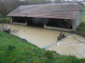
(8) At the crossroads, turn left then immediately right and walk alongside the Drouette (do not cross the bridge). The path passes close to a wash house, then comes out onto a street near the village of Orphin.

(9) Take the road on the right for 50 metres, then leave it to take a steep path which climbs for about a hundred metres. Turn left onto the small road leading to the D150.

(10) Avoid the departmental road by turning right onto the cycle path which runs alongside the D150 behind a hedge. At the end of the path, cross the road carefully to rejoin a yellow-markedPR® path which leads into the woods.

(11) Follow this path, which runs straight on for about 1.2 km.

(12) Continue left on thePR® path, passing a ruined tower on your left and then some large old villas on your right.

(13) When you reach Villa Léon, take the road on the right and walk alongside the tall poplars. As the road veers off to the left, carry on straight ahead along the path, skirting the large grounds of Château de Sauvage until you come to a road; take this to the right for 100 m until you reach the castle gates.

(14) Take the Route d’Émancé opposite the château for 50 metres, then take the small street on the left which leads uphill. Leave this street when it turns left, and continue straight on along thePR®-marked path, which crosses a wooded area and then descends to the Route d’Émancé below on the right. Follow it for a few metres to the left.

(15) At the sign for Émancé, take the path on the right, cross two small bridges (without railings) and follow the Drouette stream to the left until you reach the road.

(16) Turn right onto Rue de Rambouillet, which climbs and, after a hairpin bend, leads to a junction.

(17) Follow the path branching off to the right for 300 metres until you reach a junction.

(18) Turn left, following theGR® markings. Walk alongside a paddock and emerge onto a small road. Continue straight ahead until you reach the junction.

(19) Take the road on the right (Rue de Gazeran) and follow it for 800 metres until you reach the corner where two woods and two cultivated plots face each other (there is also a house on the right-hand side).

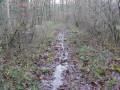
(20) Join theGR® path on the left, which runs alongside the woodland. Follow it until you come out onto a road after a very damp stretch between two fences.

(21) Follow the road to the right for about 500 m until you reach a bend to the right.

(22) Turn left onto the track, then immediately right. Pass through a small hamlet, following theGR® signposts, and head down a path to rejoin the road at the railway line. Go under the bridge and reach the hamlet of La Bellanderie.

(23) Turn right after the first house onto theGR® path and follow it to the Étang de Saint-Hilarion.

(24) Carry on straight ahead on theGR®, which follows the Guéville stream and climbs alongside the extensive grounds of the Château de Voisins.

(25) At the far end of the château’s ponds on your left, turn right and continue along the edge of the estate. Pass under the railway bridge, turn left and pass under the railway line asecond time. Follow the path until you reach the Haut de Gazeran.

(26) Carry on straight ahead along Rue du Haut de Gazeran. At the junction, turn right onto a small path that leads down to La Guéville. Take the path on the right before the bridge that runs alongside the river. You’ll reach the village hall and then Gazeran Town Hall, which is opposite it (S/E).

Waypoints

  1. S/E : mi 0 - alt. 453 ft - Car park at Gazeran Town Hall. Near the - Guéville (rivière) - Affluent de la Drouette
  2. 1 : mi 0.72 - alt. 522 ft - Route du Bray
  3. 2 : mi 0.98 - alt. 518 ft - Railway bridge
  4. 3 : mi 1.89 - alt. 548 ft - T-junction
  5. 4 : mi 2.31 - alt. 545 ft - Junction
  6. 5 : mi 3.48 - alt. 489 ft - D150 road
  7. 6 : mi 3.69 - alt. 518 ft - Route to Orcemont
  8. 7 : mi 3.96 - alt. 538 ft - Path starts on the left
  9. 8 : mi 5.85 - alt. 476 ft - Junction – Bridge over the - Drouette (rivière)
  10. 9 : mi 6.3 - alt. 469 ft - Rue de la Drouette (Orphin)
  11. 10 : mi 6.48 - alt. 509 ft - Greenway alongside the D150
  12. 11 : mi 6.83 - alt. 528 ft - Junction
  13. 12 : mi 7.59 - alt. 502 ft - Junction
  14. 13 : mi 8.24 - alt. 453 ft - Villa Léon
  15. 14 : mi 9.26 - alt. 433 ft - Château de Sauvage
  16. 15 : mi 9.88 - alt. 417 ft - Entrance to Emancé
  17. 16 : mi 10.1 - alt. 417 ft - Rue de Rambouillet (Emancé)
  18. 17 : mi 10.46 - alt. 512 ft - Rue de Gazeran (Emancé)
  19. 18 : mi 10.67 - alt. 512 ft - At the junction, return to the GR
  20. 19 : mi 10.77 - alt. 531 ft - Junction
  21. 20 : mi 11.26 - alt. 528 ft - Junction
  22. 21 : mi 12.17 - alt. 541 ft - Route d’Emancé
  23. 22 : mi 12.47 - alt. 545 ft - Junction
  24. 23 : mi 13.07 - alt. 427 ft - Junction
  25. 24 : mi 13.29 - alt. 420 ft - Étang de Saint-Hilarion
  26. 25 : mi 14.34 - alt. 459 ft - GR running alongside the - Château de Voisins
  27. 26 : mi 15.53 - alt. 495 ft - Cemetery – Rue du Haut de Gazeran
  28. S/E : mi 16 - alt. 453 ft - Gazeran Town Hall

Always be cautious and plan ahead when you're outdoors. Visorando and the author of this route cannot be held responsible for any accidents occurring on this route.

The GR® and PR® markings are the intellectual property of the Fédération Française de Randonnée Pédestre.

Reviews and comments

4.3 / 5
Based on 2 reviews

Reliability of the description
4.5 / 5
Ease of following the route
4.5 / 5
Route interest
4 / 5
broots
broots

Overall rating : 4.3 / 5

Date of your route : Jul 20, 2026
Reliability of the description : ★★★★☆ Good
Ease of following the route : ★★★★☆ Good
Route interest : ★★★★★ Very good
Very busy route : No

The walk was absolutely stunning until we came across a Chinese pheasant (a pheasant imported from China) which blocked our path and was so aggressive that it even chased us... It sounds ridiculous, but there are plenty of accounts online from walkers about the aggressiveness of this species of pheasant, complete with video evidence! What’s more, this area must be infested with processionary caterpillars at the moment. So I’d recommend it, but with caution. We didn’t come across a single other walker, incidentally.

Machine-translated

ovil
ovil

Overall rating : 4.3 / 5

Date of your route : Dec 13, 2023
Reliability of the description : ★★★★★ Very good
Ease of following the route : ★★★★★ Very good
Route interest : ★★★☆☆ Average
Very busy route : No

We did this route on foot, shortening it slightly by going directly from point 12 to point 20 along a wide, straight path.
The weather was mild for the time of year, but grey and damp.
Following the recent rain, the paths are waterlogged or muddy, especially where farm machinery has driven over them.
At point 12, you practically have to wade through a ford to reach the PR.
We didn’t see anyone apart from a tractor that was going to tow a car that had got stuck at the edge of a field.
There’s a mistake in the route description: at point 26, the path towards La Guéville is to the left (as shown on the map) and not to the right.

Machine-translated

For more walks, use our search engine .

The GPS track and description are the property of this route's author. Please do not copy them without permission.