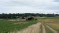
Circular route via Loivre and Berméricourt from Courcy

A pleasant little walk in any season. The first part follows the canal along a tarmac path, and the second part crosses fields along a dirt track which can be muddy in wet weather.

Details

n°29271459
Creation:
Last update:
Last review:
  • Walking
    Activity: Walking
  • ↔
    Distance: 5.32 mi
  • ◔
    Average duration: 2h 30 
  • ▲
    Difficulty: Easy

  • ⚐
    Back to start: Yes
  • ↗
    Ascent: + 95 ft
  • ↘
    Descent: - 95 ft

  • ▲
    Highest point: 351 ft
  • ▼
    Lowest point: 236 ft
  • ⚐ Country: France
  • ⚐ City: Courcy (Marne) (51220)
  • ⚑
    Start/End: N 49.329109° / E 4.011239°
  • Accessible from the train station Gare de Courcy-Brimont.
  • ❏
    IGN map(s): Ref. 2811O
  • Hour-by-hour weather

Description of the walk

Park at the side of the D26 near the bridge over the Aisne–Marne Canal, on the way out of Courcy towards Brimont.

(S/E) With the bridge on your right, follow theGR®654along the canal to the first bridge at the entrance to Loivre.

(1) Turn right, cross the bridge over the canal and follow Rue de Bourgogne towards the railway bridge.

(2) Before this bridge, turn left, still following the sameGR® route, until you reach the Bermericourt railway bridge.

(3) After crossing the bridge, continue along Rue du Général de Gaulle to the first junction.

(4) Leave theGR®, turn right onto Rue du35e Régiment d’Infanterie and continue to the D430.

(5) Cross the D430 and take the path opposite until you reach the D30, then follow it for a few dozen metres.

(6) Join the path on the left across the fields.

(7) On the right is an escape route in case of a hunt (see § Practical information). Carry on straight ahead to the small copse.

(8) Walk round the copse (the former Loivre batteries) to rejoin the path that runs alongside the Bois de la Bove, then cross a field to the D26

(9) At the old glassworks, turn right, cross the bridge and head for the car park (S/E).

Waypoints

  1. S/E : mi 0 - alt. 256 ft - Car park along the - Canal de l'Aisne à la Marne
  2. 1 : mi 1.57 - alt. 243 ft - Bridge at the entrance to Loivre
  3. 2 : mi 1.71 - alt. 236 ft - T-junction before the railway bridge
  4. 3 : mi 2.53 - alt. 295 ft - Bermericourt railway bridge
  5. 4 : mi 2.62 - alt. 285 ft - Rue du 35th Infantry Regiment
  6. 5 : mi 2.82 - alt. 282 ft - D430 road
  7. 6 : mi 3.35 - alt. 289 ft - Junction on the track
  8. 7 : mi 3.69 - alt. 279 ft - Alternative route in the event of a hunt
  9. 8 : mi 4.03 - alt. 341 ft - Former Loivre battery sites (1875–1877)
  10. 9 : mi 5.09 - alt. 302 ft - Former glassworks (1854)
  11. S/E : mi 5.32 - alt. 256 ft - Car park along the canal

Notes

If there are hunting signs at point (8), turn round and head back for about 300 m to point (7) to join a path on the left which will take you back to the path running alongside the railway line. Turn left to return to the old glassworks. Once you reach the D26, turn right to cross the bridge to the car park.

Worth a visit

- In Loivre: the Town Hall at 35 Rue de Verdun and the lock behind it.
- In Bermericourt: the Masclaux craft brewery, 15 Rue du Général De Gaulle.
- Nearby, the former Brimont military fort (1876), located in the Bois de la Bove.

Always be cautious and plan ahead when you're outdoors. Visorando and the author of this route cannot be held responsible for any accidents occurring on this route.

The GR® and PR® markings are the intellectual property of the Fédération Française de Randonnée Pédestre.

Reviews and comments

4.2 / 5
Based on 2 reviews

Reliability of the description
4.5 / 5
Ease of following the route
4 / 5
Route interest
4 / 5
User 20296665

Overall rating : 4 / 5

Date of your route : Sep 09, 2026
Reliability of the description : ★★★★☆ Good
Ease of following the route : ★★★★☆ Good
Route interest : ★★★★☆ Good
Very busy route : No

A lovely walk. The start is a bit long as it’s a tarmac towpath running alongside the canal.
But the rest is a pleasant walk. There are no difficulties.
Walk completed on 9 September 2026

Machine-translated

Dessons Evelyne
Dessons Evelyne

Overall rating : 5 / 5

Date of your route : Jan 02, 2023
Reliability of the description : ★★★★★ Very good
Ease of following the route : Not used / Not applicable
Route interest : Not used / Not applicable
Very busy route : Yes

Hello,
I’ve downloaded the walk but haven’t done it yet; I’m planning to do it when the weather’s nice.
Thank you, and best wishes for the New Year.

Machine-translated

Other walks in the area

For more walks, use our search engine .

The GPS track and description are the property of this route's author. Please do not copy them without permission.