Circular walk along the River Orne from Amayé-sur-Orne

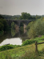
You’ll reach the Orne valley through the woods, overlooking the Val de Maizet, before following the river to the Pont du Coudray to return to your starting point.

Details

61058783
Creation:
Last update:
Last review:
  • Walking
    Activity: Walking
  • ↔
    Distance: 5.14 mi
  • ◔
    Average duration: 2h 30 
  • ▲
    Difficulty: Easy

  • ⚐
    Back to start: Yes
  • ↗
    Ascent: + 190 ft
  • ↘
    Descent: - 190 ft

  • ▲
    Highest point: 249 ft
  • ▼
    Lowest point: 36 ft

Photos

Description of the walk

Park in the car park in front of the town hall.

(S/E) Head slightly to your right onto Rue des Godets, then take Impasse de la Vaillande on your left, following it to the end where it joins a fork in the road.

(1) Turn right onto Chemin de la Vayande. You can see Château des Vaux on your right. Continue until you reach a road.

(2) Turn left onto it to cross the Vayande, and continue along the path until you reach the junction with the Chemin de la Côte de Fierville. Turn left.

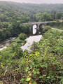
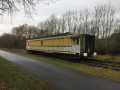
(3) Turn right onto theGR® 36 alternative route known as “Le Chemin du Val”, which leads you to a lovely viewpoint overlooking the bridge of the old “Caen–Laval” railway line, spanning the River Orne at Val de Maizet.

(4) Take the greenway on your right until you reach the banks of the Orne.

(5) Head down the short, steep, stony slope on your left towards the River Orne, at the foot of the second bridge on this walk, before turning left onto the path that takes you back towards Val de Maizet.

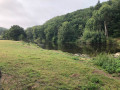
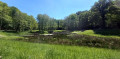
(6) Continue to the right along the road that runs alongside the River Orne; it’s quite pleasant, sheltered by trees. If you’re wearing suitable footwear and don’t mind getting your feet wet, you can, about 300 metres after passing the last house in the Val de Maizet, take the grassy path that runs alongside the River Orne and make your way to the Pont du Coudray.

(7) At the corner by the restaurant “Le Marronnier”, turn left and continue straight on along the Chemin de la Vayande until you reach the junction you passed on the way out.

(1) Turn right and, following the route in reverse, head back to the car park in front of the town hall (S/E).

Waypoints

  1. S/E : mi 0 - alt. 174 ft - Car park in front of the town hall
  2. 1 : mi 0.25 - alt. 177 ft - Crossroads at the end of the circular loop
  3. 2 : mi 0.6 - alt. 207 ft - Junction, turn left
  4. 3 : mi 1.28 - alt. 236 ft - Junction, turn right
  5. 4 : mi 2.01 - alt. 75 ft - Greenway, on the right
  6. 5 : mi 2.22 - alt. 79 ft - Small path marked in yellow, on the left - Orne (fleuve)
  7. 6 : mi 2.61 - alt. 66 ft - Y-junction: turn right towards the - Orne (fleuve)
  8. 7 : mi 4.29 - alt. 43 ft - Pont du Coudray
  9. S/E : mi 5.14 - alt. 174 ft - Car park in front of the town hall

Always be cautious and plan ahead when you're outdoors. Visorando and the author of this route cannot be held responsible for any accidents occurring on this route.

The GR® and PR® markings are the intellectual property of the Fédération Française de Randonnée Pédestre.

Reviews and comments

4.2 / 5
Based on 3 reviews

Reliability of the description
4 / 5
Ease of following the route
4.3 / 5
Route interest
4.3 / 5
User 26761565

Overall rating : 3.3 / 5

Date of your route : Jul 28, 2025
Reliability of the description : ★★★☆☆ Average
Ease of following the route : ★★★☆☆ Average
Route interest : ★★★★☆ Good
Very busy route : No

Nice discovery
However, the route after the viewpoint on the old railway bridge was unclear to us.
Very pleasant walk along the Orne.

Machine-translated

Fairbanks
Fairbanks

Overall rating : 4.7 / 5

Date of your route : May 16, 2025
Reliability of the description : ★★★★★ Very good
Ease of following the route : ★★★★★ Very good
Route interest : ★★★★☆ Good
Very busy route : No

A pleasant walk through the fields and along the River Orne, including a few kilometres of cycle path.

Machine-translated

jeangazon
jeangazon

Overall rating : 5 / 5

Date of your route : Apr 27, 2025
Reliability of the description : Not used / Not applicable
Ease of following the route : ★★★★★ Very good
Route interest : ★★★★★ Very good
Very busy route : Yes

A lovely walk, especially the start, which follows a narrow woodland path that leads onto the greenway and the big bridge.
Then you head down to the river. There are plenty of places to stop and rest.
The last bit is mostly along the road – it’s a shame, but it’s still fine.
I’d definitely recommend it!

Machine-translated

Other walks in the area

For more walks, use our search engine .

The GPS track and description are the property of this route's author. Please do not copy them without permission.