Circular route through the Grimbosq Forest starting from the Pont du Coudray

Set off from the Pont du Coudray for a short circular route through the Grimbosq Forest, starting with a stretch across the plateau.

Details

2771320
Creation:
Last update:
Last review:
  • Walking
    Activity: Walking
  • ↔
    Distance: 9.80 mi
  • ◔
    Average duration: 5h 10 
  • ▲
    Difficulty: Moderate

  • ⚐
    Back to start: Yes
  • ↗
    Ascent: + 797 ft
  • ↘
    Descent: - 787 ft

  • ▲
    Highest point: 423 ft
  • ▼
    Lowest point: 33 ft

Description of the walk

Park in the Pont du Coudray car park in Amayé-sur-Orne.

(S/E) Take the road heading south, running parallel to the River Orne. At the sewage treatment works, turn right onto thePR® path marked in yellow. This path climbs steeply to a crossroads after passing the path leading to the isolated house at La Campagne.

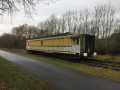
(1) Turn left to begin a descent, heading towards the car park for the rail bike track (greenway).

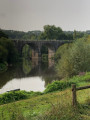
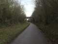
(2) Turn right onto the greenway and cross the viaduct.

(3) Continue for about fifty metres along the greenway, then turn left into the forest and climb the stone-paved slope to the Chapelle Sainte-Anne. At the top, take the small path on the left to join the Route Forestière de Sainte-Anne.

(4) Turn left onto it at a bend, running alongside the forest, and carry on straight ahead.

(5) Turn left, follow the Ruisseau de la Petite Vallée along its right bank and reach the path junction at the Ruisseau de la Grande Vallée.
Cross over and start a short climb on the opposite side to reach the Route du Chêne Guillot. Take this road to the right; this straight road leads to a car park and a picnic area.

(6) Head slightly downhill to the right and, at the edge of the Ruisseau de la Grande Vallée, join theGR®36(marked in white and red). Turn left onto it and follow the right bank of the stream until you reach a small lake.

(7) Walk round the lake and head uphill to the right alongside the wildlife park.

(8) Turn left, pass a car park on your right, then turn left again at the next junction to reach the Carrefour des Granges.

(9) Take the path on the right, then veer left a little further on to pass close to the Arboretum and continue straight on (north-west) to reach the Ruisseau de Coupe-Gorge.

(10) Follow the stream along its left bank, cross a small road and continue straight ahead. Further on, veer left to move away from the stream and reach the feudal ruins.

(11) Cross the Ruisseau de la Grande Vallée and stay on the path that runs alongside it until it joins the Orne.

(12) Carry on to the left to stay on the right bank. You’ll soon rejoin the greenway at the viaduct.

(3) Turn right, cross the viaduct and retrace your steps along the route you took on the way there to return to the Pont du Coudray car park (S/E).

Waypoints

  1. S/E : mi 0 - alt. 39 ft - Pont du Coudray car park - Orne (fleuve)
  2. 1 : mi 1.07 - alt. 233 ft - Crossroads after La Campagne
  3. 2 : mi 1.81 - alt. 79 ft - Rail Cycle Path
  4. 3 : mi 2.07 - alt. 43 ft - Junction marking the end of the circular loop
  5. 4 : mi 2.9 - alt. 240 ft - Sainte-Anne RF junction
  6. 5 : mi 3.39 - alt. 243 ft - Turn left at the fork
  7. 6 : mi 3.91 - alt. 233 ft - Chêne Guillot car park
  8. 7 : mi 4.85 - alt. 322 ft - Pond and wildlife park
  9. 8 : mi 5.21 - alt. 423 ft - Crossroads; turn left
  10. 9 : mi 5.7 - alt. 390 ft - Carrefour des Granges
  11. 10 : mi 6.39 - alt. 256 ft - Coupe-Gorge stream
  12. 11 : mi 7.03 - alt. 210 ft - Feudal motte
  13. 12 : mi 7.54 - alt. 43 ft - Banks of the Orne
  14. S/E : mi 9.8 - alt. 39 ft - Pont du Coudray car park

Worth a visit

(11) A cultural highlight: the feudal motte – do take the opportunity to visit it.

Always be cautious and plan ahead when you're outdoors. Visorando and the author of this route cannot be held responsible for any accidents occurring on this route.

The GR® and PR® markings are the intellectual property of the Fédération Française de Randonnée Pédestre.

Reviews and comments

3.7 / 5
Based on 5 reviews

Reliability of the description
3 / 5
Ease of following the route
3.6 / 5
Route interest
4.6 / 5
User 3301096

Overall rating : 4.3 / 5

Date of your route : Jun 14, 2026
Reliability of the description : ★★★★☆ Good
Ease of following the route : ★★★★☆ Good
Route interest : ★★★★★ Very good
Very busy route : No

A lovely route. Easy to follow using the GPS track; it might not be quite so straightforward just using the description, as there are so many junctions in the Grimbosc Forest.

Machine-translated

musenger
musenger

Overall rating : 3.7 / 5

Date of your route : Oct 20, 2025
Reliability of the description : ★★★☆☆ Average
Ease of following the route : ★★★☆☆ Average
Route interest : ★★★★★ Very good
Very busy route : No

Beautiful hike, but very limited signage, caution advised

Machine-translated

Dgedge
Dgedge

Overall rating : 3.3 / 5

Date of your route : Aug 13, 2023
Reliability of the description : ★★★☆☆ Average
Ease of following the route : ★★★☆☆ Average
Route interest : ★★★★☆ Good
Very busy route : No

The written instructions are a bit vague. You’ll need to use the app to check the route regularly

Machine-translated

francois-beatrice
francois-beatrice

Overall rating : 3.3 / 5

Date of your route : Apr 27, 2022
Reliability of the description : ★★★☆☆ Average
Ease of following the route : ★★★☆☆ Average
Route interest : ★★★★☆ Good
Very busy route : No

The signposts are not always clear.
There are no signposts or landmarks in Grimbosq Forest.
It’s a shame, as the route is lovely, but it’s difficult to find your way around.

Machine-translated

Marie Segura
Marie Segura

Overall rating : 4 / 5

Date of your route : Aug 22, 2020
Reliability of the description : ★★☆☆☆ Disappointing
Ease of following the route : ★★★★★ Very good
Route interest : ★★★★★ Very good
Very busy route : No

Highlights:
- Grimboscq Forest is definitely worth a look!
- The French Hiking Federation’s guidebook on Calvados doesn’t feature anything in this area, so this walk fills a significant gap.

Weakness: we didn’t find the signposting clear enough. For example,
- the names of roads or points of interest are sometimes used in the description (“the path leading to the isolated house at La Campagne”, “join the Sainte Anne forest road”, “follow the Ruisseau de la Petite Vallée”, etc.), yet they are not indicated by a sign along the route. How, then, are you supposed to find your way?
- the directions seem rather vague for novice walkers like us: for example, between points 1 and 2, we had to make decisions ‘on a whim’ to reach the greenway car park, as the minor roads were not mentioned in the description.
- In the forest, there are plenty of trail markers: these could be used to make the directions clearer. For example, between points 3 and 4, we climbed the ‘stone slope’ (on a mountain bike track, so we weren’t entirely sure of ourselves), but when we reached the ‘top’, we found ourselves not at a ‘small path on the left’, but at a junction with three possible routes. It seemed to us that the signposts could have helped us find our way.

We ended up following the directions on the signs in the Grimboscq Forest. If we go back, we’ll try to suggest some changes to make the directions clearer for hikers who aren’t as resourceful as we are.

Machine-translated

Other walks in the area

For more walks, use our search engine .

The GPS track and description are the property of this route's author. Please do not copy them without permission.