


Circular walk between Stave, Biesmerée and Ermeton-sur-Biert


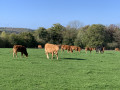
Alternating between country lanes, RAVeL cycle paths, narrow village streets and woodland trails, this walk takes you on a journey of discovery through the south-east of the municipality of Mettet, focusing in particular on the lower part of the village of Ermeton-sur-Biert, its Benedictine monastery and the more recent AquaLodge complex. It is situated at the northern end of a splendid string of ponds where egrets, ducks, cormorants, herons, geese and swans are sure to make an appearance in every season. And with a bit of luck, the odd roe deer might even emerge from the woods to graze in the middle of a field!
Details
–
-
 Activity: Walking
-
 Distance: 8.94 mi
-
 Average duration: 4h 35
-
 Difficulty: Moderate
-
-
 Back to start: Yes
-
 Ascent: + 528 ft
-
 Descent: - 528 ft
-
-
 Highest point: 889 ft
-
 Lowest point: 643 ft
 Country:

 City:


Photos
Waypoints
- S/E : mi 0 - alt. 860 ft - Stave football pitch
- 1 : mi 0.28 - alt. 889 ft - Very steep descent towards the RAVeL L136A
- 2 : mi 0.97 - alt. 807 ft - A gentle descent along the RAVeL
- 3 : mi 2.04 - alt. 725 ft - Biesmerée football pitch
- 4 : mi 2.31 - alt. 774 ft - RAVeL L136A clap 2 - Au Grenier de la Floye (gîtes à la ferme)
- 5 : mi 3.01 - alt. 751 ft - Forest trail
- 6 : mi 3.19 - alt. 764 ft - RAVeL L150
- 7 : mi 3.26 - alt. 735 ft - A steep climb
- 8 : mi 4 - alt. 889 ft - Potale Saint-Joseph
- 9 : mi 4.53 - alt. 679 ft - Passing under the RAVeL L150
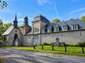
- 10 : mi 4.64 - alt. 653 ft - Ermeton-sur-Biert Monastery
- 11 : mi 4.87 - alt. 679 ft - Plant-covered church
- 12 : mi 5.19 - alt. 686 ft - Aqua Lodge
- 13 : mi 6.46 - alt. 856 ft - Fork in the road
- 14 : mi 7.12 - alt. 883 ft - Bois Maguinette
- 15 : mi 7.86 - alt. 817 ft - Stavesoule Farm
- 16 : mi 8.63 - alt. 863 ft - Cornelle
- S/E : mi 8.94 - alt. 860 ft - Stave football pitch
Other walks in the area
The “Heures Saines” walk in Stave
 Visorando Member4.45 mi
+210 ft
-236 ft
2h 15
 Easy
 Departure from Mettet (Province de Namur)
Upstream from the Molignée from Biesmerée
 10.78 mi
+866 ft
-866 ft
5h 45
Moderate
Departure from Mettet (Province de Namur)
Le Richa via the old Namur road
4.25 mi
+121 ft
-121 ft
2h 05
Easy
Departure from Florennes (Province de Namur)
A tour on the Tournibus
 9.25 mi
+463 ft
-472 ft
4h 40
Moderate
Departure from Mettet (Province de Namur)
In the countryside and the Tournibus Forest
 9.92 mi
+600 ft
-571 ft
5h 05
Moderate
Departure from Mettet (Province de Namur)
Circular route in the Morialmé and Saint-Aubin forest
 11.81 mi
+666 ft
-696 ft
6h 00
Moderate
Departure from Florennes (Province de Namur)
Around Florennes Air Base
 14.18 mi
+594 ft
-604 ft
7h 00
 Difficult
Departure from Florennes (Province de Namur)
Loop through the woods and countryside north of Biesme (part of Mettet)
 7.04 mi
+469 ft
-440 ft
3h 40
Moderate
Departure from Mettet (Province de Namur)
For more walks, use our search engine .
The GPS track and description are the property of this route's author. Please do not copy them without permission.

