Circular walk between Saint-Marcel and Monthieux

A short, family-friendly walk on tarmac between Saint-Marcel and Monthieux, particularly recommended on wet days.

Details

47493703
Creation:
Last update:
Last review:
  • Walking
    Activity: Walking
  • ↔
    Distance: 4.80 mi
  • ◔
    Average duration: 2h 15 
  • ▲
    Difficulty: Easy

  • ⚐
    Back to start: Yes
  • ↗
    Ascent: + 33 ft
  • ↘
    Descent: - 30 ft

  • ▲
    Highest point: 968 ft
  • ▼
    Lowest point: 928 ft
  • ⚐ Country: France
  • ⚐ City: Ain (01)
  • ⚑
    Start/End: N 45.948686° / E 4.986278°
  • ❏
    IGN map(s): Ref. 3030SB
  • Hour-by-hour weather

Description of the walk

Park in the square by the church at Saint-Marcel.

(S/E) Cross the D1083 at the traffic lights, then take the Route de Monthieux opposite, which forms part of theGRP® from Beaujolais to Bugey via the Dombes, signposted in yellow and red. You’ll reach the railway line at Saint-Marcel station.

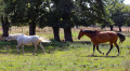
(1) Cross the railway tracks at the level crossing, continue on and pass through the hamlet of Brochassin. You will then reach the Live equestrian centre.

(2) Keep theGRP® ahead of you until you reach a four-way junction.

(3) Leave theGRP® here and take the path on the right. Please note that in wet weather, this section can be rather muddy. You’ll rejoin Rue du Marécage after crossing the small stream known as the Brévonne. You’ll reach the four-way junction in the hamlet of Les Brévonnes.

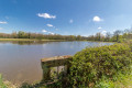
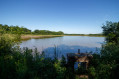
(4) Turn right onto Rue des Brévonnes and you’ll soon reach Étang Magneux.

(5) Walk alongside it, cross Le Plantet and continue along the road, ignoring any turnings to the right or left, until you reach the railway line again.

(6) Cross the railway at the level crossing, turn right onto the street and pass La Genetière. Continue along Rue des Noisetiers. After the houses in Gravelotte, turn right onto Rue des Dombes and continue along Rue Royale. Very soon, take a path on the right, join Rue des Tilleuls and follow it straight on. Then turn left onto Allée des Charmilles to return to the church car park (S/E).

Waypoints

  1. S/E : mi 0 - alt. 958 ft - Church car park - Église Saint-Marcel (Saint-Marcel)
  2. 1 : mi 0.44 - alt. 942 ft - Saint-Marcel-en-Dombes railway station
  3. 2 : mi 1.29 - alt. 935 ft - La Live Equestrian Centre
  4. 3 : mi 1.74 - alt. 948 ft - At the junction, turn off the GRP°°®°° path to the right
  5. 4 : mi 2.27 - alt. 955 ft - Les Brévonnes
  6. 5 : mi 2.62 - alt. 932 ft - Étang Magneux
  7. 6 : mi 4.05 - alt. 932 ft - Level crossing
  8. S/E : mi 4.8 - alt. 961 ft - Church car park - Église Saint-Marcel (Saint-Marcel)

Notes

95 per cent tarmac.
There are a few parking spaces near Saint-Marcel Church and in the surrounding area.
Take care when crossing the main road and the two level crossings, but everything is well secured.
Please respect the birds’ peace and quiet and take your rubbish home with you.

Worth a visit

(S/E) Saint-Marcel
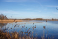
Beautiful views over the Étang Magneux and numerous spots from which you can make out the Alps in the distance on a clear day
The Dombes lakes

Reviews and comments

4.5 / 5
Based on 2 reviews

Reliability of the description
5 / 5
Ease of following the route
5 / 5
Route interest
3.5 / 5
Jobb
Jobb

Overall rating : 4.7 / 5

Date of your route : Feb 17, 2025
Reliability of the description : ★★★★★ Very good
Ease of following the route : ★★★★★ Very good
Route interest : ★★★★☆ Good
Very busy route : No

A lovely walk for a winter’s afternoon through the sunny, cultivated countryside.
Admittedly, you’ll mainly be walking along small roads, but they’re very quiet.

Machine-translated

TotoB
TotoB

Overall rating : 4.3 / 5

Date of your route : May 08, 2024
Reliability of the description : ★★★★★ Very good
Ease of following the route : ★★★★★ Very good
Route interest : ★★★☆☆ Average
Very busy route : No

A relaxing walk in the Dombes. Nothing much to see, but lovely scenery. As it’s very short, we extended it by turning left at point 3 (instead of turning right...) to reach the centre of Monthieux, passing through La Croix and Le Couet before reaching point 4: approximately 12.5 km with a total elevation gain of around 50 metres.

Machine-translated

Other walks in the area

For more walks, use our search engine .

The GPS track and description are the property of this route's author. Please do not copy them without permission.