Circular route between the Plate Pierre pond and the sea

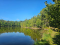
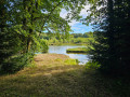
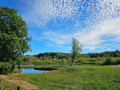
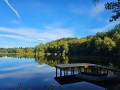
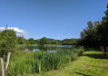
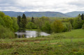
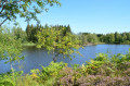
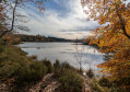
Explore the Plateau des 1000 Étangs on an easy route with very little elevation gain (though do save some energy for the only climb on the route, which comes towards the end of the walk). There are numerous ponds along this route, which passes through the small village of La Mer.

Details

107732786
Creation:
Last update:
Last review:
  • Walking
    Activity: Walking
  • ↔
    Distance: 5.92 mi
  • ◔
    Average duration: 3h 35 
  • ▲
    Difficulty: Moderate

  • ⚐
    Back to start: Yes
  • ↗
    Ascent: + 1,001 ft
  • ↘
    Descent: - 997 ft

  • ▲
    Highest point: 1,690 ft
  • ▼
    Lowest point: 1,388 ft

Photos

Description of the walk

Park along the road near the Étang de Plate Pierre.

(S/E) Take the forest track which descends almost directly opposite the car park.

(1) Follow the track to the left and continue to the pond.

(2) Turn right onto the pond’s embankment.

(3) At the junction, take the track on the right until you reach the next Fork in the road.

(4) Turn left.

(5) Turn left onto the tarmac road and pass through the small village of La Mer.

(6) On leaving the village, take the track on the left and follow it to La Marceline. At La Marceline, turn right and then rejoin the road.

(7) Turn right, then take the first left.

(8) When you reach the tarmac road, turn left uphill. Keep left again after the bend.

(9) At the top of the climb, take the forest track on the right. Follow it straight ahead to go round the Étang de Plate Pierre.

(10) When you reach the tarmac road, turn left to return to the car park (S/E).

Waypoints

  1. S/E : mi 0 - alt. 1,686 ft - Car park - Étang de Plate Pierre
  2. 1 : mi 0.55 - alt. 1,617 ft - Forest track
  3. 2 : mi 1.13 - alt. 1,512 ft - Dike, pond
  4. 3 : mi 1.44 - alt. 1,529 ft - Forest track - Étang Mama (Annegray)
  5. 4 : mi 1.74 - alt. 1,519 ft - Fork in the road - Étang des Grands Prés (Annegray)
  6. 5 : mi 2.47 - alt. 1,522 ft - The Sea
  7. 6 : mi 2.6 - alt. 1,535 ft - Forest track
  8. 7 : mi 3.76 - alt. 1,555 ft - La Marceline
  9. 8 : mi 4.61 - alt. 1,391 ft - Route
  10. 9 : mi 4.91 - alt. 1,552 ft - Top of the climb
  11. 10 : mi 5.66 - alt. 1,545 ft - Route
  12. S/E : mi 5.92 - alt. 1,690 ft - Plate Pierre car park

Worth a visit

Various ponds

Other walks in the area

For more walks, use our search engine .

The GPS track and description are the property of this route's author. Please do not copy them without permission.