Circular walk between Flavignac and Texon

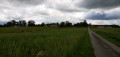
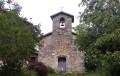
A walk for days when the paths are muddy, as it follows only tarmac roads. Two beautiful churches, in the village of Flavignac and the hamlet of Texon, mark this circular route through the Limousin countryside.

Details

n°52453543
Creation:
Last update:
Last review:
  • Walking
    Activity: Walking
  • ↔
    Distance: 6.92 mi
  • ◔
    Average duration: 3h 30 
  • ▲
    Difficulty: Moderate

  • ⚐
    Back to start: Yes
  • ↗
    Ascent: + 404 ft
  • ↘
    Descent: - 397 ft

  • ▲
    Highest point: 1,234 ft
  • ▼
    Lowest point: 909 ft
  • ⚐ Country: France
  • ⚐ City: Flavignac (87230)
  • ⚑
    Start/End: N 45.704116° / E 1.092715°
  • ❏
    IGN map(s): Ref. 1931E, 1932E, 2032O
  • Hour-by-hour weather

Photos

Description of the walk

The walk starts at Place du Général de Gaulle, on the edge of which is the Flavignac post office. There is a large central car park.

There are a few signposts, spaced out and in various colours; however, as the route is straightforward, there is no need to mention them in the description.

(S/E) With your back to the post office, head east, pass a restaurant on your right and go down a flight of steps. Then turn right into a street and walk past the base of Flavignac church. Follow the D59 for about fifty metres towards Nexon.

(1) Then turn left onto the D46 towards Lavignac. Pass two streets on the left and go past the sign marking the exit from Flavignac. Ignore a further two turn-offs on the left and enter the hamlet of Le Païssex.

(2) At the junction by No. 9, turn left onto a small road closed to vehicles over 5.5 tonnes. Carry straight on.

(3) At the ‘give way’ sign, cross the D20 with care and follow it to the right for about twenty metres. Then turn left onto the C202 towards Texon Church.

(4) At the next junction, note the hamlet of La Bastide on your right and carry on straight ahead. Ignore the turn-off on the left for the hamlet of Puy Hoby and head downhill.

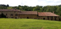
(5) At the end of the road, turn left onto the C240 towards Texon. Continue downhill, turn left then right (there’s a beautiful old farmhouse on the right) and you’ll come to a crossroads.

(6) Carry on straight ahead, cross the Arthonnet and head uphill on the other side. After about 150 m, you’ll find the little church of Texon on the right, nestled between two houses.

(7) Retrace your steps back to the previous crossroads.

(6) Then turn right. Head uphill and pass the hamlet of Bas Texon (a lovely house).

(8) At the T-junction, follow the D59a to the left and continue steadily uphill. At the hamlet of Laborde, ignore a turn-off to the left.

(9) At the next junction, turn right towards the Moulin des Grolles. Head downhill, cross a small stream and head back uphill.

(10) At the T-junction, turn left and continue uphill. Pass between a farm on your right and the Château de Faye on your left.

(11) At the T-junction, first turn right then left.

(12) At the junction shortly afterwards, turn right towards Lambaudie.

(13) At the next junction, turn left and pass between two houses.

(14) At the crossroads (water tower, wayside shrine, stone cross), veer slightly to the left.

(15) At the Stop sign, cross the D20 again and continue straight ahead along Rue Victor Hugo. At the next Stop sign (town hall on the left), turn right and you’ll soon reach the car park where you started (S/E).

Waypoints

  1. S/E : mi 0 - alt. 1,165 ft - Place du Général de Gaulle
  2. 1 : mi 0.14 - alt. 1,145 ft - Rue Michelet - Église de l'Assomption de la Très Sainte-Vierge (Flavignac)
  3. 2 : mi 0.77 - alt. 1,168 ft - Intersection – Le Païssex
  4. 3 : mi 1.14 - alt. 1,165 ft - Crossing the D20
  5. 4 : mi 1.71 - alt. 1,115 ft - Crossroads – La Bastide
  6. 5 : mi 2.65 - alt. 981 ft - T-junction
  7. 6 : mi 3.02 - alt. 919 ft - Carrefour – Texon
  8. 7 : mi 3.15 - alt. 948 ft - Église Saint-Pierre-ès-Liens (Texon)
  9. 8 : mi 4.04 - alt. 942 ft - T-junction
  10. 9 : mi 4.53 - alt. 1,066 ft - Junction
  11. 10 : mi 4.8 - alt. 1,066 ft - T-junction
  12. 11 : mi 5.41 - alt. 1,178 ft - T-junction - Château de Faye
  13. 12 : mi 5.55 - alt. 1,194 ft - Junction
  14. 13 : mi 6.01 - alt. 1,207 ft - Junction
  15. 14 : mi 6.42 - alt. 1,234 ft - Crossroads – Oratory
  16. 15 : mi 6.62 - alt. 1,214 ft - Crossing the D20
  17. S/E : mi 6.92 - alt. 1,165 ft - Place du Général de Gaulle

Notes

Good walking shoes are recommended for this walk.

No water sources identified along the route.

A detailed map is useful (at the very least, the one accompanying this description).

Warning:
Hikers should be aware that this walk takes place exclusively on tarmac roads. With a few exceptions, these roads have little or very little traffic.

Hike completed by the author on 1 June 2024.

Worth a visit

- Flavignac Church (15th–16th centuries), between (S/E) and (1).
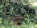
- A beautiful old farmhouse in Texon, just before (6).
- Texon Church (15th century) (7).
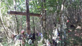
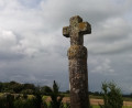
- Oratory and stone cross in (14).

Reviews and comments

4.7 / 5
Based on 1 review

Reliability of the description
5 / 5
Ease of following the route
5 / 5
Route interest
4 / 5
User 18036399
• Edited:

Overall rating : 4.7 / 5

Date of your route : Nov 13, 2025
Reliability of the description : ★★★★★ Very good
Ease of following the route : ★★★★★ Very good
Route interest : ★★★★☆ Good
Very busy route : No

A beautiful and enjoyable hike.

Machine-translated

Other walks in the area

For more walks, use our search engine .

The GPS track and description are the property of this route's author. Please do not copy them without permission.