Route de la Haute-Vallée de l’Isle at La Meyze

The Respir association has signposted a charming walking trail in La Meyze: the Haute Vallée de l’Isle route. It is this route that I invite you to discover.

Details

4144762
Creation:
Last update:
Last review:
  • Walking
    Activity: Walking
  • ↔
    Distance: 4.05 mi
  • ◔
    Average duration: 2h 00 
  • ▲
    Difficulty: Easy

  • ⚐
    Back to start: Yes
  • ↗
    Ascent: + 180 ft
  • ↘
    Descent: - 210 ft

  • ▲
    Highest point: 1,237 ft
  • ▼
    Lowest point: 1,083 ft
  • ⚐ Country: France
  • ⚐ City: La Meyze (87800)
  • ⚑
    Start/End: N 45.615108° / E 1.214169°
  • ❏
    IGN map(s): Ref. 2032O
  • Hour-by-hour weather

Description of the walk

Park near the town hall in La Meize.

(S/E) Take the D17 towards Nexon, passing the war memorial. Cross the railway bridge, then turn immediately left towards Puyrassou.

(1) At the three-way junction, keep slightly to the right, cross the Ruisseau des Planches which flows into the Isle. Then turn left towards Pluviers.

(2) Take the dirt track on the left, cross the stream again and continue to the level crossing.

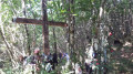
(3) Cross the railway line and turn right towards the Chapelle du Rocher.

(4) Once at the chapel, carry on along the railway line as far as La Jaunie.

(5) Turn left. Cross the Isle, then take the first path on the left, which leads to a crossroads at the edge of a wood.

(6) Keep to the right and, when you reach the road, turn left towards Busserolles.

(7) In Busserolles, turn left onto the D17 and follow it carefully. Stay on the road, passing the cemetery, the vicarage and the church, until you reach the town hall (S/E).

Waypoints

  1. S/E : mi 0 - alt. 1,194 ft - La Meyze Town Hall
  2. 1 : mi 0.38 - alt. 1,211 ft - Road junction, go straight on
  3. 2 : mi 1.02 - alt. 1,178 ft - Dirt track on the left
  4. 3 : mi 1.54 - alt. 1,168 ft - Railway track
  5. 4 : mi 1.95 - alt. 1,109 ft - The Chapel of Le Rocher
  6. 5 : mi 2.33 - alt. 1,099 ft - La Jaunie. Cross the - Isle (rivière)
  7. 6 : mi 3.03 - alt. 1,135 ft - End of shortcut
  8. 7 : mi 3.56 - alt. 1,184 ft - Busserolles
  9. S/E : mi 4.05 - alt. 1,194 ft - La Meyze Town Hall

Notes

Alternative route: at (3), go straight on and join the long route at (6).

Reviews and comments

3.9 / 5
Based on 3 reviews

Reliability of the description
4.7 / 5
Ease of following the route
5 / 5
Route interest
2 / 5
Alpha Philippe
Alpha Philippe

Overall rating : 3.7 / 5

Date of your route : Oct 30, 2023
Reliability of the description : ★★★★☆ Good
Ease of following the route : ★★★★★ Very good
Route interest : ★★☆☆☆ Disappointing
Very busy route : No

An easy route with plenty of tarmac and not much to see

Machine-translated

michel87
michel87

Overall rating : 4 / 5

Date of your route : Feb 12, 2023
Reliability of the description : ★★★★★ Very good
Ease of following the route : ★★★★★ Very good
Route interest : ★★☆☆☆ Disappointing
Very busy route : No

There’s far too much driving on this route, even though the roads aren’t very busy.
Long, somewhat monotonous straights!
Lovely views across the clear horizon, but not much else of interest apart from the Chapelle du Rocher.

Machine-translated

dusvia
dusvia

Overall rating : 4 / 5

Date of your route : Jul 26, 2021
Reliability of the description : ★★★★★ Very good
Ease of following the route : ★★★★★ Very good
Route interest : ★★☆☆☆ Disappointing
Very busy route : No

Far too long a walk to be enjoyable. Best done only after a long spell of rain – that way, you won’t end up with muddy feet...

Machine-translated

Other walks in the area

For more walks, use our search engine .

The GPS track and description are the property of this route's author. Please do not copy them without permission.