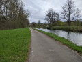
Circular walk between Cravant and Cheuilly

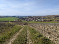
A walk in the great outdoors! Ideal for lovers of the great outdoors.
Presents no major difficulties.

Details

45131928
Creation:
Last update:
Last review:
  • Walking
    Activity: Walking
  • ↔
    Distance: 9.09 mi
  • ◔
    Average duration: 4h 35 
  • ▲
    Difficulty: Moderate

  • ⚐
    Back to start: Yes
  • ↗
    Ascent: + 443 ft
  • ↘
    Descent: - 433 ft

  • ▲
    Highest point: 830 ft
  • ▼
    Lowest point: 404 ft

Photos

Description of the walk

Start from the car park at Cravant cemetery.

(S/E) Head east and follow the D130 towards Cheuilly.

(1) Just past the buildings of La Baraque farm, take a path on the left for about a hundred metres.

(2) Then turn right towards a hunting lodge. Continue along this small track.

(3) Join the D139, follow it to the right for about fifty metres and take the first path on the left. Head uphill and enter the forest.

(4) At a fork in the road, take the path on the left. Carry on straight ahead (north-east) and ignore all paths to the left and right until you reach the end of the path.

(5) Turn right onto the D2 and follow it to the left. Stay on the road until you reach a junction. There, join theGRP® trail marked in yellow and red and follow it to a multi-way junction.

(6) Take theGRP® path which branches off diagonally to the left (north-west). Cross through a woodland. At the next junction (elevation 233), go straight on.

(7) At the next junction, at the edge of a copse, leave theGRP® path. Turn left, keep heading south-west and, at the various junctions, go straight on.

(8) At the entrance to a woodland, ignore the path on the left and continue along the edge of the woodland. Further on (marker 218), enter the woodland. The path descends more and more noticeably and you’ll emerge from the woodland. Ignore a path coming from the right and turn left onto the main path. Pass a sewage treatment plant and you’ll come to a junction you took on the way out.

(2) Then turn right, in the opposite direction to the outward journey, and pass La Baraque farm again.

(1) Return to the D139 and follow it to the right, in the opposite direction to your outward journey, to return to the cemetery (S/E).

Waypoints

  1. S/E : mi 0 - alt. 404 ft - Cemetery
  2. 1 : mi 0.27 - alt. 423 ft - La Baraque
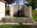
  3. 2 : mi 0.36 - alt. 413 ft - Junction of the circular loop - Fontaine d'Arbault (Cravant)
  4. 3 : mi 0.91 - alt. 443 ft - D139 road
  5. 4 : mi 1.47 - alt. 669 ft - Fork in the road
  6. 5 : mi 3.57 - alt. 791 ft - T-junction
  7. 6 : mi 4.42 - alt. 755 ft - Multi-way junction
  8. 7 : mi 6.07 - alt. 827 ft - Junction. Edge of the forest
  9. 8 : mi 7.48 - alt. 758 ft - Junction
  10. S/E : mi 9.09 - alt. 404 ft - Cemetery

Worth a visit

Heritage in Cravant: town gate, church, keep, belfry.

Reviews and comments

4.5 / 5
Based on 2 reviews

Reliability of the description
4.5 / 5
Ease of following the route
4.5 / 5
Route interest
4.5 / 5
Daniel Ceschin
Daniel Ceschin

Overall rating : 4 / 5

Date of your route : Aug 20, 2024
Reliability of the description : ★★★★☆ Good
Ease of following the route : ★★★★☆ Good
Route interest : ★★★★☆ Good
Very busy route : No

A very lovely route, but hardly ever used.
It’s easy to do, in pleasant surroundings.

Machine-translated

Jacques HOPPMANN
Jacques HOPPMANN

Overall rating : 5 / 5

Date of your route : Mar 11, 2024
Reliability of the description : ★★★★★ Very good
Ease of following the route : ★★★★★ Very good
Route interest : ★★★★★ Very good
Very busy route : No

At the top of the “Côte des loups” (I didn’t spot a single wolf), you reach the “Plantes” area, where, in wet weather, tracks are better than even the best crampons. Farm tractors churn up the route as if it were a training ground, which can make the going tricky for the uninitiated.
I’ve done this walk both ways, starting from Cravant 15 days apart and in the rain, to enjoy some wonderful encounters with the local wildlife (which was rather skittish). I’d happily do it again in the sunshine.
The only slight downside is the detour around ‘La Rémone’ via the D2, where the 800 metres of tarmac break up this truly beautiful sensory walk, which I’d recommend to everyone.

Machine-translated

Other walks in the area

For more walks, use our search engine .

The GPS track and description are the property of this route's author. Please do not copy them without permission.