


 Country:
 City:
City:


Start from Burncross in South Yorkshire after parking near the Crown & Cushion restaurant.
(S/E) Head south and walk down Chapel Road.
(1) After 200 m, turn right onto the footpath next to the houses and, once you reach the meadow, turn left (towards the rubbish bin) and cross Foxfield Spring Wood. Go through the fence and continue along the footpath across the pasture (watch out for cows)
(2) Cross Elliot Lane and head straight ahead, veering slightly to the right onto the path behind the gate. Join the A61.
(3) After carefully crossing the road, head towards Woodseats. Join the Sheffield Country Walk (SCW).
(4) Take the shortcut to the left and continue straight on to rejoin the SCW.
(5) Continue along this path until you reach Woodhead Road.
(6) Pass the car park on your left and take the track straight ahead, then follow it to the right at the next junction
(7) Turn right and carry on until you cross the Sough Dike.
(8) Continue along the narrow path through the moorland.
(9) Take the main path heading south-west.
(10) Here you can either take a shortcut to the right across the moor (as shown on the map) or carry on straight ahead to Hobb Stones.
(11) Go through the gate and join the small road.
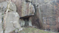
(12) Turn left to reach Dragon’s Den.
(13) Retrace your steps.
(12) Follow the road to the left again.
(14) At Wharncliffe Chase, turn right and carry on straight ahead, ignoring the side paths. Join Woodhead Road.
(15) Follow the road to the right.
(16) Turn left opposite the houses and head down into the woods to Harrison Spring.
(17) Turn left to join the A61. Cross it carefully and, on the other side, follow the path leading to Hall Wood Road.
(18) Turn right onto it and follow it back to the starting point (S/E).
 Visorando Member
 Very difficult
  Difficult
