Circular walk around Pic Saint-Guiral and Lac des Pises, starting from Alzon

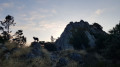
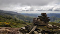
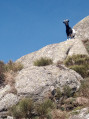
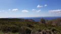
A very long, variedcircular route through pine and beech woods, offering shade and water, perfect for exploring the Cévennes. An original route starting from the Oratory of Saint-Guiralhet, featuring lovely panoramic views, which then leads to Pic Saint-Guiral at Lac des Pises.

Details

n°9310689
Creation:
Last update:
Last review:
  • Walking
    Activity: Walking
  • ↔
    Distance: 19.37 mi
  • ◔
    Duration according to the author: 8 hrs 
  • ▲
    Difficulty: Very difficult

  • ⚐
    Back to start: Yes
  • ↗
    Ascent: + 3,763 ft
  • ↘
    Descent: - 3,757 ft

  • ▲
    Highest point: 4,475 ft
  • ▼
    Lowest point: 2,034 ft

Photos

Description of the walk

Park to the left of the Oratory of Saint-Guiralhet, north of the village of Alzon.

(S/E) Take theGR®71A, marked in red and white, and walk along the ridge. Reach the Font de Truc crossroads, where you’ll rejoin theGR®71.

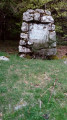
(1) Turn right here and continue until you reach a crossroads marked by a menhir.

(2) Leave the forest track here to stay on theGR® and head for the junction – where there is also a menhir – at the Pic de Saint-Guiral.

(3) Turn right and follow a short out-and-back path to reach the peak. Then rejoin theGR® on the right, pass to the left of the peak and head down onto the forest road.

(4) Opposite, take theGR® which runs alongside the 3 Quilles nature reserve.

(5) Leave the forest road and take the path on the right, under the pine trees, which leads to the Col de l’Homme Mort. Go round the fallen trees.

(6) Here, rejoin theGR® and follow it uphill through the pine trees between the road and the wide path leading off opposite. At the top of the climb, you’ll reach the Col des Pises.

(7) Leave the forest track and continue along theGR® as it heads across the grassy area and descends into the beech forest. Walk past the observatory and reach the shore of Lac des Pises.

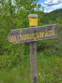
(8) Turn right onto theGR® shared by routes 66 and 71, crossing the wooden bridge. Leave theGR® by turning right uphill before the dam. Pass the Baraque de Pialot. Join theGR® again and follow it to the right. Turn right uphill again at a Y-junction. Reach the Col des Portes.

(9) Continue along the forest track, taking the path up the hillside to the right at a Y-junction. Then leave the track, heading left and crossing a small grassy area. Turn right onto the path hidden by broom. Follow the cairns until you reach the riverbed.

(10) Turn left as you head downhill. Keep the river on your right. Follow the yellow markings on the trees. Reach a junction by the riverbank.

(11) Turn right to cross the river. You’ll reach an old, wide path on the hillside which gradually becomes overgrown with broom in the middle. Make a wide circular loop along the hillside to the right; the path widens again as it climbs northwards. You’ll arrive at a sheepfold.

(12) Continue due west to reach the Ruisseau du Garel in the forest. Cross it, then head south-west to reach the junction with a forest track.

(13) Turn left onto this track and head downhill to reach a shelter and the River Vis.

(14) Cross the river and continue along the track on the left; after a few bends, you’ll reach the Col des Tempêtes.

(15) Continue downhill along the track on the right, passing a shelter. Then cross the hamlet of La Fabrié to reach a hairpin bend.

(16) Turn right onto a grassy path. Pass through a gate. Continue along the grassy path on the hillside. You’ll reach another junction at a hairpin bend.

(17) Turn right onto the path that climbs up the ridge. Keep left at the next junction. Cross a stream a little further on, where the track becomes somewhat overgrown. Climb up the opposite slope, still following the contour line, to rejoin the path. Continue before descending along the ridge towards the Vis valley until you reach a road.

(18) Turn right onto the road to Villaret, pass Mas Delmas and then Mas Delfe to return to the car park at the Oratory of Saint-Guiralhet (S/E).

Waypoints

  1. S/E : mi 0 - alt. 2,041 ft - Car park at the Oratory of Saint-Guiralhet
  2. 1 : mi 1.27 - alt. 3,189 ft - Font de Truc
  3. 2 : mi 1.69 - alt. 3,396 ft - Menhir crossroads
  4. 3 : mi 3.33 - alt. 4,360 ft - Saint Guiral
  5. 4 : mi 3.62 - alt. 4,252 ft - Y-junction on the forest track
  6. 5 : mi 5.63 - alt. 4,190 ft - GR junction
  7. 6 : mi 5.85 - alt. 4,268 ft - Col de l'Homme Mort (1345m)
  8. 7 : mi 6.6 - alt. 4,475 ft - Col des Pises (1363m)
  9. 8 : mi 7.27 - alt. 4,147 ft - Bank of the - Lac des Pises
  10. 9 : mi 8.9 - alt. 4,268 ft - Col des Portes (1302m)
  11. 10 : mi 9.76 - alt. 3,868 ft - Riverbed
  12. 11 : mi 10.36 - alt. 3,570 ft - Fording
  13. 12 : mi 11.89 - alt. 3,914 ft - Sheepfold
  14. 13 : mi 13.2 - alt. 4,091 ft - Forest track
  15. 14 : mi 13.81 - alt. 3,960 ft - Vis (rivière)
  16. 15 : mi 15.18 - alt. 3,264 ft - Col des Tempêtes (997m)
  17. 16 : mi 16.78 - alt. 2,654 ft - 1st junction: hairpin bend
  18. 17 : mi 17.19 - alt. 2,723 ft - 2nd junction: hairpin bend
  19. 18 : mi 18.41 - alt. 2,162 ft - Route de Villaret
  20. S/E : mi 19.37 - alt. 2,041 ft - Car park at the Oratory of Saint-Guiralhet

Notes

No particular difficulty apart from the distance.
Drinking water tap in front of the Lac des Pises observatory (off in winter).
Please note: this walk is very long with a steep gradient; it is only suitable for very experienced walkers. It is therefore classified as ‘Very difficult’.

Always be cautious and plan ahead when you're outdoors. Visorando and the author of this route cannot be held responsible for any accidents occurring on this route.

The GR® and PR® markings are the intellectual property of the Fédération Française de Randonnée Pédestre.

Reviews and comments

4.3 / 5
Based on 2 reviews

Reliability of the description
4.5 / 5
Ease of following the route
4 / 5
Route interest
4.5 / 5
huhra
huhra

Overall rating : 3.7 / 5

Date of your route : Apr 25, 2026
Reliability of the description : ★★★★☆ Good
Ease of following the route : ★★★☆☆ Average
Route interest : ★★★★☆ Good
Very busy route : No

A two-day hike with a bivouac not far from the Col des Portes. Bivouacking is now prohibited on the shores of Lac des Pises.
The section after the Col des Portes is currently very overgrown; I strongly advise against this route if you are not very good at navigating.
Apart from the lakeside, I only came across two groups of people in two days, despite it being the weekend and the good weather. Most of the paths after the Col des Portes are littered with dead trees blocking the way, and it’s sometimes tricky to get past them; there are also quite a few places where the path is no longer visible at all and you have to make your way through 50 metres of undergrowth.
The stretch of forest track and road at the end isn’t anything to write home about, but it gives your legs a rest!
I still have very fond memories of this hike.

Machine-translated

Miltoche
Miltoche

Overall rating : 5 / 5

Date of your route : May 12, 2025
Reliability of the description : ★★★★★ Very good
Ease of following the route : ★★★★★ Very good
Route interest : ★★★★★ Very good
Very busy route : No

A two-day hike with a camp-out by the river after Lac des Pises.
A varied and enjoyable route, apart perhaps from the section of forest track and road towards the end.
Please note that it is currently not possible to go round Lac des Pises on the right due to roadworks; you must go round it on the left.

Machine-translated

Other walks in the area

For more walks, use our search engine .

The GPS track and description are the property of this route's author. Please do not copy them without permission.