Tour of the hamlets of Aumessas

A stroll through this beautiful Cévennes village, taking in some of its most picturesque hamlets.
This walk includes sections along unmarked paths through the woodland. You’ll need a very good sense of direction, but the route is well worth the effort. You’ll pass through chestnut groves above Caladon.

Details

n°65133020
Creation:
Last update:
Last review:
  • Walking
    Activity: Walking
  • ↔
    Distance: 6.86 mi
  • ◔
    Average duration: 4h 55 
  • ▲
    Difficulty: Average

  • ⚐
    Back to start: Yes
  • ↗
    Ascent: + 2,064 ft
  • ↘
    Descent: - 2,064 ft

  • ▲
    Highest point: 2,835 ft
  • ▼
    Lowest point: 1,378 ft

Description of the walk

Head for Caladon, the highest hamlet in Aumessas. Park in the upper part of the hairpin bend in the road.

(S/E) Walk straight through the entire hamlet. After the last house, take the path – with its steps and hairpin bends – to climb up to the spot known as Mas du Caladon. Turn right onto the forest track, then follow the yellow-marked trail to the road leading to the Col de Mouzoulès.

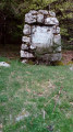
(1) Leave the road at the signpost where the hiking trails intersect, opposite the pass’s commemorative stele. Climb straight ahead to thefirst standing stone. Continue straight on to thesecond standing stone. Take the small path opposite and climb up through the bushes to the main forest track. Directly ahead, slightly to the right, a path climbs steeply through the forest, just above a water tank. Carry on through the coniferous forest, then emerge through the broom to the foot of the Fageole sub-summit (marker).

(2) Turn 90° to the right, heading downhill, through the broom once more. Join a more clearly marked path on the left, then follow the ridge to reach an interesting viewpoint.

(3) Continue the descent to the Rocher du Comte.

(4) Take care here: the path is very poorly marked and has few signposts all the way to Saint-Cau. Leave the ridge towards Saint-Cau to begin the descent through the chestnut trees, and further down, you’ll come across a slightly better-marked track.

(5) Turn right onto it and descend gently, diagonally, down the north-western slope. After several hairpin bends, you’ll reach the greenway along the old railway line.

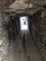
(6) Join it straight ahead, pass through two relatively short tunnels, then cross a magnificent viaduct overlooking the Bavezon. You’ll then emerge into the village of Aumessas.

(7) Turn right onto the path marked in yellow. Take a flight of steps, then follow Rue de la Tour to reach the church and one of the central squares in this beautiful village. At the far end of the square, behind the fountain, head back down almost to the River Bavezon, following the course of the stream from a distance. Climb gently uphill to reach the hamlet of Sauveplane.

(8) You will then reach the hamlet of Lascanals, which is accessible by road.

(9) Take the road opposite and continue along the D336 to the pretty hamlet of Le Cambon.

(10) Turn right off the D336, pass through Le Cambon, then Le Bavezon, and continue climbing through the chestnut trees to the Col de Mouzoules, which you passed at the start of the walk.

(1) Turn left and follow the route you took on the way out in the opposite direction to return to the Caladon car park (S/E).

Waypoints

  1. S/E : mi 0 - alt. 2,293 ft - Car park: Le Caladon hamlet
  2. 1 : mi 0.67 - alt. 2,418 ft - Col de Mouzoulès
  3. 2 : mi 1.04 - alt. 2,835 ft - La Fageole-Borne
  4. 3 : mi 1.47 - alt. 2,671 ft - Le Colombier Haut
  5. 4 : mi 2.33 - alt. 2,218 ft - Rocher du Comte
  6. 5 : mi 2.98 - alt. 1,873 ft - Crossroads with signposted path
  7. 6 : mi 3.47 - alt. 1,417 ft - Old railway line
  8. 7 : mi 4.08 - alt. 1,512 ft - Aumessas
  9. 8 : mi 4.37 - alt. 1,499 ft - The hamlet of Sauveplane
  10. 9 : mi 4.9 - alt. 1,686 ft - Lascanals
  11. 10 : mi 5.31 - alt. 1,788 ft - Entrance to Le Cambon
  12. S/E : mi 6.86 - alt. 2,293 ft - Car park: Le Caladon hamlet

Notes

Shortly after (7), there is a fountain in the village of Aumessas.

Worth a visit

(S/E) The hamlet of Caladon: this was a waystation, with a tollgate on the Le Vigan–Millau road.
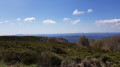
Between (1) and (2), at the standing stone, take in the 360° view overlooking Bréau-Mars and the hills of Le Vigan on one side, and the whole of the Aumessas and Arrigas valley on the other.
(3) Viewpoint on the ridge:
- to the left, Esparon and the Arre valley,
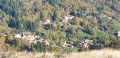
- to the right, the whole of Aumessas with its many hamlets.
- You can also see the starting point, the hamlet of Caladon, which is built atop an impressive rocky outcrop.
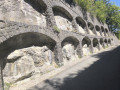
Between (6) and (7) lies the old railway line, with its two tunnels and viaduct.

Reviews and comments

4.3 / 5
Based on 2 reviews

Reliability of the description
4 / 5
Ease of following the route
4.5 / 5
Route interest
4.5 / 5
User 2981218

Overall rating : 5 / 5

Date of your route : Sep 14, 2026
Reliability of the description : ★★★★★ Very good
Ease of following the route : ★★★★★ Very good
Route interest : ★★★★★ Very good
Very busy route : No

Some truly beautiful panoramic views
The start of the route through the woodland requires vigilance and a good sense of direction
The climb to the Col de Mouzoules is well worth the effort
Highly recommended

Machine-translated

Paul-Marie Plaideau
Paul-Marie Plaideau
Mamimo
Mamimo

Overall rating : 3.7 / 5

Date of your route : Jun 04, 2026
Reliability of the description : ★★★☆☆ Average
Ease of following the route : ★★★★☆ Good
Route interest : ★★★★☆ Good
Very busy route : No

A nice little walk with no difficulties… A bit too much tarmac for my liking.

Machine-translated

Other walks in the area

For more walks, use our search engine .

The GPS track and description are the property of this route's author. Please do not copy them without permission.