Circular Mas del Bos from Lespinasse

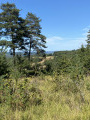
From the valley to the forest, a circular route around the Madeleine site. A circular route that follows the meandering course of the Vézère to Tursac, leaving the valley to enter the dense woods towards the plateaus before returning to the river’s wide plain.

Details

98469749
Creation:
Last update:
Last review:
  • Walking
    Activity: Walking
  • ↔
    Distance: 6.01 mi
  • ◔
    Average duration: 3h 25 
  • ▲
    Difficulty: Moderate

  • ⚐
    Back to start: Yes
  • ↗
    Ascent: + 797 ft
  • ↘
    Descent: - 781 ft

  • ▲
    Highest point: 728 ft
  • ▼
    Lowest point: 197 ft

Description of the walk

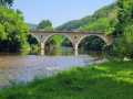
Car park at Pont de Lespinasse.

(S/E) Cross the bridge and follow the tarmac road uphill to the third junction (Chemin du Ruth).

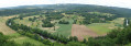
(1) Turn right onto the signposted path which follows the GR®36. Ignore one junction. There is a stunning view over the Vézère valley and the Maison Forte de Reignac. Cross a stream and arrive at the houses in Sous le Ruth.

(2) The path leaves the GR® before the Ruth ore deposit (possible link to Le Moustier). Then enter the woods and follow the path which climbs to the left. Stay on this side all the way to the stream and keep left to reach another crossroads.

(3) A shorter alternative: head for the Pont de Lespinasse by turning left. Otherwise, for the suggested route, carry on straight ahead until you leave the woods.

(4) Follow the signposts to the right (possible link to Fleurac). In the Petite Forêt, the path climbs again and joins the tarmac road.

(5) Turn left and walk alongside the road for about a hundred metres, before entering the woods again on the right. Continue straight on until you reach the ‘chemin de castine’.

(6) At the junction, turn left, then at the next junction turn right at the hairpin bend.

(7) As you come out of the woods, take the path on the right. Head back into the woods for about 1 km.

(8) When you reach the road again, turn left and continue along this road until you cross the bridge on the right and return to the car park (S/E).

Waypoints

  1. S/E : mi 0 - alt. 240 ft - Lespinasse Bridge - Vézère (rivière)
  2. 1 : mi 0.27 - alt. 272 ft - Chemin du Ruth
  3. 2 : mi 1.32 - alt. 394 ft - Below Le Ruth – junction
  4. 3 : mi 3.08 - alt. 407 ft - Junction - Fangues (cours d'eau) - Affluent de la Vézère
  5. 4 : mi 3.3 - alt. 495 ft - Junction at the edge of the woods
  6. 5 : mi 3.71 - alt. 715 ft - Route de Louvetier
  7. 6 : mi 4.11 - alt. 705 ft - Chemin de Castine
  8. 7 : mi 4.64 - alt. 453 ft - Forest track
  9. 8 : mi 5.42 - alt. 226 ft - Road
  10. S/E : mi 6.01 - alt. 240 ft - Lespinasse Bridge - Vézère (rivière)

Notes

(3) Short route: To return to the starting point, simply turn left and follow the signs for Tursac via the ‘short route’. A footpath followed by a tarmac road will take you back to the starting point; allow about 1 hour’s walk.

Always be cautious and plan ahead when you're outdoors. Visorando and the author of this route cannot be held responsible for any accidents occurring on this route.

The GR® and PR® markings are the intellectual property of the Fédération Française de Randonnée Pédestre.

Other walks in the area

For more walks, use our search engine .

The GPS track and description are the property of this route's author. Please do not copy them without permission.