La Cipière via the Bois de la Tante, starting from La Baillerie

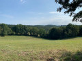
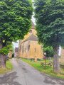
The walk takes in old farmhouses, beautiful views, a few hamlets and an estate. A varied walk that can be shortened by 2 km (see practical information)

Details

n°43094682
Creation:
Last update:
Last review:
  • Walking
    Activity: Walking
  • ↔
    Distance: 5.91 mi
  • ◔
    Average duration: 3h 10 
  • ▲
    Difficulty: Easy

  • ⚐
    Back to start: Yes
  • ↗
    Ascent: + 548 ft
  • ↘
    Descent: - 548 ft

  • ▲
    Highest point: 768 ft
  • ▼
    Lowest point: 276 ft

Photos

Description of the walk

Park on Route de l’Estrade, in the village of Tursac, at the junction with Route de la Baillerie. There is also a car park on Route de la Brauge; see number 6 on the map.

(S/E) Take this small road, following the sign for La Baillerie. Follow the yellow posts downhill until you reach a junction by the houses in La Baillerie.

(1) Keep to the right on the road to reach, after a hairpin bend, the junction with the road leading to the hamlet of La Cabane.

(2) Turn right onto the path to enter the forest. You’ll then emerge into a clearing; follow the edge of the clearing until you reach another crossroads at the far end.

(3) Take the path on the right, continue through the woodland and head downhill. At the bottom of the descent, you’ll find a hiking sign at the path junction.

(4) Turn left towards Peyzac. Begin the climb through the woodland and then across a clearing to reach a telecoms mast above the hamlet of Le Verdier.

(5) Turn left in the clearing onto the ascending path, passing a hay barn. You’ll soon reach the Camping de la Brauge, then a junction with a tarmac road. Carry on to the right.

(6) Head diagonally left into the forest, then follow the edge of a woodland to reach a road junction.

(7) Turn left onto this road. At the next Y-junction, keep right for about a hundred metres, then turn left at the three-way junction to reach the hamlet of La Baronie.

(8) Carry on straight ahead, pass a few houses, then turn right to reach the hamlet of Le Burladi.

(9) Turn left to reach, a few hundred metres further on, the junction situated not far from the hamlet of Le Maine.

(10) Turn right for a few metres, then leave the road and turn left onto the yellow-marked path, which runs parallel to the road and leads back to the car park on the Route de la Baillerie (S/E).

Waypoints

  1. S/E : mi 0 - alt. 719 ft - Car park on Route de la Baillerie
  2. 1 : mi 0.29 - alt. 591 ft - La Baillerie
  3. 2 : mi 0.56 - alt. 436 ft - Crossroads at the hamlet of La Cabane
  4. 3 : mi 0.93 - alt. 404 ft - Forest crossroads
  5. 4 : mi 1.68 - alt. 276 ft - Low point
  6. 5 : mi 2.56 - alt. 640 ft - Le Verdier outpost
  7. 6 : mi 3.18 - alt. 758 ft - La Balloterie crossroads
  8. 7 : mi 3.96 - alt. 768 ft - Road junction
  9. 8 : mi 4.59 - alt. 702 ft - La Baronie
  10. 9 : mi 5.1 - alt. 725 ft - Burladi
  11. 10 : mi 5.39 - alt. 751 ft - Le Maine, crossroads
  12. S/E : mi 5.91 - alt. 719 ft - Car park on Route de la Baillerie

Notes

Shortcut reducing the walk by 2 km between (3 and) 5:: :
(3) At the signpost, turn left towards Peyzac. Continue through the forest until you reach a path with meadows on your left. Carry on straight ahead until you reach (5).

Worth a visit

Reviews and comments

4.7 / 5
Based on 2 reviews

Reliability of the description
5 / 5
Ease of following the route
4.5 / 5
Route interest
4.5 / 5
User 19281798

Overall rating : 4.7 / 5

Date of your route : Oct 05, 2026
Reliability of the description : ★★★★★ Very good
Ease of following the route : ★★★★☆ Good
Route interest : ★★★★★ Very good
Very busy route : Yes

.

Machine-translated

GOGO
GOGO

Overall rating : 4.5 / 5

Date of your route : Jun 07, 2025
Reliability of the description : Not used / Not applicable
Ease of following the route : ★★★★★ Very good
Route interest : ★★★★☆ Good
Very busy route : No

A pleasant walk with no difficulty whatsoever. Suitable for families, provided you are comfortable walking 10 km.

Machine-translated

Other walks in the area

For more walks, use our search engine .

The GPS track and description are the property of this route's author. Please do not copy them without permission.