Country:

 City:


The start of this walk is at Lac des Mesches. See the ‘Practical Information’ section for details on how to get to Lac des Mesches.
Park along the shore of Lac des Mesches.
(S/E) From the lake, head towards the footbridge over the Torrent de la Beugne via the Route de Castérino, which is closed to traffic at this point.
Signposted with fluorescent orange markers on posts.
(1) Cross the footbridge and follow the marker posts until you reach a junction with the old path leading to the Chemin de Valaire.
(2) Turn left and follow the orange markings. Walk past the back of the gravel pit and, after a climb through the woods, you’ll reach another footbridge. Cross the Torrent de la Beugne once more and climb the steps to reach the Route de Castérino.
No signposting.
(3) Walk along the road to the hamlet of Castérino, passing by Lac de Castérino and the Pont des Gasis. Cross the bridge and continue to the Auberge Sainte-Marie-Madeleine.
(4) Continue along the small road leading to the upper car park. Before reaching marker 395, take a shortcut to cut across the bend.
(5) Turn left and take the track towards Lac des Grenouilles, shortly after marker 392.
(6) Return to marker 392 and head right, towards the Refuge de Fontanalbe, until you reach the junction at marker 390.
(7) Take the track on the right (signposted ‘Refuge de Fontanalbe’) and, after about 150 metres, look out for the start of a path on the right. Take this shortcut, which leads directly to the Refuge de Fontanalbe.
Yellow markings.
The most direct route to Lac Vert from the Fontanalbe Refuge is (was) the track that starts behind the refuge and passes marker posts 389, 387 and 388. Yes, but that was before Storm Alex. This track has suffered damage and repair work is currently underway. Following the advice of the refuge warden, you should take an old path that has been restored and re-routed.
(8) From the refuge, go down the steps and head west. Follow this pleasant, well-signposted path. Cross another stream via a brand-new footbridge. After the stream, the slope becomes steeper. Continue along the winding path through a rugged landscape of large scree. You’ll emerge onto the track leading to the Lacs Jumeaux.
(9) Turn right towards Lac Vert, the Lacs Jumeaux and the Voie Sacrée, as indicated by the sign.
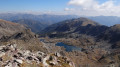
(10) Less than a hundred metres further on, turn left towards Lac Vert de Fontanalbe along a nature trail. Join another path coming back from the second of the Lacs Jumeaux, turn left again and head down towards the shore of Lac Vert.
(11) Take a break at Lac Vert. Continue along the path towards markers 388 and 387. Heading west, take the path through the Baisse de Fontanalbe and the Baisse de Valaurette. You’ll reach the junction where these two routes split at marker 386.
(12) At the fork, take the path on the left and climb the steep slope up to the Baisse de Valaurette. (Marker 385).
(13) Begin the descent towards the Minière valley and return to marker 384 at the Gias de Valauretta.
(14) Continue the descent towards the valley, passing through a wooded area. Walk past a waterfall and follow a stream before joining the Vallon de la Minière path at marker 383.
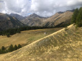
(15) Head eastwards through the valley, passing marker 382, and follow the stream until it widens.
(16) At this point, follow the detour off the path which leads away from the stream. The stream, where it bends, completely washed away the path during the flooding caused by Storm Alex. You’ll rejoin the old path just before Lac de la Minière.
(17) Walk alongside Lac de la Minière, whose left bank is completely unrecognisable following the massive influx of large boulders during the storm. Continue to the start of the old concrete road that used to lead to the buildings of the “Neige et Merveilles” lodge.
(18) Turn right onto a small path that has been created to replace the concrete road, which is completely buried under large boulders that have tumbled down from the stream on the left. Return to the “Neige et Merveilles” lodge and cross to the right bank of the stream. Begin the descent along the track towards Lac des Mesches.
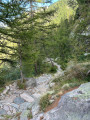
(19) At this point, the track has been swept away by a deluge of large boulders and tree trunks, leaving no trace of its former route. Follow the new section of the remodelled 4x4 track, which now requires you to descend further down into the dry stream bed before climbing back up towards the old track.
(20) Resume the track in a less rugged area and return to Lac des Mesches (S/E).


 Visorando Member

 Difficult

 Moderate