Country:

 City:
City:


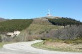
Park at the Crêt de l’Œillon car park, near the large mast, on the D63.1.
A second car can be parked at the Croix de Chaubouret car park to return to the start of the walk.
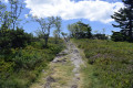
(S/E) Take the path to the west leading to the Crêt de Botte. This is recognisable by its square telecommunications tower. Go round it to the north and reach the Col de Botte.
(1) Head straight on towards the Crêt du Rachat pylon, then descend to the Col du Rachat. Continue along the path, keeping the Crêt de l’Étançon on your left, until you reach the junction at the Col d’Étançon.
(2) Without heading straight south, continue along the path slightly to the left.
(3) Turn right at the junction and head towards the Bourguisan chalet.
(4) Turn due south, then turn left into the moorland to reach the neighbouring ridges of the Arnica and then the Chèvre.
(5) There is an unobstructed view towards the Crêt de la Perdrix, easily recognisable by its orientation table. Head towards it, join the GR®°°®°°7, and reach a crossroads situated about a hundred metres further on, to the north-west of the ridge.
(6) Carry on straight ahead, cross the departmental road and head for the hamlet of La Jasserie, where you may wish to sample the famous blueberry tart.
(7) Turn back towards the Crêt de la Perdrix.
(6) Turn right, diagonally, to reach it.
(8) Join the GR®°°®°°7 again and begin the descent. Continue straight ahead and slightly to the left at the crossroads, and you’ll come out onto the D8.6.
(9) Follow the road with care as it is very busy during the holidays.
(10) Leave the road and follow the path on the left, which serves as a shortcut, before rejoining the road further down.
(11) Cross carefully to rejoin the path opposite, and continue to the Croix de Chaubouret car park (E).
 Visorando Member
 Easy
Easy 
 Difficult