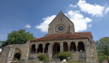
Rognac Castle Circular (Hike D)

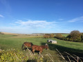
Rognac is the name of the castle overlooking the village of Coulonges, in the commune of Coulonges-Cohan. This route, starting from the Château de Rognac (a private castle), takes you to the top of the hill, on the edge of the forest, with magnificent views over Coulonges, Cohan, Dravegny and the Orillon valley towards Fismes.

The walk is marked with the letter D on the signs installed along the route.

Details

n°30879173
Creation:
Last update:
Last review:
  • Walking
    Activity: Walking
  • ↔
    Distance: 5.19 mi
  • ◔
    Average duration: 2h 50 
  • ▲
    Difficulty: Easy

  • ⚐
    Back to start: Yes
  • ↗
    Ascent: + 515 ft
  • ↘
    Descent: - 515 ft

  • ▲
    Highest point: 705 ft
  • ▼
    Lowest point: 381 ft

Photos

Description of the walk

Marked ‘D’

From Fère-en-Tardenois, take the D2 towards Villers-Agron-Aiguizy and the Autoroute de l’Est. Turn left onto the D27 towards Coulonges-Cohan and park along Rue du Chauffour before the entrance to the Château de Rognac. The château is private property. Take care during hunting seasons.

(S/E) Head towards the mobile phone mast, then turn left and walk past it. The path continues to follow the edge of the forest. Carry on to the stream and cross it via a footbridge.

(1) Carry on to the right and follow the edge of the forest to join the GRP® – Tour de L’Omois, with a view over the Orillon valley.

(2) Head straight ahead. Carry on straight on all the way to Cohan. Continue along the road, turn right then left and cross a stream. Immediately afterwards, turn left onto a track and you’ll come to another junction.

(3) Leave the GRP® via the path on the left to head back towards Coulonges. Carry on to the next junction.

(4) Turn right towards Coulonges; the path straight ahead is a private road. Start climbing until you reach a crossroads.
The view of the village of Coulonges and its church, dominated by Rognac Castle, is magnificent.

(5) Turn left to head back down towards the village. Turn right when you reach the junction of Rue de l’Épinette and Rue de la Bouverie. Turn left twice to pass in front of the Auberge de la Roue Fleurie.

(6) You can take a short break here before finishing the walk.
Cross the Orillon stream and you’ll arrive at Place de la Jaunière.

(7) You can learn about the village’s history from the information boards.
Continue straight on along Rue de la Ferronnerie, then turn left towards the church.

(8) First turn right then left onto Chemin du Savart, which runs alongside the old ramparts and takes you back to the car park (S/E).
Waypoints

  1. S/E : mi 0 - alt. 505 ft - Rognac Castle
  2. 1 : mi 1.34 - alt. 574 ft - Footbridge
  3. 2 : mi 1.85 - alt. 659 ft - View over the Orillon valley
  4. 3 : mi 3.25 - alt. 397 ft - Junction after the Cohan stream
  5. 4 : mi 3.74 - alt. 466 ft - Chemin de Cubry (private)
  6. 5 : mi 4.34 - alt. 600 ft - View of the village of Coulonges
  7. 6 : mi 4.94 - alt. 433 ft - Auberge de la Roue Fleurie
  8. 7 : mi 5.02 - alt. 427 ft - Place de la Jaunière
  9. 8 : mi 5.12 - alt. 469 ft - Ramparts of Rognac Castle - Eglise Saint-Rufin et Saint-Valère (Coulonges)
  10. S/E : mi 5.19 - alt. 505 ft - Rognac Castle

Notes

Some sections of the route may be muddy and slippery depending on the time of year. Please wear non-slip footwear.
On the first section, the path runs along the edge of the forest. Do not take the parallel path through the forest, as this is a private track.
The hike involves a significant elevation gain and the condition of the paths may be poor in places (new paths cleared by volunteers).
You can eat or stay overnight at the Auberge de la Roue Fleurie in Coulonges.

Worth a visit

The ruins of Rognac Castle overlook the village of Coulonges. It features a communal oven where the ‘Les Jacques de Rognac’ association regularly bakes bread.

The route also offers magnificent views of the villages of Coulonges and Cohan and their listed churches. Igny Abbey is situated nearby. It specialises in making chocolates, which can be found in the abbey shop.

Reviews and comments

virgule
virgule

A lovely spot. I’ll go and do the route

Machine-translated

Other walks in the area

For more walks, use our search engine .

The GPS track and description are the property of this route's author. Please do not copy them without permission.