Circular loop around the leisure and community centre

A circular loop at the Mont Saint-Aignan Leisure and Community Centre.

Details

66495
Creation:
Last update:
Last review:
  • Walking
    Activity: Walking
  • ↔
    Distance: 1.47 mi
  • ◔
    Average duration: 0h 55 
  • ▲
    Difficulty: Easy

  • ⚐
    Back to start: Yes
  • ↗
    Ascent: + 279 ft
  • ↘
    Descent: - 279 ft

  • ▲
    Highest point: 463 ft
  • ▼
    Lowest point: 177 ft

Photos

Description of the walk

Park in the car park between the leisure and community centre and the Mont-Saint-Aignan golf course, on Rue Francis Poulenc.

(S/E) Enter the leisure centre and follow the main path.
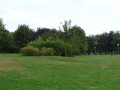
At the small crossroads, where the path turns left towards the leisure centre buildings, leave the path and continue straight ahead, walking across the grass. Walk alongside the trees at the edge of the woodland. Follow the path. There are one or two benches by the side of the path on the right.
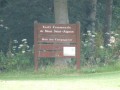
Just after passing a wooden sign, a path branches off to the right. Do not take it; stay on the path, which veers very slightly to the left before curving back to the right. The path climbs and reaches a junction.

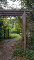
(1) Turn left. Follow the path and take thefirst path on the left. Keep a close eye out, as it isn’t always very visible. There is a concrete circle with a manhole cover at the point where you need to turn left. Follow the path as it climbs.
The path leads to an underpass; do not take it, but carry on straight ahead.
Walk alongside the leisure centre on the wide grass verge beside the dual carriageway

(2). Head for the car park on the left:/A.

Waypoints

  1. S/E : mi 0 - alt. 456 ft - Car park on Rue Francis Poulenc
  2. 1 : mi 0.41 - alt. 213 ft - GR25D junction
  3. 2 : mi 1.17 - alt. 374 ft - Alongside the dual carriageway
  4. S/E : mi 1.47 - alt. 456 ft - Car park on Rue Francis Poulenc

Notes

The circular path can be walked in the opposite direction, but the climb back up is very steep.
There are public toilets at the entrance to the leisure centre, on the left, just after the barrier.

Worth a visit

At the leisure centre, there is a large playground.
A lovely spot for a picnic.

Reviews and comments

4 / 5
Based on 4 reviews

Reliability of the description
4.3 / 5
Ease of following the route
4.5 / 5
Route interest
3.3 / 5
sigouben
sigouben

Overall rating : 3.3 / 5

Date of your route : Nov 23, 2021
Reliability of the description : ★★★☆☆ Average
Ease of following the route : ★★★★☆ Good
Route interest : ★★★☆☆ Average
Very busy route : Yes

A lovely walk through the woods after the park. The path is pleasant (provided you’re wearing sturdy shoes to avoid slipping), but it isn’t signposted at all. You’ll therefore need to pay close attention to the map or the route description.

Machine-translated

noellechahi
noellechahi

Overall rating : 4 / 5

Date of your route : Mar 11, 2019
Reliability of the description : ★★★★☆ Good
Ease of following the route : ★★★★☆ Good
Route interest : ★★★★☆ Good

This is a walk best done in dry weather, as the climb up is quite muddy.

Machine-translated

adriendu13
adriendu13

Overall rating : 4.3 / 5

Date of your route : Mar 10, 2019
Reliability of the description : ★★★★★ Very good
Ease of following the route : ★★★★★ Very good
Route interest : ★★★☆☆ Average

a leisurely stroll / a family walk

Machine-translated

dedepostel
dedepostel

Overall rating : 4.3 / 5

Date of your route : Apr 12, 2015
Reliability of the description : ★★★★★ Very good
Ease of following the route : ★★★★★ Very good
Route interest : ★★★☆☆ Average

A nice walk to help with digestion

Machine-translated

Other walks in the area

For more walks, use our search engine .

The GPS track and description are the property of this route's author. Please do not copy them without permission.