Country:

 City:
City:


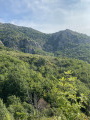
Access: Mayres is situated on the RN102, at the foot of the Col de la Chavade, between Aubenas and Le Puy-en-Velay.
Park in the church square.
(S/E) The start is behind Parc Émile Jean, next to the town hall. Take the Chemin du Chazalet, running alongside the cemetery.
(1) After walking for about 150 metres, turn left onto Rue de la Trapette (a small tarmac path) which joins the main road. Cross at the pedestrian crossing, then continue to the right for about 100 metres, towards Aubenas.
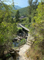
(2) Take the path that opens up on the left and leads to the Ardèche. Cross the footbridge. Once you reach the junction at the top of the hill, carry on straight ahead and follow the path as it curves widely to the left, crossing two streams. You’ll reach a junction of paths on the ridge.
(3) Go straight on to begin the descent towards the hamlet of Banne, and reach it.
(4) At the junction, turn left onto the Chemin du Pigeonnier, which runs alongside the Ardèche at a distance. Continue for about 200 m.
(5) Take a path on the right, shaped like steps, which leads down to the footbridge allowing you to cross the Ardèche again. Once on the other side, you’ll come out onto Chemin du Moulin, and continue to the A-road. Cross at the pedestrian crossing to return to the car park at the church square (S/E).



 Visorando Member
 Difficult
 Very difficult
 Association / Club / Walk leader