Balcon de Joyeuse circular loop

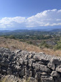
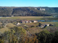
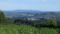
The path winds across the aptly named Plaine des Mûres plateau, which runs along the foot of the Cévennes. There are beautiful panoramic views of the Monts d’Ardèche Regional Nature Park.
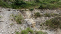
You’ll discover this arid, rocky plateau, which is home to the Mediterranean heath.
A very easy walk with very little elevation gain and few technical difficulties.

Details

104021027
Creation:
Last update:
Last review:
  • Walking
    Activity: Walking
  • ↔
    Distance: 3.64 mi
  • ◔
    Average duration: 1h 50 
  • ▲
    Difficulty: Easy

  • ⚐
    Back to start: Yes
  • ↗
    Ascent: + 174 ft
  • ↘
    Descent: - 187 ft

  • ▲
    Highest point: 974 ft
  • ▼
    Lowest point: 833 ft

Photos

Description of the walk

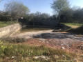
Park in the car park at the ‘La Perle d’Eau’ swimming pool in Lablachère.

(S/E) Head to the far end of the car park, heading north towards the vineyards. Follow the yellow and white markings. Take the tarmac road that leads down towards the D104. Join the D104.

(1) Before the tunnel that passes under the D104, turn right and walk alongside the D104. Then turn right onto Chemin de Bouchard. You’ll come to a Fork in the road.

(2) Keep right onto Chemin de Bouchard. Continue straight on until you reach another junction at Plaine des Mures.

(3) Turn left onto Chemin de la Lauzette and continue until you reach the fork near the houses in Lauzette.

(4) Carry on to the left, passing by the houses, and begin a short climb which ends at a crossroads with four directions that are almost perpendicular to one another.

(5) Take the small path on the left and turn right at the next junction to reach the viewpoint.

(6) Turn left to walk along the top of the plateau. You’ll reach a place called Le Bouchard at a small gate.

(7) Turn right onto the path leading towards the church bell tower. You’ll come back to the crossroads you passed earlier at Bouchard.

(2) Follow the route you took on the way there in the opposite direction to return to the car park at the La Perle d’Eau swimming pool (S/E).

Waypoints

  1. S/E : mi 0 - alt. 883 ft - Swimming pool car park
  2. 1 : mi 0.12 - alt. 840 ft - Before the tunnel
  3. 2 : mi 0.59 - alt. 866 ft - Crossroads at the end of the circular loop
  4. 3 : mi 1.01 - alt. 866 ft - Plaine des Mures
  5. 4 : mi 1.49 - alt. 850 ft - Lauzette
  6. 5 : mi 1.81 - alt. 974 ft - Top of the hill
  7. 6 : mi 2.35 - alt. 899 ft - Viewpoint
  8. 7 : mi 2.69 - alt. 876 ft - Gate
  9. S/E : mi 3.64 - alt. 883 ft - Swimming pool car park

Notes

Hike featured in theCévennes Ardèche Tourist Office’s hiking guide
This walk should be avoided during heatwaves or in direct sunlight as there is very little shade.
This route is best undertaken in late August/early September to make the most of wild blackberry picking.
This route is suitable for mountain bikes.
Follow the yellow and white markings.

Worth a visit

(5) Top of the hill: view of the Ardèche Regional Park.
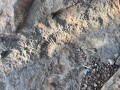
Between (6) and (7): keep your eyes peeled – you’ll probably be lucky enough to come across a magnificent fossilised ammonite footprint.
Monts d’Ardèche Regional Nature Park (UNESCO Global Geopark).

Other walks in the area

For more walks, use our search engine .

The GPS track and description are the property of this route's author. Please do not copy them without permission.