


 Country:

 City:
City:


The start is at the top of the Vignal campsite. A few cars can park along the small tarmac road.
(S/E) Follow the road, keeping the campsite on your right, and you’ll soon reach a junction.
(1) Turn left onto the road towards Le Roux. Note the private chapel on the right and, as you leave the hamlet, the lovely flight of steps leading down to the vineyards.
(2) Leave the road that descends to the right and take, opposite, the path which slopes further on to the left and joins a track.
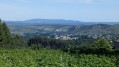
(3) Take this track to the left: mountain bike signpost no. 14/15. Through the trees, you can see, straight ahead, the village of Ribes and Joyeuse, to the left up the hill.
(4) Leave the MTB signposting, which heads off to the left, and follow straight ahead onto the Sentier du Vigneron, which joins from the left. The path winds through the vineyards, making a wide circular loop, and eventually leads to a star-shaped junction.
(5) Continue straight on along the Route de l’Estrade: there’s a beautiful stone cross on the left.
(6) On the descent, leave the Sentier du Vigneron, which branches off to the right. Continue straight on to reach Lestrade, where you’ll rejoin the Sentier du Vigneron coming from the opposite direction: there are some lovely houses here.
(7) Take the paved slanting street that descends to the left, crosses the Orval and climbs up the other side: you can admire the old terraced fields. Pass close to a spring and come out onto a tarmac road (Chemin du Vignal). Head right to cross the hamlet, negotiate the left-hand bend and, once at the top, rejoin the road you took at the start.
(1) Turn left to return to the car park (S/E).

 Visorando Member

 Moderate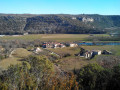
 Difficult
