The Four Villages Circular Tour in Girauvoisin

A walk through the plains, forests and villages of the Côtes de Meuse.

Details

n°45126819
Creation:
Last update:
Last review:
  • Walking
    Activity: Walking
  • ↔
    Distance: 10.46 mi
  • ◔
    Average duration: 5h 20 
  • ▲
    Difficulty: Moderate

  • ⚐
    Back to start: Yes
  • ↗
    Ascent: + 564 ft
  • ↘
    Descent: - 577 ft

  • ▲
    Highest point: 1,250 ft
  • ▼
    Lowest point: 791 ft

Photos

Description of the walk

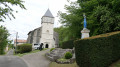
Park in the small car park on the edge of the Grand Rue, near the church.

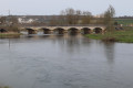
(S/E) Walk past the town hall and the church and go past the wash house.

(1) Turn left onto the path just after the washhouse, following the yellow markings. Further on, veer right onto the path which is circular and turns to the right before returning to the road.

(2) Turn left back onto the departmental road and cross over the railway line.

(3) Cross the D178 and turn right, walking carefully alongside it until you reach the first junction.

(4) Head up the dirt track on the left. Navigate the bend to the right, then, at the next one, carry on straight on towards Saint-Julien-sous-les-Côtes.

(5) Walk past the church and continue straight on along Rue Haute to cross the whole village. Pass under a power line.

(6) Head up the dirt track on the right, following the yellow markings, and walk up the Vau de Roulard.

(7) At the top, turn right and carry on straight ahead until you reach the entrance to Liouville Fort.

(8) Carry on straight ahead to the fort.

(9) Walk round the fort, following the ditches on the right or left, and return to the starting point of the circular route.

(9) Return to the previous junction.

(8) Head down the path marked in yellow (PR®) to the left, towards the village of Liouville.

(10) Turn left onto the village’s main street. Pass the church on your left, then the washhouse and the fountain.

(11) Turn right onto the Chemin Rural de Bricourt.

(12) Turn right onto the grassy path. Keep left at the two junctions ahead, go under the railway line and continue to the next fork (signpost).

(13) Turn left.

(14) Turn right before the woods, then right again at the next junction towards Frémeréville-sous-les-Côtes, which you’ll reach via Rue du Puits.

(15) Turn right onto Rue Haute, pass the town hall and the church, and carry on straight on until you reach the edge of the village.

(16) Turn right onto the dirt track which runs more or less parallel to the D130 and eventually joins it at the entrance to Girauvoisin. Return to the small car park where you started (S/E).

Waypoints

  1. S/E : mi 0 - alt. 869 ft - Church, car park
  2. 1 : mi 0.19 - alt. 873 ft - Path on the left
  3. 2 : mi 0.89 - alt. 853 ft - Return to the D130
  4. 3 : mi 1.39 - alt. 817 ft - D178
  5. 4 : mi 1.59 - alt. 830 ft - Dirt track on the left
  6. 5 : mi 2.01 - alt. 886 ft - Saint-Julien-sous-les-Côtes
  7. 6 : mi 2.37 - alt. 919 ft - Dirt track on the right
  8. 7 : mi 3.14 - alt. 1,204 ft - Junction, on the right
  9. 8 : mi 3.56 - alt. 1,237 ft - Junction: A/ straight on – R/ left
  10. 9 : mi 3.75 - alt. 1,214 ft - Tour of the fort via the moats - Ancien Fort de Liouville (Apremont-la-Forêt)
  11. 10 : mi 5.23 - alt. 902 ft - Liouville, on the left
  12. 11 : mi 5.39 - alt. 879 ft - Chemin Rural de Bricourt
  13. 12 : mi 5.82 - alt. 810 ft - Turn right
  14. 13 : mi 7.24 - alt. 820 ft - Signpost, on the left
  15. 14 : mi 7.96 - alt. 791 ft - Turn right
  16. 15 : mi 9.01 - alt. 833 ft - Frémeréville-sous-les-Côtes, on the right
  17. 16 : mi 9.25 - alt. 935 ft - Dirt track on the right
  18. S/E : mi 10.46 - alt. 869 ft - Church, car park

Notes

Parking is available in front of Girauvoisin Church, but you can also park at (1) next to the wash house.
(1) There is a picnic table here.
From point (2) to point (4), the route is tarmac.
(5) In front of the church at Saint-Julien-sous-les-Côtes, there is a bench and a shelter for picnics.
(11) In Liouville, on the left, a picnic table on the Chemin Rural de Bricourt.
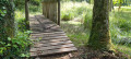
Between points (12) and (15), the path can be quite muddy in places during wet weather.
You can shorten the route by about a third by heading straight on at point (13) and returning directly to (S/E), which takes you straight back to the starting point.
Please note: the route is signposted with yellow bars (PR®) throughout.

Worth a visit

(1) An unusual wash house with beautiful oak beams.

(9) External tour of the old Liouville Fort (1876) via the outer moats. Tours of the fort’s interior take place on the third Sunday of every month (information available from the local association). Do not enter areas marked off by signs.
https://fr.wikipedia.org/wiki/Fort_de_Li...

(15) You can visit the church at Fréméréville-sous-les-Côtes, where you can admire a magnificent collection of ceramic scale models of various churches in the region (works by a local artist).

Always be cautious and plan ahead when you're outdoors. Visorando and the author of this route cannot be held responsible for any accidents occurring on this route.

The GR® and PR® markings are the intellectual property of the Fédération Française de Randonnée Pédestre.

Reviews and comments

4.7 / 5
Based on 1 review

Reliability of the description
5 / 5
Ease of following the route
5 / 5
Route interest
4 / 5
Randophil57
Randophil57

Overall rating : 4.7 / 5

Date of your route : Jun 20, 2026
Reliability of the description : ★★★★★ Very good
Ease of following the route : ★★★★★ Very good
Route interest : ★★★★☆ Good
Very busy route : No

We made two changes to the suggested route: firstly, we reached Saint Julien via the very pleasant path heading due north, which runs alongside the fields and passes under the railway line; and from Liouville, we made our way to Frèmereville by cutting through the small wood.
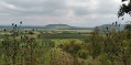
The walk is very pleasant, with plenty of scenic views and passes through small villages, and we really enjoyed the fountains in Liouville and Frèmereville on such a hot day.

Machine-translated

Other walks in the area

For more walks, use our search engine .

The GPS track and description are the property of this route's author. Please do not copy them without permission.