Beauronne Potters’ Circular Loop

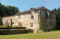
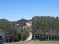
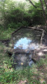
A superb family walk following in the footsteps of the potters, through woodland and past small heritage sites. The route is dotted with water features: fountains, streams and ponds… ideal for our canine friends!

Details

29837723
Creation:
Last update:
Last review:
  • Walking
    Activity: Walking
  • ↔
    Distance: 6.99 mi
  • ◔
    Average duration: 3h 40 
  • ▲
    Difficulty: Moderate

  • ⚐
    Back to start: Yes
  • ↗
    Ascent: + 482 ft
  • ↘
    Descent: - 482 ft

  • ▲
    Highest point: 367 ft
  • ▼
    Lowest point: 184 ft

Photos

Description of the walk

Starting point: In front of Beauronne Town Hall. Car park.

(S/E) From the hiking sign in front of the town hall, follow the road running alongside the town hall car park. After 100 m, turn right onto Impasse du Château towards Le Breuil. On your right, you’ll see the ruins of the old castle. Just before the farm, take the dirt track straight ahead.

(1) At the T-junction, turn left. At the next junction (elevation 111), turn left again into a woodland.

(2) At the next junction, continue to the right until you reach the road. Follow it to the left to reach the pretty hamlet of Grand Boissonnie. There is a building on the right with bars on the windows, where, during the First World War, German prisoners of war were held whilst extracting clay for pottery production.

(3) Turn right to cross the village and carry on straight ahead towards Faye. Turn right onto the Chemin des Crozes. At the Fork in the road, turn left onto the Chemin de la Taupe. Leave the tarmac roads on your left and carry on straight ahead.

(4) At the junction of the paths, turn sharply left. Cross the D709 (take care!) and take Chemin Meymond opposite, with the Faye washhouse on your left. At the end of this track (you can take a detour to the left to admire the potter’s kiln and the spiked turkey on the roof ridge (private property)), first turn right then left to follow the Chemin du Gué. Ford the Beauronne and you’ll immediately come to a T-junction.

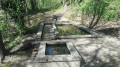
(5) Turn left here and pass under a high-voltage power line. At the three-way junction, turn left again; there’s a lovely view of some (private) ponds on your left. The path becomes tarmac at a place called Petit Boissonnie. Keep to the left, walk past a wash house and through the pretty hamlet. At the crossroads, you can make a detour to the Moulin de Boissonnie fish farm, which is on the left opposite.

(6) Otherwise, take the road on the right through the hamlet, then immediately turn left onto Rue Boucle de Petit Boissonnie. Follow this road for 1 km (with a lovely view of the church spire in the distance) until you reach Les Thoumelies. At the T-junction, veer left and continue along the small road until you reach the D40.

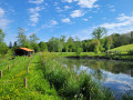
(7) At the Stop sign, turn left then right onto Rue de Tropy. Continue along the path through the woods. After a few hundred metres, when you reach the three-way junction, follow the path to the left. There is a small pond on the left before you reach the tarmac road at La Vidalie.

(8) Turn left. At the junction you’ll soon come to, turn left onto Route des Gourdils (there’s a pottery workshop at a place called Les Gourdils, off the route, on the right). Immediately after, in a bend, take the path on the right that leads into the woods. Ignore the first path coming from the right and you’ll soon reach a junction with a second path.

(9) Then turn sharply right. Follow the path to the sign for the Vidalie fountain (picnic area). Continue through the woods to the village of Le Treuil.

(10) Turn left onto the road and pass the Maine Moulin leat. Cross the D709 (take care!) and head straight on along Rue de Chantecoucou for 100 m.

(11) Turn left towards the south and follow the Chemin Royal. Carry on straight ahead until you reach the town hall (S/E).

Waypoints

  1. S/E : mi 0 - alt. 259 ft - Beauronne Town Hall
  2. 1 : mi 0.72 - alt. 331 ft - T-junction
  3. 2 : mi 1.3 - alt. 299 ft - Junction
  4. 3 : mi 1.58 - alt. 262 ft - Boissonnie
  5. 4 : mi 2.27 - alt. 256 ft - Crossroads
  6. 5 : mi 2.68 - alt. 190 ft - T-junction
  7. 6 : mi 3.3 - alt. 213 ft - Petit Boissonnie
  8. 7 : mi 4.1 - alt. 240 ft - Moulin de la Beauronne – D40 road - Beauronne de Saint-Vincent (rivière) - Affluent de l'Isle
  9. 8 : mi 4.95 - alt. 361 ft - Junction of path and road
  10. 9 : mi 5.27 - alt. 253 ft - Junction
  11. 10 : mi 5.55 - alt. 299 ft - Junction of path and road
  12. 11 : mi 5.97 - alt. 272 ft - Chemin Royal
  13. S/E : mi 6.99 - alt. 259 ft - Beauronne Town Hall

Notes

This route can be completed on foot, by mountain bike or on horseback.

The guidebook and the content and information below can be accessed via this link.

Worth a visit

Don’t leave Beauronne without taking a stroll round the village and looking up at the sky to admire the finials on the roofs of the houses!

Stories and legends
According to its Gallic origins, the name Beauronne is said to mean ‘The River of Beavers’.
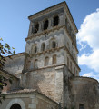
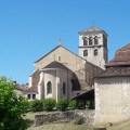
In the past, Beauronne was a commandery of St John of Jerusalem. Here you can admire the fortified Romanesque church, built in the 12th century, with its bell tower added in 1879 by the architect Vauthier.

In the footsteps of Catherine de’ Medici…
The Queen and her son Charles IX undertook a political tour of France from 1550 to 1574. The royal procession, comprising between 2,000 and 3,000 people, passed through Beauronne on 10 August 1565 on its way to Ribérac. Amongst the entourage was Henri de Navarre, the future Henri IV.

Beauronne, a village with a pottery tradition
The subsoil contains kaolin and refractory clays of the highest quality, renowned worldwide. On the eve of the Revolution, the village was home to 132 potters, but more than 80 per cent of them disappeared as a result of the war. Around thirty potters remained in the 19th century. The brick walls of the potters’ kilns were built up as the kiln was loaded; firing with wood lasted up to 48 hours. The pottery produced was then sold at local markets or transported down the River Isle by barge to Libourne.
Every year, a potters’ market is held in the village for a whole weekend in mid-August.

The roof finials
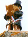
Since 2006, a series of quirky figures have been perched on the roofs of the village of Beauronne. You can spot a postman in the middle of the ridge of the old post office, two schoolchildren on the school building, the parish priest on the roof of the old vicarage, the rural constable drumming on the village hall, the mayor, decked out in his ceremonial sash, reading his speech on the current town hall, a goose-feeder, a Bacchus getting drunk above the pub, and a blacksmith hammering away at his anvil on the former blacksmith’s house. These figures are all dressed in the style of the 1900s, in their gleaming black outfits. They were crafted and donated by the potter Abel Coustillas in memory of the village’s pottery heritage.

The Pottery House
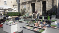
Situated right in the heart of the village, its aim is to bring together the local pottery tradition, contemporary ceramicists and the public. Classes and workshops are held there; please contact Florence de Sacy’s pottery studio.

The Boissonnie Mill
On the River Beauronne, which forms the boundary between the communes of Beauronne and Douzillac, the Petit Boissonnie Mill has been converted into a salmonid farm. Visitors can explore the aquaculture farm at their leisure, enjoy a fishing pond and pay-by-weight fishing, as well as buy fresh fish, smoked trout and trout roe directly from the farm…

Reviews and comments

4.8 / 5
Based on 2 reviews

Reliability of the description
5 / 5
Ease of following the route
4.5 / 5
Route interest
5 / 5
Office de Tourisme de Neuvic
estelle_blanchet
estelle_blanchet

Overall rating : 4.7 / 5

Date of your route : Nov 11, 2025
Reliability of the description : ★★★★★ Very good
Ease of following the route : ★★★★☆ Good
Route interest : ★★★★★ Very good
Very busy route : No

Apart from one junction where the yellow marker pointed to the right and we went left, the route was very easy to follow (I teach my children to follow a map and find their way around). We loved the variety of the walk, with its woodland, bridges and pretty houses in peaceful locations.

Machine-translated

Office de Tourisme de Neuvic

"Hello, thank you very much for your feedback! We are delighted that you enjoyed the hike and found the description useful. We look forward to seeing you again on other trails!"

More hikes: https://tourisme-isleperigord.com/randon...

Machine-translated

BERNARDLAB
BERNARDLAB

Overall rating : 5 / 5

Date of your route : Aug 03, 2025
Reliability of the description : ★★★★★ Very good
Ease of following the route : ★★★★★ Very good
Route interest : ★★★★★ Very good
Very busy route : Yes

Hello, Beautiful hike on wide paths, in the middle of the forest and meadows. The description of the route is perfect. Thank you.

Machine-translated

Other walks in the area

For more walks, use our search engine .

The GPS track and description are the property of this route's author. Please do not copy them without permission.