Country:

 City:
City:


The walk starts 3 km after the village of Boulc, at a place called Alex: there are few parking options, apart from between the two stone bridges, on the hard shoulder of the very quiet D148 road (a cul-de-sac), at the junction with the local track leading to the lodges.
Signposting: Faded yellow plastic Yellow Triangles. These are now only partially visible along the route.
(S/E) Take this path to pass in front of the two old farmhouses converted into lodges, continue straight on and cross the concrete footbridge spanning the stream: the faded yellow Triangle markings and the number 77 from the original route can be spotted here and there on some trees. Follow the stream, keeping it on your left at all times. The flat path crosses a field (ruined house on the right) and then winds its way uphill through the forest.
(1) Halfway up the slope, there is a viewpoint overlooking a beautiful waterfall and, beyond that, the hamlet of Les Tatins. Continue along the path until you reach the locality known as Les Rabeyroux and rejoin the tarmac road. Follow the road to the junction just before the hamlet of Les Tatins, where it meets theGR®95(red and white markings).
(2) Turn right onto the small tarmac road which forms part of the GR®°°° and leads to the hamlet of Bois Noir.
(3) Continue uphill along the forest track: please note that, depending on logging activities, the red and white markings may be missing.
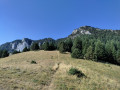
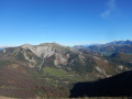
(4) Cross the Col Varaime (1,447 m). Follow the red and white marked path which runs along the mountainside (superb views) to the Col de Vaunières, where wooden signs on the ground indicate the directions of the world’s capital cities.
(5) Leave theGR® trail, which turns left, and also ignore the yellow markings heading straight ahead, which lead to a more expansive view (1,531 m). Turn immediately right, despite the Red Cross and the Yellow Cross, and look out for the faded Yellow Triangle right next to them. The path begins its descent through the forest, winding down in a series of hairpin bends.
(6) Admire the pretty waterfall on the Ruisseau de Bonneval and continue the descent until you reach the track leading to Terre Rouge.
(7) Follow this track downhill, taking several hairpin bends, until you reach the tarmac road at Souvestrière.
(8) Pass through the hamlet and reach Bonneval.
(9) Carry on along the road.
(10) Take the shortcut on the right to avoid a hairpin bend, rejoin the road and follow it straight on to the car park at Alex (S/E).

 Visorando Member


 Difficult

 Easy
Easy