Circular dels Pobles

A trail to explore by bike or on foot through several Catalan villages, offering beautiful scenery.

Details

n°8653894
Creation:
Last update:
Last review:
  • Mountain biking
    Activity: Mountain biking
  • ↔
    Distance: 8.52 mi
  • ◔
    Duration according to the author: 1.5 hrs 
  • ▲
    Difficulty: Moderate

  • ⚐
    Back to start: Yes
  • ↗
    Ascent: + 33 ft
  • ↘
    Descent: - 33 ft

  • ▲
    Highest point: 56 ft
  • ▼
    Lowest point: 10 ft
  • ⚐ Country: France
  • ⚐ City: Alénya (66200)
  • ⚑
    Start/End: N 42.64034° / E 2.980847°
  • ❏
    IGN map(s): Ref. 2548OT

  • ◶
    Type of surface:
  •  
     
    ■ 33% Road ■ 67% Path
  • ⇧
    Bike carrying: No
  • ▲
    Difficulty: Moderate
  • Hour-by-hour weather

Photos

Description of the route

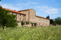
Park at the Caves Ecoiffier in Allénya, which date back to 1905.

(S/E) As you leave the car park, follow the D11 to the left onto Rue Jean-Jaurès. At the roundabout, continue straight ahead, taking the cycle path to the left of the road. Cross one road and head for the next roundabout.

(1) Just before the roundabout, take the path running alongside Rue Vasarely and follow it to the end

(2) Turn right onto Rue du Réart and leave the built-up area of Alénya. Follow the road to the River Réart at Mas de la Ripolla.

(3) Turn left and walk alongside the river. You can easily spot grey herons and little egrets on the banks of this coastal river.

(4) Go under the road bridge and continue along the Réart. You’ll then be able to see Mount Canigou on your right. On the other side of the Réart, you’ll see the village of Saleilles. Follow a dirt track until you reach a junction with a road.

(5) Turn left and enter Théza. You’ll then see a meadow with cows before entering the village.

(6) At the roundabout, turn right onto Chemin de Carolus Magnus. Follow the cycle/pedestrian path, which runs alongside market-garden plots, until you reach a playground, a skate park and a pump track.

(7) Continue along the safe cycle and footpath. You’ll enter Corneilla-del-Vercol, passing new housing estates and vineyards. At the end of the path, you’ll come face to face with the Agouille de la Mar and the Notre-Dame du Paradis chapel. Turn left and follow the Agouille de la Mar until you reach a bridge on your right.

(8) Cross the bridge and take the path immediately on the left. Follow the Agouille de la Mar on your left, cross a road and reach the junction between the Canal d’Elne and the Agouille de la Mar.

(9) Turn left, cross the Agouille de la Mar and, at the roundabout at the entrance to Alénya, turn right towards Saint-Cyprien. Continue along the Agouille de la Mar until you reach a crossroad.

(10) Cross this road carefully and turn immediately left onto the cycle path. Follow this towards the stadium (signposted on the ground), running alongside the Chemin du Golf and then the Avenue du Littoral, until you reach the roundabout on Avenue Jean Jaurès. Turn left and you’ll soon reach the Caves Ecoiffier car park (S/E).

Waypoints

  1. S/E : mi 0 - alt. 23 ft - Ecoiffier Cellars
  2. 1 : mi 0.31 - alt. 23 ft - T-junction, turn left
  3. 2 : mi 0.55 - alt. 26 ft - Rue du Réart, on the right
  4. 3 : mi 1.45 - alt. 26 ft - Mas de la Ripolla, on the left - Réart (rivière)
  5. 4 : mi 2.63 - alt. 43 ft - Road bridge
  6. 5 : mi 3.35 - alt. 52 ft - T-junction, turn left
  7. 6 : mi 3.8 - alt. 43 ft - Roundabout, Chemin de Carolus Magnus
  8. 7 : mi 4.43 - alt. 52 ft - Théza Skate Park
  9. 8 : mi 6.23 - alt. 26 ft - Corneilla-del-Vercol Bridge
  10. 9 : mi 7.48 - alt. 16 ft - Elne Canal
  11. 10 : mi 7.86 - alt. 13 ft - Turn left onto the cycle path
  12. S/E : mi 8.52 - alt. 23 ft - Ecoiffier Cellars

Notes

In Allénya, vineyards once covered around 90 per cent of the commune’s arable land, and more than 130 people worked on this estate.

Worth a visit

Behind the Caves Ecoiffier lies the romantic Tauléra garden. It is a place for strolling, featuring green patches and winding paths. Wooden animal sculptures, some of which are rocking figures, catch the visitor’s eye. At the far end stands a chapel and its garden, guarded by a pair of wrought-iron peacocks.

The Notre-Dame du Paradis Chapel, a former hermitage rebuilt in 1829. Nearby, you’ll find a fitness trail, a children’s playground and picnic tables.

Reviews and comments

4.7 / 5
Based on 1 review

Reliability of the description
5 / 5
Ease of following the route
5 / 5
Route interest
4 / 5
jacques 66
jacques 66

Overall rating : 4.7 / 5

Date of your route : Apr 15, 2026
Reliability of the description : ★★★★★ Very good
Ease of following the route : ★★★★★ Very good
Route interest : ★★★★☆ Good
Very busy route : No

A lovely, easy circular route that’s best avoided in summer as there are many sunny stretches (cycle paths). The route description is reliable, but it’s best to have the app as there are no signposts in some places. The section following the Agouille de la Mar is not maintained and is overgrown with vegetation.

Machine-translated

Other walks in the area

For more walks, use our search engine .

The GPS track and description are the property of this route's author. Please do not copy them without permission.