Country:
 City:


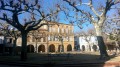
Start from Place des Marronniers in Viterbo: free parking.
(S/E) Opposite the church, take the road on the left, turn left, then follow the Agoût stream to the hydroelectric power station. Viewpoint overlooking the hydroelectric power station.
(1) Turn round and take the Côte du Moulin on the right, then turn right and left to follow the Chemin de la Baissade. You’ll arrive near La Véranié, where you’ll find a wayside cross.
(2) From here, turn right and follow the road, leaving Sairaguel on your right.
(3) As you approach En Testoulat, take the grassy path on the left and continue between the ponds until you reach the Route de Fiac.
(4) Turn right onto this road towards En Rémy. You’ll first see a private pond on your left, then another pond. Carry straight on through the hamlet.
(5) As you reach En Restoul, you’ll see the village of Fiac and Château en Bouffil in the distance on your right. After 200 metres, turn left and keep carefully to the left-hand side of the road.
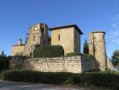
(6) Enjoy the view of Jonquières Castle and carry on until you reach the D112.
(7) Cross the road carefully, then turn left and follow the road.
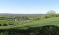
(8) Turn right towards Maison Saint-Alary, following the Chemin d’en Ayral. Pass the farm on the right-hand side of the track and continue to the top of the road, about 300 metres before the woods (viewpoint).
(9) Take the path on the left towards La Mouline. Cross the stream and carry on straight ahead to rejoin the D112.
(10) Cross the road again with the same care and continue along the grassy path opposite towards Baudan, the sawmill and En Perrel.
(11) As you approach Consuls (viewpoint), first turn right then left to continue along the grassy path towards Viterbe.
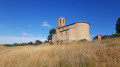
(12) Keep to the right before reaching La Véranié and carry on straight on towards Viterbe. Before the Grand Rue, turn right, then immediately left into the Passage du Vieux Viterbe, cross the Grand Rue and head for the Place des Marroniers, with its church and wayside shrine (S/E).

 Visorando Member

 Moderate