Country:

 City:
City:


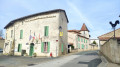
Park in the car park at Place de la Mairie.
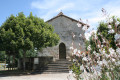
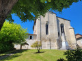
(S/E) Opposite Notre-Dame Church, turn right, then left onto Rue Léonardon. Turn left again onto Rue du Lavoir. After the beautifully restored washhouse, turn right onto Rue de la Font Sainte-Marie, go up to the left then right, following the road. At the first junction, carry straight on and join the RD43.
(1) Cross the road carefully and take the ‘chemin de castine’ opposite, heading towards Chez Moreau.
(2) After about 250 m, take the dirt track on the left: marked in yellow. You can take a break at asecond well-maintained washhouse with picnic tables. Then follow the road, veering slightly to the right, until you reach the T-junction.
(3) Turn right onto the Route de la Pastorale, towards Chez Moreau. Continue along this road through the hamlet, taking time to admire some of the beautiful houses. Join the D43.
(4) Turn left onto the departmental road and follow it carefully for a few dozen metres, then turn right onto the DFCI Vanxa 16 track, continuing to follow the yellow markings.
(5) At the end of the track, turn left onto the Route des Résistants and then take thefirst track on the right, called Impasse des Ruches. Keep to the right at the three-way junction before reaching Les Sions, then turn right again towards the hamlet of La Tisonnie.
(6) Turn left to cross the hamlet, then turn right, following the yellow signposts. As you leave the hamlet, continue along the limestone track and join the Route des Peschiers.
(7) Turn left onto the Route des Peschiers: please note, there are no signposts at this point. Continue along the tarmac road, passing the turn-off for Leybarnie on your left, until you reach a junction with hiking information boards.
(8) Continue along the tarmac road. Pass the turn-off for Le Maine, then a small pond on your right.
(9) About a hundred metres further on, turn right onto the tree-lined path between two fields: yellow signposting. Head down into the forest.
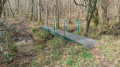
(10) Cross the metal footbridge and, as you climb back up, take the path on the left. Join a road (Impasse des Picadis) and follow it to the left for about 200 metres.
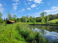
(11) Turn right onto the ‘chemin de castine’. A little further up, there’s a lovely view to the right over the pond and Fouilloux Farm. Further on, you’ll come to a junction near a tarmac road.
(12) Head along the path on the left and cross an area currently being reforested. You’ll reach a road junction.
(13) Turn right onto the tarmac road (Route des Résistants) and continue to a further junction amongst fields and meadows.
(14) Turn left, following the sign for ‘Chez Terrat’, and continue for about 300 m. Then leave the road and take a track on the right at the sign for ‘Chemin des Hérons’.
(15) Before reaching the Pervenche farm, take the dirt track on the right: a little further on, you’ll have a view of some ponds. You’ll emerge onto Route des Cistudes, opposite the Tournepige buildings.
(16) Turn left, then left again at the junction at Élie Dubois to follow the Routedu Bronze.
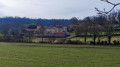
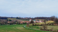
(17) Turn right onto the Route du Conservatoire: there’s a lovely view of Vanxains as you reach the village. Pass the cemetery, rejoin Rue Léonardon and continue on to return to the town hall square, which will be on your right (S/E).
 Visorando Member
 Easy
Easy 
 Tourist office
 Association / Club / Walk leader