Sacoué circular route via Plan d’Ilheu

A short, easy and very pleasant walk, mainly along signposted paths. Ideal for introducing children or those unaccustomed to walking to the joys of hiking: there’s little elevation gain, but enough to give you a sense of sporting achievement!
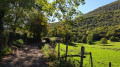
And the colours and light will delight photography enthusiasts!

Details

n°27957015
Creation:
Last update:
Last review:
  • Walking
    Activity: Walking
  • ↔
    Distance: 3.14 mi
  • ◔
    Average duration: 1h 55 
  • ▲
    Difficulty: Easy

  • ⚐
    Back to start: Yes
  • ↗
    Ascent: + 525 ft
  • ↘
    Descent: - 502 ft

  • ▲
    Highest point: 2,169 ft
  • ▼
    Lowest point: 1,640 ft

Photos

Description of the walk

Park in the village to start from the church heading south. Small wooden signs indicate the paths.

(S/E) From the church, head south-west for about fifty metres, then south along the Chemin du Sarrat.
At the fork in the road, at an elevation of 610, keep left and join a small road.

(1) Turn right to follow the yellow markings and take the footpath until you reach a fork.

(2) Turn left between the two ash trees onto the path which descends slightly, then continue between the hazel bushes. The Fontaine de Bioué in the woods is worth a detour if the ground isn’t too waterlogged. Further down, rejoin the D125.

(3) Do not turn onto it. Take the footpath on the right to avoid this departmental road. You will nevertheless reach the other departmental road, the D925.

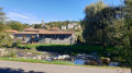
(4) Turn left onto the departmental road for a few metres, head towards the bus shelter and turn left onto the Chemin de Peyrega, then right onto the Chemin de Bareilles. Continue past Plan d’Ilheu and its chapel, then take the D324 departmental road on the left to reach the village of Gaudent and walk through it.

(5) Join the footpath on the right, level with the barn, then turn left, leaving the track on the right which leads to private property.

(6) Turn left again after a small barn (marked in yellow) to head back towards the church along the signposted path, passing the town hall (S/E).


Waypoints

  1. S/E : mi 0 - alt. 1,939 ft - Church Square
  2. 1 : mi 0.59 - alt. 1,913 ft - Small road
  3. 2 : mi 0.74 - alt. 1,864 ft - To the left, between two ash trees
  4. 3 : mi 1.42 - alt. 1,703 ft - Path running parallel to the D125
  5. 4 : mi 1.61 - alt. 1,640 ft - Bus shelter. Chemin Peyrega. Near the - Ourse (rivière)
  6. 5 : mi 2.35 - alt. 1,939 ft - Barn
  7. 6 : mi 2.66 - alt. 2,169 ft - Barn
  8. S/E : mi 3.14 - alt. 1,939 ft

Notes

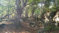
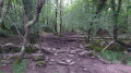
It is advisable to wear waterproof footwear during wet seasons as the route includes sections through woodland.

Reviews and comments

3.3 / 5
Based on 4 reviews

Reliability of the description
3.5 / 5
Ease of following the route
2.8 / 5
Route interest
3.5 / 5
RAMOUNAS
RAMOUNAS

Overall rating : 3.3 / 5

Date of your route : Mar 13, 2026
Reliability of the description : ★★★★☆ Good
Ease of following the route : ★★★☆☆ Average
Route interest : ★★★☆☆ Average
Very busy route : No

Avoid points 5 and 6 and the finish line; after point 5, the path is blocked by trees and acts as a stream; there are 5 herding dogs, including 2 Patous, after point 6. I had to turn back and take the road from point 5 to the finish line.

Machine-translated

allemax
allemax
• Edited:

Overall rating : 3.7 / 5

Date of your route : Feb 21, 2024
Reliability of the description : ★★★★☆ Good
Ease of following the route : ★★★★☆ Good
Route interest : ★★★☆☆ Average
Very busy route : No

The signposting is rather old; the signs need refreshing
At point 6, you must turn left immediately at the corner by the barn. After that, the route is very clear and relatively easy to follow

Machine-translated

Meliande
Meliande

Overall rating : 2.3 / 5

Date of your route : Sep 05, 2023
Reliability of the description : ★★☆☆☆ Disappointing
Ease of following the route : ★★☆☆☆ Disappointing
Route interest : ★★★☆☆ Average
Very busy route : No

The yellow markings are hard to spot. There’s a major problem at point 6, as you have to turn onto a path that’s barely visible after the barn. You end up going round in circles and taking pointless detours… Best avoided after it’s rained.

Machine-translated

Pianopiano
Pianopiano

Overall rating : 3.7 / 5

Date of your route : Aug 19, 2023
Reliability of the description : ★★★★☆ Good
Ease of following the route : ★★☆☆☆ Disappointing
Route interest : ★★★★★ Very good
Very busy route : No

A perfect and magnificent route, but there’s a major drawback at point 6 of the itinerary. The path on the left is completely blocked by vegetation. This forces you to take a perilous detour through the fields, which are protected by barbed wire.

Machine-translated

Other walks in the area

For more walks, use our search engine .

The GPS track and description are the property of this route's author. Please do not copy them without permission.