Circular Quingey route via Cessey and the Ferme des Routes

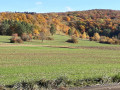
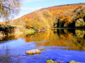
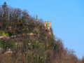
A lovely little walk along the River Loue, then through meadows and forests with a variety of tree species. A family walk with a section emerging from the forest offering a unique view of the village of Quingey.

Details

1613393
Creation:
Last update:
Last review:
  • Walking
    Activity: Walking
  • ↔
    Distance: 3.36 mi
  • ◔
    Average duration: 1h 45 
  • ▲
    Difficulty: Easy

  • ⚐
    Back to start: Yes
  • ↗
    Ascent: + 253 ft
  • ↘
    Descent: - 276 ft

  • ▲
    Highest point: 1,109 ft
  • ▼
    Lowest point: 873 ft
  • ⚐ Country: France
  • ⚐ City: Cessey (25440)
  • ⚑
    Start/End: N 47.106162° / E 5.911703°
  • ❏
    IGN map(s): Ref. 3324ET
  • Hour-by-hour weather

Photos

Description of the walk

This walk starts in Cessey in front of the local sign describing the walks, at the junction of the Chemin de l’Abreuvoir and the Grande Rue.

(S/E) Turn right onto the departmental road and follow it for about 200 metres.

(1) Leave the D286 when you reach the three-way junction. Turn left onto Chemin des Ronchottes, then 100 metres further on, turn left onto a very well-marked path, although it is overgrown with grass. Walk past old orchards and pastures to reach the D101, which you cross to take the white path opposite. Walk for about a hundred metres until you reach the end of the small row of trees.

(2) Leave the track by turning right. Look out for what looks like a track at the corner of the bush on the right and head straight towards the corner of the woodland visible below. At the junction with a track, continue straight ahead, enter the woodland and come out onto a small tarmac road.

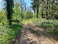
(3) You are now on the Chemin des Routes; follow it to the left. Pass through the hamlet and continue into the woods. Shortly afterwards, take a lovely forest track leading into a fir forest on the left.

(4) Leave the dirt track at a right-angled bend to the right. Follow the dirt track straight ahead. A short distance further on, when you reach a lovely tree-lined avenue, keep right until you come to a farm track that is stony at first, then tarmac. Pass under the A-road and continue downhill, passing through a small housing estate. Reach the D101 and turn right.

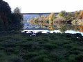
(5) At the pumping station, just past the bus stop, take the small path leading down to the left. Follow the river and pass under the viaduct. Keep as close to the river as possible, then look out for a lovely stony path.

(6) Turn right and head up the Chemin de l’Abreuvoir. Pass the treatment plant’s lagoons. Carry on until you reach the car park (S/E).


Waypoints

  1. S/E : mi 0 - alt. 988 ft - Cantonal information sign
  2. 1 : mi 0.11 - alt. 994 ft - Chemin des Ronchottes on the left
  3. 2 : mi 0.55 - alt. 1,086 ft - Turn right
  4. 3 : mi 0.82 - alt. 1,030 ft - Chemin des Routes
  5. 4 : mi 1.4 - alt. 1,096 ft - Exit the dirt track
  6. 5 : mi 2.33 - alt. 889 ft - Path on the left towards the pumping station - Loue (rivière)
  7. 6 : mi 3.15 - alt. 873 ft - Turn right towards Cessey
  8. S/E : mi 3.36 - alt. 988 ft - Cantonal information sign

Reviews and comments

4.4 / 5
Based on 3 reviews

Reliability of the description
4.3 / 5
Ease of following the route
4.7 / 5
Route interest
4.3 / 5
pnuninger
pnuninger

Hello. Thank you for your comment and your positive feedback.
Have a lovely day. Enjoy your walks.

Machine-translated

mimijulien
mimijulien

Overall rating : 5 / 5

Date of your route : Jul 10, 2023
Reliability of the description : ★★★★★ Very good
Ease of following the route : ★★★★★ Very good
Route interest : ★★★★★ Very good
Very busy route : No

A very pleasant walk. You do need to follow the path carefully – it’s not very visible – as it crosses the field, but it’s easy to find your way back down to the path below. Thank you for posting this little walk.

Machine-translated

pnuninger
pnuninger

Thank you very much for your kind comment. Have a lovely day

Machine-translated

Alaingag
Alaingag

Overall rating : 4.3 / 5

Date of your route : Mar 10, 2022
Reliability of the description : ★★★★★ Very good
Ease of following the route : ★★★★☆ Good
Route interest : ★★★★☆ Good
Very busy route : No

A lovely little walk.

Machine-translated

pnuninger
pnuninger

Thanks. See you later

Machine-translated

henri57
henri57 ★

Hello,

However, it’s visible on the website but I don’t have the tab to publish it.

No problem, the walk has been double-checked and re-approved.

See you soon

Machine-translated

pnuninger
pnuninger

That’s it, it’s sorted. I’ve re-edited the waypoints, re-positioned the start and finish, and re-edited the description comments.
However, it’s visible on the site but I don’t have the tab to publish it.
Thanks

Machine-translated

henri57
henri57 ★

Good evening,

I don’t think that will be a problem. If it is, please let me know and tell me what to do.

Thank you for your prompt response.

Once you’ve finished making the changes, please send me a private message.

See you soon

Machine-translated

pnuninger
pnuninger

Good evening. Following comments from a fellow hiker, I need to change the starting point of this walk to avoid any issues with the police. I’ll set the starting point in the village of Cessey. There’s also a change to point 3, as it wasn’t specific enough. I’ll repost it afterwards. I don’t think this will cause any problems. If it does, please let me know and tell me what to do. Kind regards

Machine-translated

pnuninger
pnuninger

OK. Thanks. I didn’t think that would cause any problems. I’ll change the start and finish points to the village of Cessey.
Regarding point 3, I could see a few tractor tracks. I’ll make an amendment.
Enjoy your walks

Machine-translated

reveillo
reveillo

Overall rating : 4 / 5

Date of your route : Nov 25, 2018
Reliability of the description : ★★★☆☆ Average
Ease of following the route : ★★★★★ Very good
Route interest : ★★★★☆ Good

Please note, there’s no car park in front of the pumping station – it’s a bus stop. On our return, we learnt that the police had stopped by our car!
A minor problem at No. 3: you can’t see the track; you have to cut across the fields, at right angles to the path you’re on
A nice little walk

Machine-translated

Other walks in the area

For more walks, use our search engine .

The GPS track and description are the property of this route's author. Please do not copy them without permission.