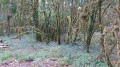
Pressiat to Val-Revermont circular loop

A pleasant walk that takes you along a variety of paths – tarmac, dirt and stony – with some lovely views and, if you’re lucky, the chance to watch paragliders taking off from Mont Myon.

Details

3888309
Creation:
Last update:
Last review:
  • Walking
    Activity: Walking
  • ↔
    Distance: 5.04 mi
  • ◔
    Average duration: 2h 40 
  • ▲
    Difficulty: Moderate

  • ⚐
    Back to start: Yes
  • ↗
    Ascent: + 374 ft
  • ↘
    Descent: - 374 ft

  • ▲
    Highest point: 1,142 ft
  • ▼
    Lowest point: 771 ft

Description of the walk

The car park and starting point are at Place de Pressiat “18 July 1944”.

(S/E) Turn right as you leave the car park to walk past the town hall and head towards the Auberge du Mont Myon. Once there, take the tarmac path on the left which runs alongside the inn.
When you reach a three-way junction, at elevation 307, turn left onto the tarmac path and continue to the next junction.

(1) Follow the stony track opposite and carry on straight ahead along the main track.

(2) At the crossroads, carry on straight ahead along the dirt track, which then becomes a stony track.

(3) At the tarmac road in the hamlet of Carisse, turn left and carry on straight ahead towards the La Grange du Pin campsite.

(4) At the 45 km/h speed limit sign, take the small dirt track on the left which leads into the woodland. After following the path, take the track that branches off to the right and do not go downhill.

(5) Take the small path on the left which leads downhill. Be careful not to slip as you reach a makeshift bridge made of concrete posts, which will take you across a small stream; then continue straight on at the clearing to re-enter the woodland. Continue along the main path towards the tarmac road, then turn right towards a car park.

(6) Leave the road at the gravel turning area, take the small path on the right which leads down into the woodland again immediately on the left.
At the Y-junction, turn left, then turn right at the tarmac path.

(7) Turn left onto the Chemin des Fontenailles. At the end of the tarmac road, turn right, then at the central tree, turn left.

(8) At the junction with the D52, turn left, then veer right onto the Route du Revermont (at the houses opposite you), then continue to the car park (S/E).

Waypoints

  1. S/E : mi 0 - alt. 1,135 ft - Car park, Place du 18 Juillet 1944
  2. 1 : mi 1.08 - alt. 919 ft - Junction.
  3. 2 : mi 1.81 - alt. 827 ft - Opposite, on the dirt track
  4. 3 : mi 2.35 - alt. 827 ft - Carisse crossroads
  5. 4 : mi 2.86 - alt. 866 ft - A small dirt track on the left.
  6. 5 : mi 3.11 - alt. 820 ft - Small bridge
  7. 6 : mi 3.51 - alt. 840 ft - Car park.
  8. 7 : mi 3.96 - alt. 951 ft - Chemin des Fontenailles.
  9. 8 : mi 4.86 - alt. 1,089 ft - D52 junction
  10. S/E : mi 5.05 - alt. 1,135 ft - Car park, Place du 18 Juillet 1944

Notes

Follow route No. 4; the signposting is fairly clear.

Worth a visit

(7) On the tarmac road, look ahead – with a bit of luck, you’ll be able to count the paragliders taking off from Mont Myon.

Reviews and comments

4.5 / 5
Based on 2 reviews

Reliability of the description
4.5 / 5
Ease of following the route
4.5 / 5
Route interest
4.5 / 5
Pierre des Vignes
Pierre des Vignes

Overall rating : 4.3 / 5

Date of your route : Aug 09, 2021
Reliability of the description : ★★★★★ Very good
Ease of following the route : ★★★★☆ Good
Route interest : ★★★★☆ Good
Very busy route : No

An easy walk, half through fields and half through woodland.
Be sure to pop into the church in PRESSIAT. No need to say any more.
On the way, you’ll also come across an inn whose menu makes it well worth a visit.

Machine-translated

tenebre6683
tenebre6683

Hello Béa,

Thank you for your feedback; I’m glad you’re enjoying the route.
As for the duration, that’s just a rough guide – it might be quicker for keen walkers or take longer for those who aren’t used to walking.
I hope you enjoy your walks.
Julien

Machine-translated

Bea.31
Bea.31
• Edited:

Overall rating : 4.7 / 5

Date of your route : Feb 21, 2021
Reliability of the description : ★★★★☆ Good
Ease of following the route : ★★★★★ Very good
Route interest : ★★★★★ Very good
Very busy route : No

A lovely, idyllic walk – very accessible and varied:
You go from narrow lanes to rockier paths and walk through some lovely pine forests.
We really enjoyed it. Very lovely scenery.
However, we completed it faster than the estimated time; it took us barely 2 hours.

Machine-translated

Other walks in the area

For more walks, use our search engine .

The GPS track and description are the property of this route's author. Please do not copy them without permission.