Notre-Dame de Capimont circular

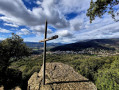
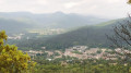
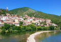
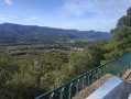
A short walk with a historical focus and a beautiful view over the valley. This route takes you on a wide circular route, allowing you to discover a thoroughly pleasant and refreshing historical and religious site.

Details

22082103
Creation:
Last update:
Last review:
  • Walking
    Activity: Walking
  • ↔
    Distance: 3.29 mi
  • ◔
    Average duration: 2h 05 
  • ▲
    Difficulty: Easy

  • ⚐
    Back to start: Yes
  • ↗
    Ascent: + 673 ft
  • ↘
    Descent: - 673 ft

  • ▲
    Highest point: 1,257 ft
  • ▼
    Lowest point: 577 ft

Photos

Description of the walk

Park in the large car park called ‘Calmes’, which provides access to the town centre.

(S/E) Head back towards Boulevard Saint-Michel, cross it, turn right, go past the roundabout and take Rue de Capimont.
Follow this street to the motorhome site.

(1) Walk past the entrance to the site and take the wide path opposite (tarmacked at the start), marked by a wooden sign pointing towards Notre-Dame de Capimont.

(2) Continue in the same direction (north), ignoring the paths to the right and left.

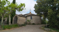
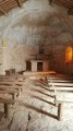
(3) Turn left onto the tarmac road and head for the chapel.
The return journey follows the same route to start with, then take the first path on the right; this follows the contour lines almost exactly and is marked in yellow.

(4) Turn right onto the small road towards the hamlet of Bardejean,

(5) Before reaching the hamlet, look out for a path on the left overlooking a house (clearly marked in yellow)
The road becomes a footpath and begins to descend, crossing a first small road, then a second. The descent continues through the forest.

(6) Reach Boulevard Saint-Michel via a few steps, turn left and follow the boulevard to return to the starting car park (S/E).


Waypoints

  1. S/E : mi 0 - alt. 584 ft - “Calmes” car park - Bitoulet (rivière) - Affluent de de l'Orb
  2. 1 : mi 0.64 - alt. 699 ft - Path opposite
  3. 2 : mi 0.88 - alt. 833 ft - Straight ahead
  4. 3 : mi 1.32 - alt. 1,194 ft - Junction - Église Notre-Dame de Capimont (Lamalou-les-Bains)
  5. 4 : mi 2.21 - alt. 971 ft - Junction
  6. 5 : mi 2.36 - alt. 981 ft - Junction
  7. 6 : mi 2.92 - alt. 620 ft - Boulevard on the left
  8. S/E : mi 3.29 - alt. 584 ft - “Calmes” car park

Worth a visit

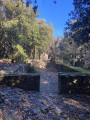
Take your time at the Notre-Dame de Capimont site; it is shaded and has picnic tables, and an information board tells you about the landscape (peaks, villages).

Reviews and comments

4.4 / 5
Based on 3 reviews

Reliability of the description
4.7 / 5
Ease of following the route
4.3 / 5
Route interest
4.3 / 5
titi06480
titi06480

Overall rating : 5 / 5

Date of your route : Sep 22, 2025
Reliability of the description : ★★★★★ Very good
Ease of following the route : ★★★★★ Very good
Route interest : ★★★★★ Very good
Very busy route : No

Lovely walk, in the shade, magnificent view of the chapel.

Machine-translated

patrujmmf
patrujmmf

Overall rating : 4 / 5

Date of your route : Mar 30, 2025
Reliability of the description : ★★★★☆ Good
Ease of following the route : ★★★★☆ Good
Route interest : ★★★★☆ Good
Very busy route : No

A fairly long climb up a stony path, a very pretty spot, a visit to the chapel, and a pleasant walk back down.

Machine-translated

jeanine terral
jeanine terral

Overall rating : 4.3 / 5

Date of your route : Mar 12, 2025
Reliability of the description : ★★★★★ Very good
Ease of following the route : ★★★★☆ Good
Route interest : ★★★★☆ Good
Very busy route : Yes

A moderate hike – not as easy as advertised. Very rugged terrain. The path is sometimes just a small stream, so it’s best not to do this walk after it’s rained. The view from the Notre Dame de Capimont site is magnificent.

Machine-translated

Other walks in the area

For more walks, use our search engine .

The GPS track and description are the property of this route's author. Please do not copy them without permission.