Circular Martillac via the wine châteaux

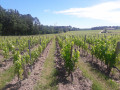
This walk through the vineyards is notable for its many wine châteaux, an ancient church with a purely Romanesque chancel, and the region’s significant lily-of-the-valley production.
You’ll pass the châteaux Latour Martillac, Haut Nouchet and Cruzeau Martillac, situated on the outskirts of the Bordeaux conurbation.
A village in Aquitaine situated in southern Gironde, Martillac forms part of the Pessac-Léognan wine-growing region, which lends its wines a prestigious appellation.

Details

1357144
Creation:
Last update:
Last review:
  • Walking
    Activity: Walking
  • ↔
    Distance: 6.15 mi
  • ◔
    Average duration: 2h 55 
  • ▲
    Difficulty: Easy

  • ⚐
    Back to start: Yes
  • ↗
    Ascent: + 66 ft
  • ↘
    Descent: - 66 ft

  • ▲
    Highest point: 184 ft
  • ▼
    Lowest point: 79 ft
  • ⚐ Country: France
  • ⚐ City: Martillac (33650)
  • ⚑
    Start/End: N 44.714052° / W 0.542323°
  • ❏
    IGN map(s): Ref. 1537SB
  • Hour-by-hour weather

Photos

Description of the walk

Park in the car park at Martillac church.

(S/E) Walk round the back of the church, then, opposite No. 5, turn left. Walk for about 150 m and turn right onto Chemin de la Tour. Walk past the Château de la Tour Martillac and head for the gate opposite the Château Haut Nouchet.

(1) Turn left at the gate and walk alongside the vineyard. When you reach a ditch, turn left just before it. Take the second bridge on the right, then continue straight on (path not shown on the map) until you reach the cross-path.

(2) Turn left onto it, then turn right at the end of the hedge. Continue to the houses at Naudin, turn right again into the vineyards, then left to reach some more houses. Follow the wire fences and then the vineyard for a few metres, then turn left to reach the driveway leading to Château Cruzeau.

(3) Walk past the entrance to the château, continue straight on towards the woodland, leaving the white track behind. Turn right, then left, then right again to walk alongside the woodland and the vineyards. Take the white track on the right, running alongside the woodland, to reach the junction with a wide track.

(4) Take the path opposite until you reach the power line. Turn left under the power line and follow it until you are near the junction with the D109 road. Head slightly to the right to join the road, cross carefully, go through the barrier and head towards the Bel-Air house.

(5) Turn right to take thesecond track which passes near the shed and continue straight on. Head slightly to the left, then continue until you reach thesecond track on the right.

(6) Turn right, then right again at the next junction. Carry on along this wide track until you reach the houses at Tanticoste.

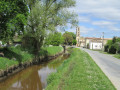
(7) Turn left onto the road (be careful here, as it’s a busy road). You can walk along the edge of the vineyard on the left-hand side for part of the way to avoid walking on the road. Cross the bridge over the little stream known as the Nouchet, then carry on until you reach a four-way junction.

(8) Turn right onto the small road (light traffic) which leads back to the village centre. Pass through the Gorre neighbourhood, then follow the clearly visible church spire to the car park (S/E).

Waypoints

  1. S/E : mi 0 - alt. 131 ft - Church Square
  2. 1 : mi 0.58 - alt. 118 ft - Barrier opposite Haut Nouchet Castle
  3. 2 : mi 1.14 - alt. 121 ft - Dirt track
  4. 3 : mi 2.01 - alt. 128 ft - Entrance to Cruzeau Castle
  5. 4 : mi 2.67 - alt. 148 ft - Four-way junction
  6. 5 : mi 3.42 - alt. 184 ft - Maison de Bel-Air
  7. 6 : mi 4.07 - alt. 177 ft - Four-way junction
  8. 7 : mi 4.78 - alt. 171 ft - D109 road
  9. 8 : mi 5.19 - alt. 157 ft - Crossroads, road on the right
  10. S/E : mi 6.15 - alt. 128 ft - Church Square

Reviews and comments

4.1 / 5
Based on 22 reviews

Reliability of the description
4.1 / 5
Ease of following the route
4.3 / 5
Route interest
4 / 5
Denis26
Denis26 ★

Thank you, Minos, for your comments; I’ve just clarified the description.

Machine-translated

Minos
Minos
• Edited:

Overall rating : 2 / 5

Date of your route : Aug 11, 2026
Reliability of the description : ★★☆☆☆ Disappointing
Ease of following the route : ★★☆☆☆ Disappointing
Route interest : Not used / Not applicable
Very busy route : No

(S/E) ‘Take the road towards Château de l’Hironde’ (???)
No! The Route de l’Hironde is 150 metres further south.
The road we’re directed to take at the start is the Route de Lartigue, heading due east, and after 250 m, you need to turn right.

(1) “Turn left at the barrier and follow the vineyard. Turn right at the edge of the woodland, then left to follow the ditch. Cross the bridge to the right, then head diagonally left to reach the edge of the woodland. Follow it and carry on straight ahead until you reach the dirt track.”
‘Follow it’! Follow it which way? To the right or to the left? In either case, there’s no white track.
We returned to Château Latour via the north to rejoin the route, heading straight to point 4.

Given the state of the path leading to point 5, we returned to point 4 and went back up this tarmac road to rejoin the route between points 7 and 8.

It’s absolutely essential to revisit points 1, 2 and 3; this will restore the route to its full appeal.
But we’re certainly not very good walkers

Machine-translated

cascoromero
cascoromero

Overall rating : 4.7 / 5

Date of your route : Mar 16, 2026
Reliability of the description : ★★★★★ Very good
Ease of following the route : ★★★★☆ Good
Route interest : ★★★★★ Very good
Very busy route : No

Very interesting and well signposted, easy to follow with GPS; the only downside is towards the end, where there’s a stretch of roughly 300 metres along a busy track where it’s difficult to walk on the sides, which have been ploughed up – an old field full of shrub stumps.

Machine-translated

GuyMP
GuyMP

Overall rating : 4.3 / 5

Date of your route : May 03, 2025
Reliability of the description : ★★★★★ Very good
Ease of following the route : ★★★★★ Very good
Route interest : ★★★☆☆ Average
Very busy route : No

Pros: Very easy hike on flat terrain and very easy to follow with the trail. Cons: Somewhat monotonous scenery and the edges of the ponds are littered with fly-tipped rubbish.

Machine-translated

SYLLAV
SYLLAV

Overall rating : 3.7 / 5

Date of your route : Mar 03, 2025
Reliability of the description : ★★★★☆ Good
Ease of following the route : ★★★★☆ Good
Route interest : ★★★☆☆ Average
Very busy route : No

A somewhat monotonous route, vineyards, pine forests, vineyards, pine forests... apart from the three châteaux at the start of the hike, nothing particularly interesting.

Machine-translated

Bauma
Bauma

Overall rating : 4.3 / 5

Date of your route : Sep 09, 2024
Reliability of the description : ★★★★★ Very good
Ease of following the route : ★★★★★ Very good
Route interest : ★★★☆☆ Average
Very busy route : No

A very pleasant route at the beginning, where you pass magnificent wine châteaux, but far too much of it is on roads or paths very close to roads, perhaps 30%
Easy hike but too dangerous
to do with children:🚶🏻‍♂️

Machine-translated

Neimy
Neimy

Overall rating : 4.3 / 5

Date of your route : Aug 19, 2024
Reliability of the description : ★★★★☆ Good
Ease of following the route : ★★★★★ Very good
Route interest : ★★★★☆ Good
Very busy route : No

A pleasant walk through vineyards and forest, providing shelter from the sun. However, part of the path along the electricity pylons was not very clear (tall grass and uprooted trees blocking the way) and was uninteresting.

Machine-translated

sylvie33
sylvie33

Overall rating : 4.3 / 5

Date of your route : Sep 04, 2023
Reliability of the description : ★★★★☆ Good
Ease of following the route : ★★★★☆ Good
Route interest : ★★★★★ Very good
Very busy route : No

A lovely circular that offers hikers beautiful views of the Martillac vineyards.
There is just one small problem with a fence that forces us to go around a few houses – already reported by other hikers.

Machine-translated

palois
palois

Overall rating : 4.7 / 5

Date of your route : Feb 16, 2023
Reliability of the description : ★★★★★ Very good
Ease of following the route : ★★★★★ Very good
Route interest : ★★★★☆ Good
Very busy route : No

Pleasant, well-marked route. Easy to follow using the Visorando mobile app

Machine-translated

So 33
So 33

Overall rating : 4.3 / 5

Date of your route : Feb 09, 2023
Reliability of the description : ★★★★☆ Good
Ease of following the route : ★★★★☆ Good
Route interest : ★★★★★ Very good
Very busy route : No

we got a bit lost walking along the first wood, but thanks to Greece à la carte, we found our way back on track. A really nice hike

Machine-translated

Yves B
Yves B
• Edited:

Overall rating : 3 / 5

Date of your route : Mar 20, 2022
Reliability of the description : ★★★★☆ Good
Ease of following the route : ★★★★☆ Good
Route interest : ★☆☆☆☆ Very disappointing
Very busy route : No

The route winds around the high-voltage power line (400 KV...), under which we travel for 500 metres, making some of us shiver. The banks of the pond near point 6 serve as a landfill site and, at the same time, a motocross track. their drivers try to make more noise than the wealthy Bordeaux residents who make vroom vroom noises in their planes, as the Saucats Léognan aerodrome is nearby. To avoid the busy main road, we took a more westerly route and found ourselves in an area where the ground had been stripped, no doubt to make way for a new quarry...

The only attractive scenery is near the village, notably two pretty wine cellars. The rest is best avoided....

Machine-translated

DOUCAT
DOUCAT

Overall rating : 4 / 5

Date of your route : May 02, 2021
Reliability of the description : ★★★☆☆ Average
Ease of following the route : ★★★★☆ Good
Route interest : ★★★★★ Very good
Very busy route : No

A very pleasant hike, but best done in dry weather: the first part takes you through the vineyards of Graves.
Be careful! There is no shade, so you will need the Visorando app to find your way through this wine-growing maze. The second part of the hike takes you along forest paths in the shade in summer. The last kilometre is on a country road that is not very busy at weekends, with wide enough verges to walk on.

Machine-translated

villenavais
villenavais

Overall rating : 4 / 5

Date of your route : Apr 27, 2021
Reliability of the description : ★★★★☆ Good
Ease of following the route : ★★★★☆ Good
Route interest : ★★★★☆ Good
Very busy route : No

A pleasant circular, completed on 26 April, the first day of rain in Aquitaine, but it went well. Be careful along the edge of the main road; you can veer off towards the woods or vineyards, especially in dry weather.

Machine-translated

Etevlys
Etevlys
• Edited:

Overall rating : 4 / 5

Date of your route : Mar 30, 2021
Reliability of the description : ★★★★☆ Good
Ease of following the route : ★★★★☆ Good
Route interest : ★★★★☆ Good
Very busy route : No

hello: I enjoyed this hike through vineyards and woods in good weather, despite a small mistake in the route that was quickly corrected. I must do it again with a friend
I didn't meet any hikers on this route, but I did meet some hikers doing a different route, equipped with their route description, with whom I exchanged a few words. Thank you, Visorando.

Machine-translated

Doboul
Doboul

Overall rating : 3.7 / 5

Date of your route : Apr 02, 2021
Reliability of the description : ★★★☆☆ Average
Ease of following the route : ★★★☆☆ Average
Route interest : ★★★★★ Very good
Very busy route : No

i couldn't get to Bel Air. It was difficult to follow the power line, which was a shame because we lost track of the route
but it was enjoyable. I'll do it again

Machine-translated

Other walks in the area

For more walks, use our search engine .

The GPS track and description are the property of this route's author. Please do not copy them without permission.