When the Romans lead us to Marson

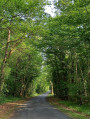
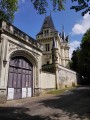
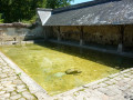
A lovely trip to the countryside through woods and meadows, taking in the Land Art, the castle and Marson Pond along the way.

Details

46725160
Creation:
Last update:
Last review:
  • Walking
    Activity: Walking
  • ↔
    Distance: 7.09 mi
  • ◔
    Average duration: 3h 25 
  • ▲
    Difficulty: Moderate

  • ⚐
    Back to start: Yes
  • ↗
    Ascent: + 194 ft
  • ↘
    Descent: - 197 ft

  • ▲
    Highest point: 259 ft
  • ▼
    Lowest point: 121 ft
  • ⚐ Country: France
  • ⚐ City: Distré (49400)
  • ⚑
    Start/End: N 47.243106° / W 0.115049°
  • ❏
    IGN map(s): Ref. 1623ET, 1623SB
  • Hour-by-hour weather

Photos

Description of the walk

Take the Ogalo bus, line 36, to the Les Romans stop.

(S/E) Take the Voie Romaine downhill; this is also theGR®®3, marked in white and red. Walk along the Bois de Pocé and reach a four-way crossroads at the entrance to Riou.

(1) Leave theGR®®, turn right, continue through the woods and stay on this path, ignoring the paths branching off to the right and left. You’ll reach a crossroads marked by two pillars.

(2) Pass between them and continue straight ahead to quickly reach a multi-way junction.

(3) Head diagonally left along the Montée du Château to reach the castle.

(4) Take the path on the left, then the steps shortly afterwards on the right, go down the Chemin du Tertre and then turn right onto Rue Fricotelle. At the church, turn right onto the Montée du Château to return to the castle.

(4) Then head back in the opposite direction to return to the multi-way junction you passed earlier.

(3) Then turn left onto theGR®®3, marked in white and red. Enter the woods on the left and continue until you reach a T-junction, near the metal gate leading to the École Nationale d’Équitation du Cadre Noir in Saumur.

(5) Keep left on theGR®® and reach the Étang de Marson junction.

(6) Leave theGR®® here to cross the stream, continue on and, after passing thesecond high-voltage power line, you will come to another junction.

(7) Take a narrow path on the left. After a left-hand bend, pass under the
first high-voltage power line and reach another junction.

(8) Stay on the path to the left and now pass under thesecond high-voltage power line to reach the Route de l’Étang; continue to the right to reach the Chemin de la Croix junction.

(9) Turn right onto this path, pass in front of the Croix de Marson and reach the crossroads of the hamlet of La Noue. Turn left at a 90° angle to reach the edge of the Bois de Godebert.

(10) Walk along the edge of the woods on the right, then enter them again on the left. Pass under the power lines and past a cemetery, then cross the D305 with care before entering the village of Riou. At the village exit, you will come to the junction you passed on the way out.

(1) Continue opposite, retracing your steps in the opposite direction to return to the Les Romans bus stop (S/E).

Waypoints

  1. S/E : mi 0 - alt. 184 ft - Les Romans bus stop
  2. 1 : mi 0.94 - alt. 200 ft - Crossroads at the circular loop
  3. 2 : mi 1.52 - alt. 207 ft - Crossroads (pillars)
  4. 3 : mi 1.72 - alt. 213 ft - Crossroads at the circular castle loop
  5. 4 : mi 1.9 - alt. 164 ft - Junction for the A/R route - Chateau de Marson
  6. 5 : mi 3.03 - alt. 259 ft - Metal gate
  7. 6 : mi 3.45 - alt. 203 ft - Marson Pond
  8. 7 : mi 3.82 - alt. 226 ft - T-junction
  9. 8 : mi 4.21 - alt. 220 ft - High-voltage power lines
  10. 9 : mi 4.54 - alt. 184 ft - Chemin de la Croix de Manson
  11. 10 : mi 5.22 - alt. 184 ft - Crossroads at the edge of the woods
  12. S/E : mi 7.09 - alt. 184 ft - Les Romans bus stop

Notes

(4) Picnic area.

Worth a visit

(S/E) After the ‘end of built-up area’ sign, you can see Pocé Castle on the left.
(4) Exterior view of Marson Castle.
(4) To see the Land Art exhibition, take the botanical trail created by volunteers, featuring numerous works to discover along the way.
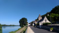
(4) Sainte-Croix Church in Marson
(6) Marson Pond.
Between (10) and (1) Rue du Pavé, take a look at the many cellars lining Rue du Pavé.

Always be cautious and plan ahead when you're outdoors. Visorando and the author of this route cannot be held responsible for any accidents occurring on this route.

The GR® and PR® markings are the intellectual property of the Fédération Française de Randonnée Pédestre.

Reviews and comments

4.7 / 5
Based on 1 review

Reliability of the description
5 / 5
Ease of following the route
5 / 5
Route interest
4 / 5
mortagne17
mortagne17

Overall rating : 4.7 / 5

Date of your route : Aug 26, 2025
Reliability of the description : ★★★★★ Very good
Ease of following the route : ★★★★★ Very good
Route interest : ★★★★☆ Good
Very busy route : No

Beautiful, easy hike - Passes near Marson Castle

Machine-translated

Other walks in the area

For more walks, use our search engine .

The GPS track and description are the property of this route's author. Please do not copy them without permission.