In the footsteps of Robrica in Chênehutte

A hilly, wooded route. Situated on the left bank of the Loire, downstream from Saumur, this village in the Loire Valley is a former Gallo-Roman settlement and home to one of the most important archaeological sites in Maine-et-Loire. Finds made on the plateau prove human presence dating back to the Neolithic period (4500 to 4000 BC).

Details

n°945175
Creation:
Last update:
Last review:
  • Walking
    Activity: Walking
  • ↔
    Distance: 5.16 mi
  • ◔
    Average duration: 2h 35 
  • ▲
    Difficulty: Easy

  • ⚐
    Back to start: Yes
  • ↗
    Ascent: + 262 ft
  • ↘
    Descent: - 246 ft

  • ▲
    Highest point: 299 ft
  • ▼
    Lowest point: 95 ft

Photos

Description of the walk

Start: Chênehutte-les-Tuffeaux (Pont Pouillet car park) – Markings: Yellow – Suitable for hybrid bikes/mountain bikes:

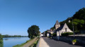
(S/E) From the car park, take Rue des Bords de Loire towards the village.

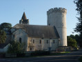
(1) Turn into the third street on the left, Rue du Comte de Castellane, towards the Château du Prieuré. Take the first path on the left towards the Roman camp and carry on straight ahead.

(2) Carry on along the third path on the left, then turn left again onto Rue du Marais.

(3) At the junction, turn right and continue straight on along the track through the woods.

(4) At the junction, turn left. Continue along the path until you reach the fourth junction.

(5) Turn left. At the next junction, carry on straight ahead until you reach the third junction after crossing the Loire à Vélo cycle route.

(6) Turn left onto theGR®®3and carry on until you reach Route du Petit Puy.

(7) Turn right. At the end of the street, turn right. Continue straight on and return to the starting point (S/E)

Waypoints

  1. S/E : mi 0 - alt. 98 ft - Pont Pouillet car park - La Loire
  2. 1 : mi 0.25 - alt. 102 ft - Rue Comte de Castellane
  3. 2 : mi 0.94 - alt. 236 ft - Path on the left
  4. 3 : mi 1.17 - alt. 161 ft - Path through the woods
  5. 4 : mi 2.15 - alt. 276 ft - Path on the left
  6. 5 : mi 3.1 - alt. 295 ft - Chemin du puits
  7. 6 : mi 4.08 - alt. 243 ft - Path on the left
  8. 7 : mi 4.7 - alt. 269 ft - Route du Petit Puy
  9. S/E : mi 5.16 - alt. 98 ft - Pont Pouillet car park

Notes

Worth a visit

Along the route
- The Church of Notre-Dame-de-la-Prée-des-Tuffeaux
- The former Benedictine priory (the ‘Le Prieuré’ hotel and restaurant) and the ruins of Saint-Pierre Church (10th century)
- Archaeological sites: the oppidum at Chênehutte and the Gallo-Roman settlement at La Fouchardière.

Nearby
- The Temple of Villiers (Gallo-Roman fanum), Grissay Manor (private) and the Saint-Jean hermitage at Chênehutte
- The Tower of Trèves, Saint-Aubin Church and the Priory of Saint-Macé (private) in Trèves
- The Priory of Cunault (3 km)
- The Cave aux Moines in Préban (1 km)

Always be cautious and plan ahead when you're outdoors. Visorando and the author of this route cannot be held responsible for any accidents occurring on this route.

The GR® and PR® markings are the intellectual property of the Fédération Française de Randonnée Pédestre.

Reviews and comments

4.1 / 5
Based on 7 reviews

Reliability of the description
3.9 / 5
Ease of following the route
4.4 / 5
Route interest
4 / 5
pierre1er
pierre1er

Overall rating : 4.7 / 5

Date of your route : Oct 10, 2023
Reliability of the description : ★★★★☆ Good
Ease of following the route : ★★★★★ Very good
Route interest : ★★★★★ Very good
Very busy route : No

A lovely walk on this beautiful autumn day – and I was really lucky. I didn’t hear a single gunshot. The paths are very well maintained and haven’t been badly damaged by farm machinery. Definitely worth a visit.

Machine-translated

balou17
balou17

Overall rating : 1.7 / 5

Date of your route : Sep 29, 2022
Reliability of the description : ★☆☆☆☆ Very disappointing
Ease of following the route : ★★★☆☆ Average
Route interest : ★☆☆☆☆ Very disappointing
Very busy route : No

60% woodland, the rest farmland. Nothing to see here; not worth a visit.

Machine-translated

Meterichard
Meterichard

Overall rating : 4.7 / 5

Date of your route : Aug 30, 2021
Reliability of the description : ★★★★★ Very good
Ease of following the route : ★★★★★ Very good
Route interest : ★★★★☆ Good
Very busy route : No

Nice. Could do with a bit more of a view of the Loire

Machine-translated

CHRIS001
CHRIS001

Overall rating : 4.7 / 5

Date of your route : Aug 21, 2020
Reliability of the description : ★★★★★ Very good
Ease of following the route : ★★★★★ Very good
Route interest : ★★★★☆ Good
Very busy route : No

Very pleasant.

Machine-translated

domlozach
domlozach

Overall rating : 4 / 5

Date of your route : Jul 12, 2020
Reliability of the description : ★★★★☆ Good
Ease of following the route : ★★★★☆ Good
Route interest : ★★★★☆ Good
Very busy route : No

A lovely walk, with a lovely stretch through the woods – perfect for hot weather!

Machine-translated

sergio49
sergio49

Overall rating : 4.3 / 5

Date of your route : Aug 19, 2019
Reliability of the description : ★★★★☆ Good
Ease of following the route : ★★★★☆ Good
Route interest : ★★★★★ Very good

Well worth a visit – a very pleasant walk

Machine-translated

mcb52
mcb52

Overall rating : 4.7 / 5

Date of your route : Jun 01, 2019
Reliability of the description : ★★★★☆ Good
Ease of following the route : ★★★★★ Very good
Route interest : ★★★★★ Very good

A lovely walk, with no particular difficulties. The signposting is very clear and highly visible.

Machine-translated

Other walks in the area

For more walks, use our search engine .

The GPS track and description are the property of this route's author. Please do not copy them without permission.