Loupchat Circular Loop

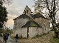
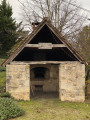
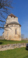
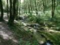
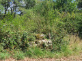
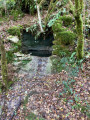
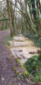
A walk around Loupchat, a small, typical village in the Lot, near Martel. It has a beautiful church, a bread oven and more. This walk is suitable for children; it is not at all difficult, consisting of stone-paved paths, woodland and a few small roads. It ends with a very pretty little path through the woodland.

Details

42154590
Creation:
Last update:
Last review:
  • Walking
    Activity: Walking
  • ↔
    Distance: 4.82 mi
  • ◔
    Average duration: 2h 40 
  • ▲
    Difficulty: Easy

  • ⚐
    Back to start: Yes
  • ↗
    Ascent: + 568 ft
  • ↘
    Descent: - 548 ft

  • ▲
    Highest point: 1,106 ft
  • ▼
    Lowest point: 712 ft

Photos

Description of the walk

Coming from Martel via the D803, drive through the small village of Loupchat and park next to the bread oven.

(S/E) Walk back through the village, heading due south. On leaving the village, walk past the church.

(1) Immediately take a path on the left which goes downhill and joins a Y-junction.

(2) Turn left and continue along the path, heading due east. Cross a road and arrive at a four-way junction (elevation 215).

(3) Turn left onto the road, heading due north, and carry on straight ahead to the hamlet of La Gilardie. Pass through this hamlet and carry on straight ahead, north-east, along the track which joins a road, until you reach the hamlet of Bonard. Pass through this hamlet.

(4) Turn left at the end of the hamlet, carry on straight ahead and, after a right-hand bend, you’ll reach a junction with a road on the left.

(5) Turn left onto this Route de Puy Gastal to reach a crossroads (elevation 322).

(6) Cross it and carry on straight ahead along the Route de Bouygareles, heading south-west. Pass the hamlet of Barbarou and carry on straight ahead. Ignore a road on the right and carry on for a few metres.

(7) Turn left, heading south-west, onto the small track. Carry on straight ahead to reach the car park (S/E).


Waypoints

  1. S/E : mi 0 - alt. 892 ft - Car park next to the bread oven
  2. 1 : mi 0.17 - alt. 896 ft - Saint-Martin Church, on the left
  3. 2 : mi 0.45 - alt. 768 ft - Junction, turn left
  4. 3 : mi 0.85 - alt. 712 ft - Four-way junction, turn left
  5. 4 : mi 2.43 - alt. 837 ft - Bonard hamlet, path on the left
  6. 5 : mi 3.05 - alt. 951 ft - At the fork, turn left
  7. 6 : mi 3.42 - alt. 1,060 ft - Road junction, straight ahead
  8. 7 : mi 4.11 - alt. 1,027 ft - Junction, turn left
  9. S/E : mi 4.82 - alt. 892 ft - Car park next to the bread oven

Reviews and comments

4 / 5
Based on 4 reviews

Reliability of the description
3.8 / 5
Ease of following the route
3.5 / 5
Route interest
4.8 / 5
Jpmezdu
Jpmezdu

Overall rating : 4 / 5

Date of your route : May 12, 2025
Reliability of the description : ★★★★☆ Good
Ease of following the route : ★★★☆☆ Average
Route interest : ★★★★★ Very good
Very busy route : No

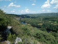
A pleasant walk through woodland, meadows and quiet country lanes with hardly any traffic. There are several superb views along the way. Please note: in places there are steep inclines, although the description states it is ‘easy’ and ‘suitable for children’.
DO NOT go through the hamlet of Bonard AND
turn left. INSTEAD, turn left WITHIN the hamlet at the small square with a lime tree.
Perhaps a small correction is needed?
No signposting. A compass and map are essential!!!
Make sure you bring water. There are no springs along the route.
You can start from Martel, which adds about 6 km to the walk via a small road that will take you through the surrounding countryside and past some beautiful wooden sculptures near a lodge.

Machine-translated

PolJean
PolJean

Overall rating : 4.3 / 5

Date of your route : Dec 02, 2024
Reliability of the description : ★★★★☆ Good
Ease of following the route : ★★★★☆ Good
Route interest : ★★★★★ Very good
Very busy route : Yes

A land of hunters!!!

Machine-translated

POULIN Gérard
POULIN Gérard ★

Good evening, Jano the Doc,
There’s no information in the route description about signposting, so you’ll need to follow the route description and the map provided.
It’s a shame to rate such a route as disappointing; neither Visorando nor the author are responsible for the lack of or poor signposting.

Machine-translated

jano le doc
jano le doc

Overall rating : 2.7 / 5

Date of your route : Feb 18, 2024
Reliability of the description : ★★☆☆☆ Disappointing
Ease of following the route : ★★☆☆☆ Disappointing
Route interest : ★★★★☆ Good
Very busy route : No

Many routes cross each other.
The one we did had no proper signposting; we followed our instincts for the most part, using, of course, the photocopy we’d taken from Visio Rendo.
We didn’t come across anyone, despite the fairly pleasant weather; much of the route was through woodland.
The village where we set off from is really lovely.
I’m thinking of doing it again this summer to see if the signposting has been updated.

Machine-translated

jo1703
jo1703

Overall rating : 5 / 5

Date of your route : Jan 30, 2024
Reliability of the description : ★★★★★ Very good
Ease of following the route : ★★★★★ Very good
Route interest : ★★★★★ Very good
Very busy route : No

A short, easy and very pleasant circular walk featuring a few farms with remarkable architecture and lovely paths through the woodland.
This walk is likely to be popular during the warmer months.
Thanks to the author

Machine-translated

Other walks in the area

For more walks, use our search engine .

The GPS track and description are the property of this route's author. Please do not copy them without permission.