Around Martel station

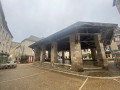
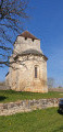
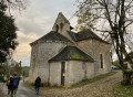
A walk around Martel, nicknamed ‘the town of seven towers’, taking in the botanical trail, with lovely views of Martel and its surroundings. The route ends in the narrow streets of the old town, the Halles, the Palais de la Raymondie, etc. The walk starts at the station heading towards the D23: take care as you’ll need to walk a good hundred metres along the departmental road. This walk is suitable for children and in sunny weather, as there are plenty of shaded spots along the route.

Details

31674956
Creation:
Last update:
Last review:
  • Walking
    Activity: Walking
  • ↔
    Distance: 4.55 mi
  • ◔
    Average duration: 2h 25 
  • ▲
    Difficulty: Easy

  • ⚐
    Back to start: Yes
  • ↗
    Ascent: + 400 ft
  • ↘
    Descent: - 384 ft

  • ▲
    Highest point: 971 ft
  • ▼
    Lowest point: 732 ft

Photos

Description of the walk

Park at the Martel station car park.

(S/E) Join the D23 (Avenue de Nassogne) and turn left. Cross the railway line and turn immediately
right. Walk alongside the railway line and follow the path.

(1) Turn right onto Rue de Montignac and return to the D23. Cross the road with care, head right for about sixty metres and turn left onto a path that climbs slightly.

(2) Turn right and follow the botanical trail until you reach the junction with a road (elevation 286) called Chemin de Tilliry.

(3) Turn right: you’ll be treated to a lovely view of Martel as you head downhill. Pass the Reptiland Vivarium and continue to the crossroads.

(4) Immediately take the path on the right. Cross the D840 with care and continue straight ahead along Rue Combes.

(5) Turn left onto the road leading up to Rouzières and continue to a triangular junction.

(6) Turn right onto the stone-paved track, pass a paddock on the left, then take the track immediately on the left, heading due north. You’ll reach a multi-way junction.

(7) Turn left onto Rue la Croix Rempart. Join the D803 and follow it to the left. Cross Avenue de la Dordogne (D840) and turn slightly left onto Chemin de sous les Murs. Continue to the junction.

(8) Turn right onto Rue du Font Saint-Maur to visit the old town. Cross Boulevard du Capitani, follow the path opposite between the houses, then turn left onto Rue de l’Église. Take the first right, then another right onto Rue Droite and head towards the church. Take the sharp left turn onto Rue du Four Bas, continue along Rue Senlis and then Rue Henri Court Mantel. At the end of the street, turn left onto Rue Droite, then right onto Rue des Mirepoises and continue straight on, crossing Boulevard du Capitani again to reach the junction with Rue Sainte-Anne.

(9) Turn left and follow the next street to the right to reach the station car park (S/E).

Waypoints

  1. S/E : mi 0 - alt. 732 ft - Car park at the - Gare de Martel
  2. 1 : mi 0.35 - alt. 774 ft - Turn right
  3. 2 : mi 0.57 - alt. 860 ft - Junction, Botanical Trail
  4. 3 : mi 1.34 - alt. 938 ft - Junction, turn right
  5. 4 : mi 1.59 - alt. 807 ft - Junction, path on the right
  6. 5 : mi 1.98 - alt. 774 ft - Junction. Route de Rouzières
  7. 6 : mi 2.34 - alt. 876 ft - T-junction, turn right
  8. 7 : mi 3.06 - alt. 886 ft - Crossroads. Rue la Croix Rempart
  9. 8 : mi 3.89 - alt. 735 ft - Street junction. Rue du Font Saint-Maur
  10. 9 : mi 4.44 - alt. 738 ft - Junction. Rue Sainte-Anne
  11. S/E : mi 4.55 - alt. 735 ft - Car park at the - Gare de Martel

Worth a visit

The route described from (8) for visiting Martel is given as an example. There are, of course, other options available to walkers.

Reviews and comments

4.7 / 5
Based on 3 reviews

Reliability of the description
5 / 5
Ease of following the route
4.3 / 5
Route interest
4.7 / 5
User 2739281

Overall rating : 4.7 / 5

Date of your route : Aug 10, 2026
Reliability of the description : ★★★★★ Very good
Ease of following the route : ★★★★★ Very good
Route interest : ★★★★☆ Good
Very busy route : No

A lovely walk, mostly flat
best done in the morning in summer as some sections are in the sun

Machine-translated

User 25073356

Overall rating : 4.7 / 5

Date of your route : Oct 02, 2025
Reliability of the description : ★★★★★ Very good
Ease of following the route : ★★★★☆ Good
Route interest : ★★★★★ Very good
Very busy route : No

An interesting walk in the woods around Martel thanks to the beautiful paths lined with charming low walls.
The descriptive tour of Martel allows you to discover this charming little town full of unique architectural features, if you are willing to stray from the route to explore it in more depth.
Alongside this morning walk, you could plan:
a picnic at the Monti car park, a 3-minute drive away
followed by a ride on the tourist train at 3pm.
These three activities together make for a very enjoyable day.

Machine-translated

FC_31
FC_31

Overall rating : 4.7 / 5

Date of your route : Sep 14, 2024
Reliability of the description : ★★★★★ Very good
Ease of following the route : ★★★★☆ Good
Route interest : ★★★★★ Very good
Very busy route : No

A very pleasant walk through the woodland around Martel, with two or three lovely views.

The only downside is that the final stretch downhill towards Martel is a bit long and on tarmac...

Well worth a go!

Machine-translated

Other walks in the area

For more walks, use our search engine .

The GPS track and description are the property of this route's author. Please do not copy them without permission.