Circular Source of Orris loop via the hamlet of Les Molières

A half-day walk that takes you through the pretty hamlet of Les Molières, then on to the beautiful site of the Notre-Dame de l’Inspiration Chapel, which offers a splendid view. The walk continues to the lovely Source des Orris before returning through the woods towards La Roquebrussanne.

Details

n°105655808
Creation:
Last update:
Last review:
–
  • Walking
    Activity: Walking
  • ↔
    Distance: 5.33 mi
  • ◔
    Average duration: 3h 20 
  • ▲
    Difficulty: Moderate

  • ⚐
    Back to start: Yes
  • ↗
    Ascent: + 1,020 ft
  • ↘
    Descent: - 1,014 ft

  • ▲
    Highest point: 1,850 ft
  • ▼
    Lowest point: 1,165 ft

Description of the walk

The car park is located near the stadium, behind the Roquebrussanne police station.

(S/E) Cross the road and join the Chemin des Molières.

(1) Keep left at the Fork in the road.

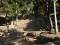
(2) Keep left again to reach the lovely hamlet of Les Molières and its Saint-Louis Chapel.

(3) Continue uphill along the Chemin des Molières, then along the Chemin du Ribas until you reach the valley of the Ruisseau du Riolet.

(4) Carry on to the left along the Chemin du Pas de Saint-Louis, still on a small road, for about 1.2 km.

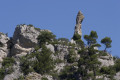
(5) On the left, near an unusual lodge, leave the road and head due north for a few dozen metres across the field to reach a track. Follow it to the right until you reach the Notre-Dame d’Inspiration site. Enjoy the tranquillity of the site and the beautiful view.

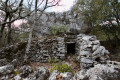
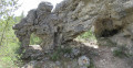
(6) Continue along the path that winds through a woodland amongst beautiful rocks and joins the Carraire du Pas de Nible, which you should follow to the right.

(7) At Pas de Nible, turn left to reach a junction near the 492-metre mark.

(8) For a round trip, turn right to reach the lovely spot at the Source des Orris.

(9) Return to the junction.

(8) Turn right and head for the Vallon des Orris.

(10) Continue down the slope and join the Chemin des Baumes, which you should follow to the left.

(11) Leave the Chemin des Baumes and take the Chemin des Sources de la Vierge.

(12) Keep left at the junction and join a road, the Chemin du Vallon du Castel.

(13) Follow it to the left. At the end of the street, turn left onto the Chemin de l’Ubac to reach the car park (S/E).

Waypoints

  1. S/E : mi 0 - alt. 1,165 ft - Car park near the stadium
  2. 1 : mi 0.57 - alt. 1,247 ft - Chemin des Molières junction
  3. 2 : mi 0.89 - alt. 1,263 ft - Junction
  4. 3 : mi 1.06 - alt. 1,355 ft - Chapelle Saint-Louis (La Roquebrussanne)
  5. 4 : mi 1.39 - alt. 1,355 ft - Riolet Stream Valley
  6. 5 : mi 2.19 - alt. 1,404 ft - Lodge
  7. 6 : mi 2.34 - alt. 1,565 ft - Chapelle Notre-Dame d'Inspiration (la Roquebrussanne)
  8. 7 : mi 3.08 - alt. 1,814 ft - No Nible
  9. 8 : mi 3.4 - alt. 1,621 ft - Return to source
  10. 9 : mi 3.53 - alt. 1,850 ft - Source des Orris
  11. 10 : mi 4.05 - alt. 1,352 ft - Vallon des Orris
  12. 11 : mi 4.38 - alt. 1,273 ft - Chemin des Baumes x des Sources de la Vierge
  13. 12 : mi 4.49 - alt. 1,270 ft - Chemin de la Vierge
  14. 13 : mi 4.69 - alt. 1,306 ft - Chemin du Vallon de Castel
  15. S/E : mi 5.33 - alt. 1,165 ft - Car park near the stadium

Notes

Although part of the route follows very quiet country lanes, it includes some stony sections and paths: sturdy footwear and walking poles are recommended.

Worth a visit

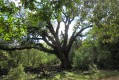
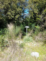
The route passes through the pretty hamlet of Les Molières, the beautiful site of Notre-Dame d’Inspiration and the refreshing Source des Orris.

Other walks in the area

For more walks, use our search engine .

The GPS track and description are the property of this route's author. Please do not copy them without permission.